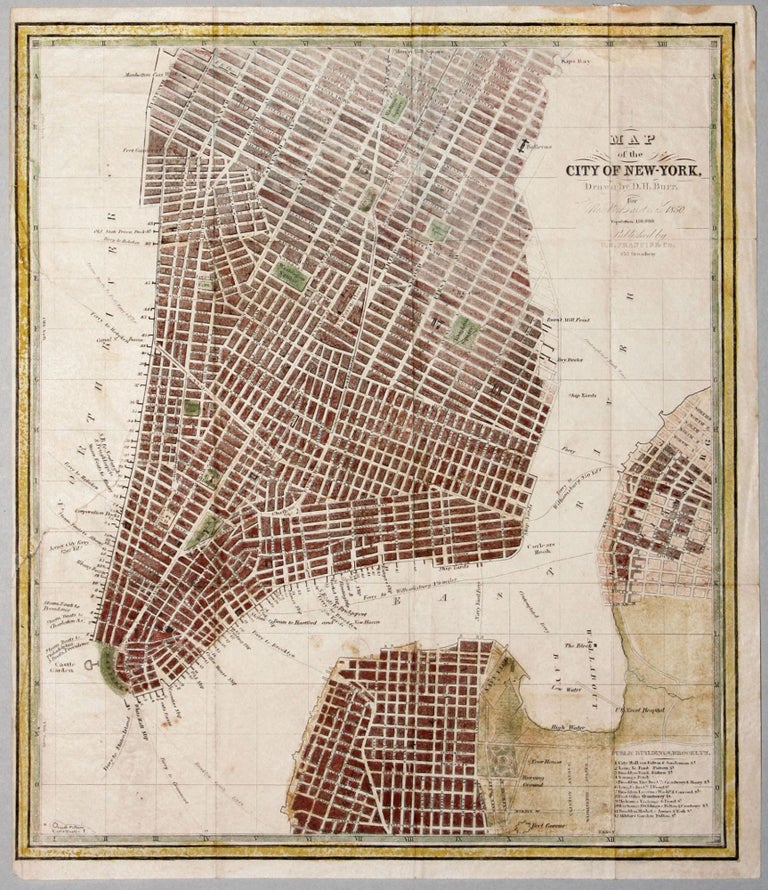
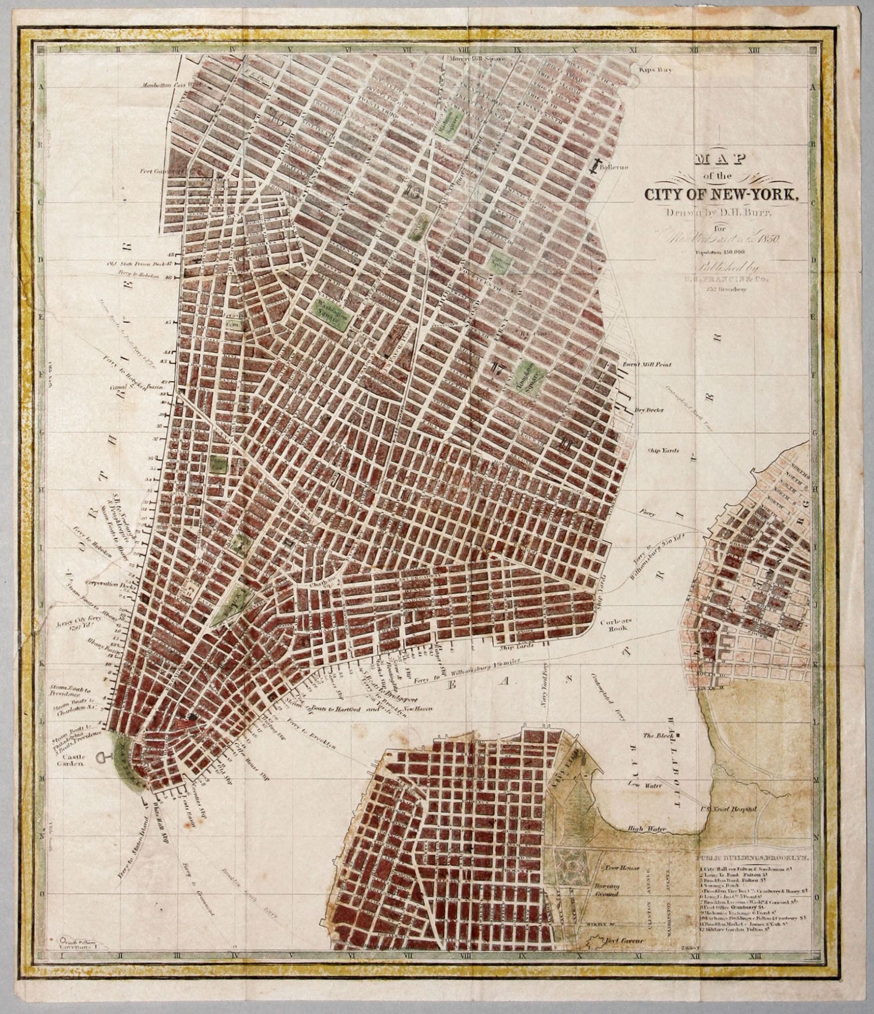
Map of the City of New-York, Drawn by D. H. Burr, for New York as it is in 1850….
12 x 10 inches, Lithograph with hand color; slight fold wear, mends where original attached, very good overall.
A nicely detailed plan of New York City, reflecting its rapid development since the 1820's. First published in 1833, the plan was frequently updated during its lifetime. Here the Manhattan grid has begun to fill as far uptown as 34th Street, and familiar features such as Washington Square, Union Park, Madison Square, and Tompkins Square Park are shown. Parts of the cities of Brooklyn and Williamsburg are shown on the map, including Brooklyn Heights, the Navy Yard and Fort Greene. A table lists twelve important structures and places in Brooklyn. The Staten Island ferry is marked, as are ferry routes between Manhattan, Brooklyn, Williamsburg and New Jersey. Steam boat piers are named as well, indicating service to more distant destinations such as Albany, Philadelphia, Hartford, New Haven and Providence. The map appeared T. R. Tanner's New York as it is…
* Cf. Haskell, D. C. Manhattan Maps, no. 774; this edition not in Haskell.
Sold