
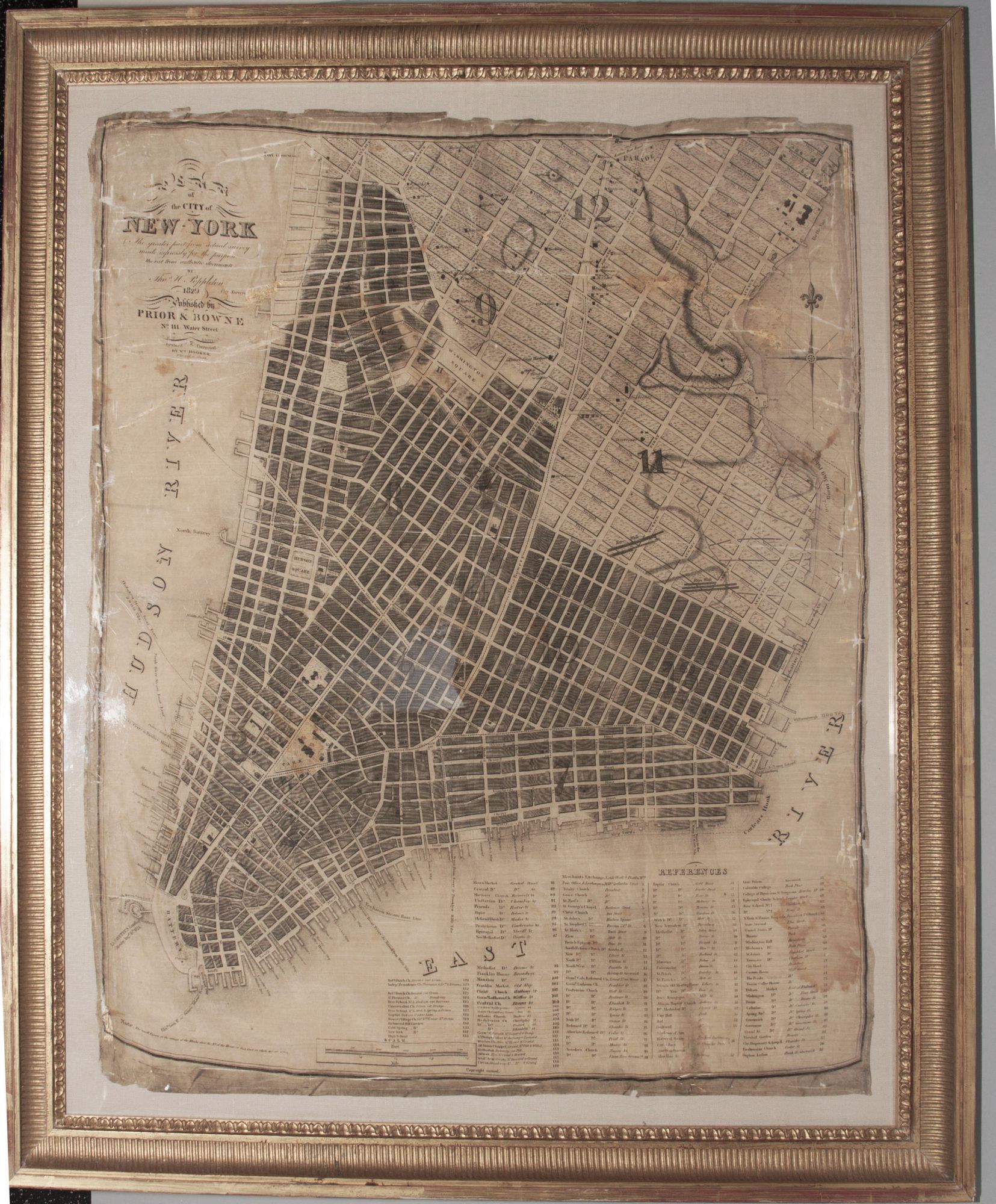
Plan of the City of New-York. The greater part from actual survey made expressly for the purpose…Revised & corrected by Wm Hooker.
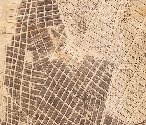
26 ¾ x 22 ¼ inches, Printed on silk; a few abrasions with losses but very good of this kind. A very rare and early plan of New York City, printed on silk, recording the beginning stages of the city’s development northward that was greatly accelerated by the opening of Erie Canal in 1825. OCLC locates only three examples of any of three editions of this map. The only market record of an example of any of the three editions of the map was for this example that was offered 17 years ago. In October of 1812 Poppleton along with Robert Fulton and Eli Whitney were tasked with surveying the city, which resulted in a plan of the city that first appeared in 1817. Poppleton was at this time the City Surveyor, so this was a quasi-official map that would continue to be so over a decade following. The 1817 edition reveals that the city at the time had developed to just short of where the grid design, adopted in 1811, would take over the city's development. However, it does show more development than is found on the Commissioners' Plan of 1811. The present, updated 1829 state of the plan added Washington Square and several, then newly laid out streets in this area--Lafayette Place, Amity Lane, Gay Street, and a lengthened Barrow Street. In 1826 the land on which Washington Square Park now stands was designated by the city as the Washington Square Parade Ground. After it was leveled and landscaped, it became the center of the city's then most fashionable neighborhood. Owing in part to this example having been printed on silk, it shows the extent of the city's development at the time with exceptional clarity. The plan is rich with information. Its legend lists 133 locations, all keyed to map, in which are identified the city’s commercial, religious as well as recreational and cultural entities at the time. Many individual residences and their owners are indicated along with the owners of wharves and piers. It depicts lower Manhattan from 31st Street south to the Battery. A somewhat poignant feature is that north of the developed portion of the city on the plan only faint traces of Manhattan’s original topography can be discerned. The 1817 first edition of the map was engraved by Peter Maverick and published by Prior & Dunning. In 1827, William Hooker revised the original copperplate of the map with numerous additions, and the map was again published by Prior & Dunning. The present issue, described in the title as "Revised & Corrected," was published by Prior and Bowne. An English-born surveyor, Poppleton fled to America after falling into debt in England, arriving in Baltimore around 1811, when he received a commission to survey the city. Falling into arguments with the city commissioners over his use of a theodolite instead of chain and compass, and with the outbreak of the War of 1812, he left Baltimore and came to New York. His manuscript journal from that time, located at the New York Public Library, details his work from October 7, 1812, until the Fulton-Whitney-Poppleton plan for draining sewage along Canal Street was submitted to Governor Clinton in Albany. Although their solutions were deemed too expensive, Poppleton's work was impressive enough to result in him being named City Surveyor, at which point he began work on the present map.
* Haskell, Manhattan Maps 686, viz 684, 685; cf. Koeppel, G. City on a Grid, p. 133; Ristow, p. 254; not in Stokes.
Sold