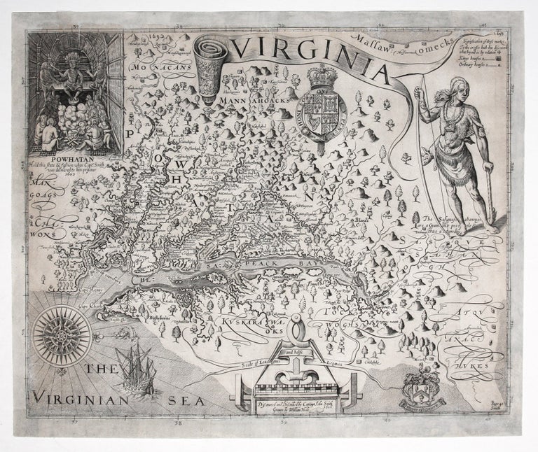
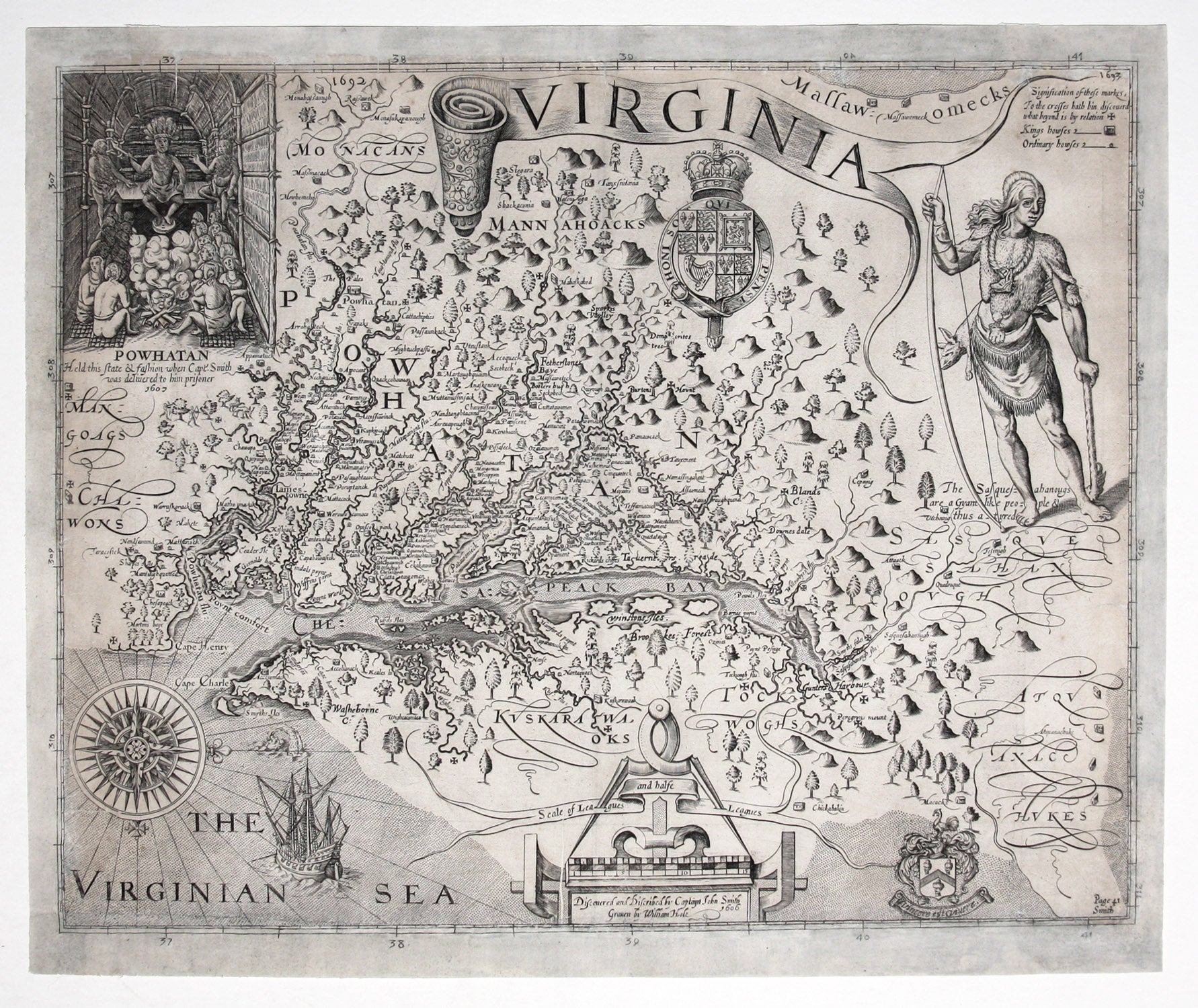
Virginia/ Discovered and Discribed by Captaiynt John Smith Graven by William Hole 1606.
13 x 16 ¼ inches, Margins extended with some restoration of ruled borders and directional numbers, though printed area within borders largely unaffected save for small areas upper and lower right and larger area at lower left; overall fair to good condition with a strong impression.
One of the foundational works in the cartography of the United States, Smith’s was the first map of the Chesapeake Bay and surrounding region. Not only was its influence present in countless succeeding maps, but it also had a considerable impact on history itself. “One of the most important printed maps of America ever produced and certainly one of the greatest influence. It became the prototype for the area for half a century until Augustine Herrman’s map of 1673. First issued separately in London, it accompanied many editions of various publications for another twenty years. It, therefore, was seen widely and inspired much interest in the fledgling Virginia colony, influencing considerably its eventual success” (Burden).
The map was based on a three-month surveying expedition throughout the Chesapeake Bay in 1608 led by Smith. The party also explored several of the larger rivers that empty into the bay and ventured as far as the falls at the site of present day Richmond. Smith was one of only a few early mapmakers to acknowledge on his map his debt to native informants. The several Maltese Crosses indicate the points to which Smith and company actually explored; the areas beyond the crosses were based on Indian reports. Also, archeologists to this day consult this map for the locations of Indian tribes at the time of first contact with Europeans.
An interesting feature in the upper right is what appears to be a small portion of a very large body of water, which most probably is meant to represent the Pacific Ocean. This is a reminder that one of chief reasons for locating a settlement in Virginia was the belief that the Pacific Ocean was just beyond the range of mountains in western Virginia. The map also has fine engravings depicting Powhaten in council and a Susquehanna Indian, both taken from the drawings of John White of the Roanoke colony.
* Burden 164, State 9; C. Verner in Tooley, America, pp. 135-160, state 9—pp. 152-53; Stephenson & McKee, Virginia in Maps, Map 1-4, pp. 8-12; On the Map, no. 7; Schwartz & Ehrenberg, pp. 89-93; Fite & Freeman, pp. 116-19; Papenfuse & Coale, pp. 1-2.
Sold