
Beschryving van Louisania, Nieuwelijks ontdekt ten Zuid-Westen van Nieuw-Vrankryk, door order van den Koning.
4to. [19.3 x 14.4 cm], two titles, one of which is engraved, (4), 158, (5) pp., with 1 folding map [plate mark: 17.5 x 28.5 cm] and 6 plates.
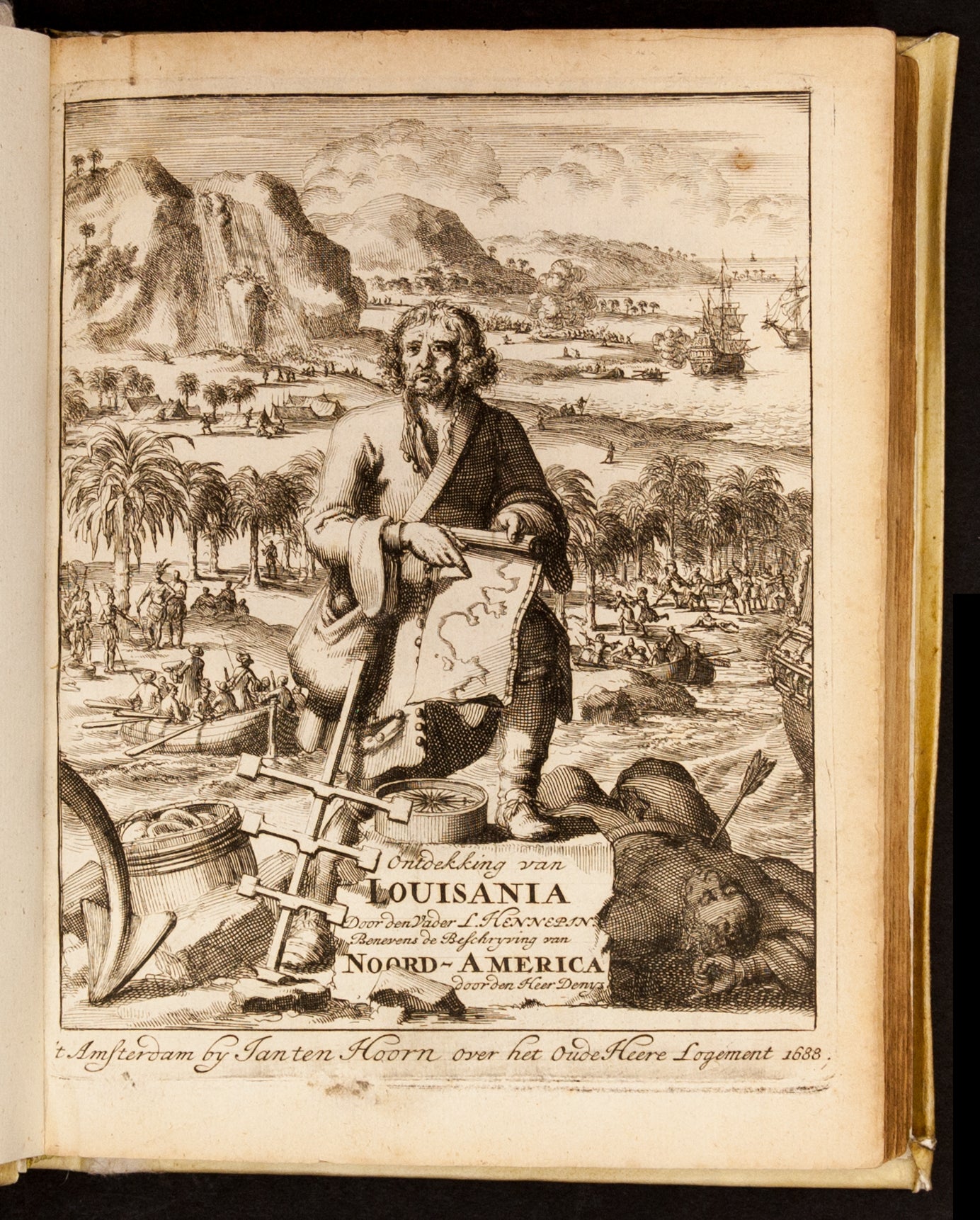
First Dutch edition of the “first and most important” of Hennepin’s writings (Howes), translated from the 1683 French original, Description de la Louisiane, and here augmented by Denys’ description of New France, BOTH ILLUSTRATED WITH NEW PLATES. This, Hennepin’s first published work, is notable for being the earliest printed account of La Salle’s 1678-9 journey to what is now Illinois, and the first book to use the name “Louisiane” (although Hennepin claimed to have coined this phrase, it was in fact La Salle who had first named the region). The Description also relates Hennepin’s travels up the Mississippi River north of Wisconsin, and contains the first published description of Niagara Falls. “One of the most important volumes in the early history of North America” (Lande).
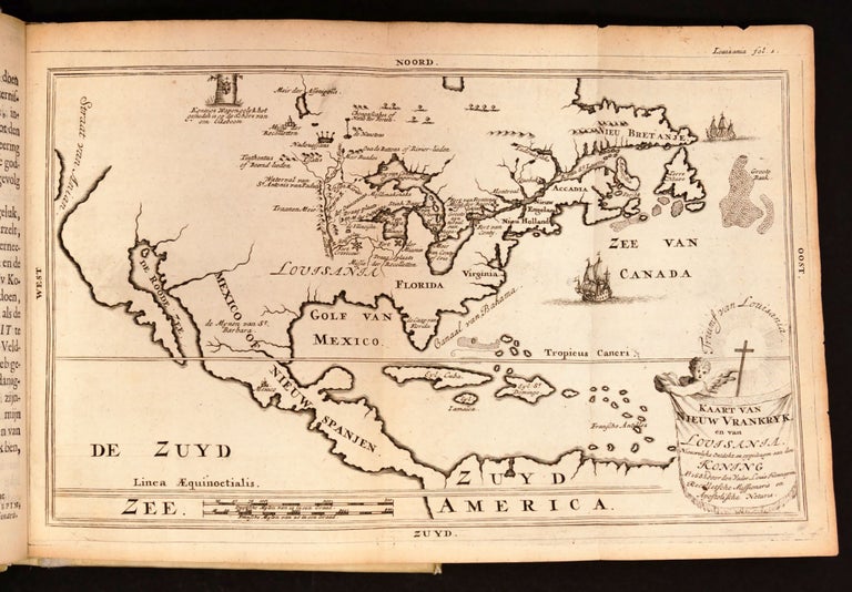
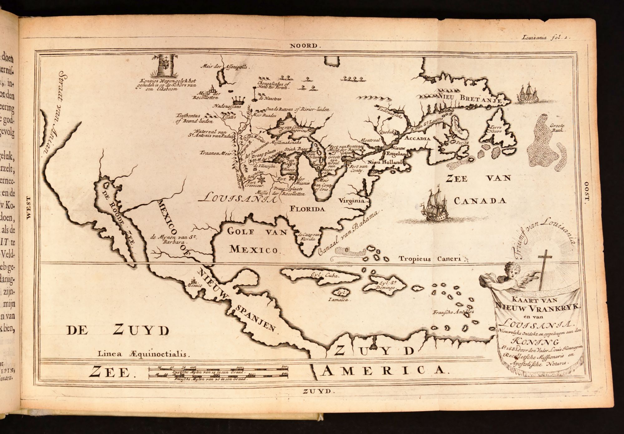
The accompanying map, here entitled “Kaart van Nieuw Vrankrijk en van Louisania (sic)” reproduces the famous map by Guerard that appeared in the 1683 edition. It locates Fort Creve Coeur, Michilimakinac, etc. Lakes Superior, Huron and Erie appear with their modern names, while the Atlantic Ocean appears as the “Canadian Sea.”
Hennepin’s Description de la Louisiane was immediately popular, with three French editions published within five years, and numerous translations—notably, the first was Italian in 1686 (12mo.), followed by this Dutch edition. Two German translations appeared in Nuremberg in 1689 (reprinted 1692) and in Bremen in 1690.
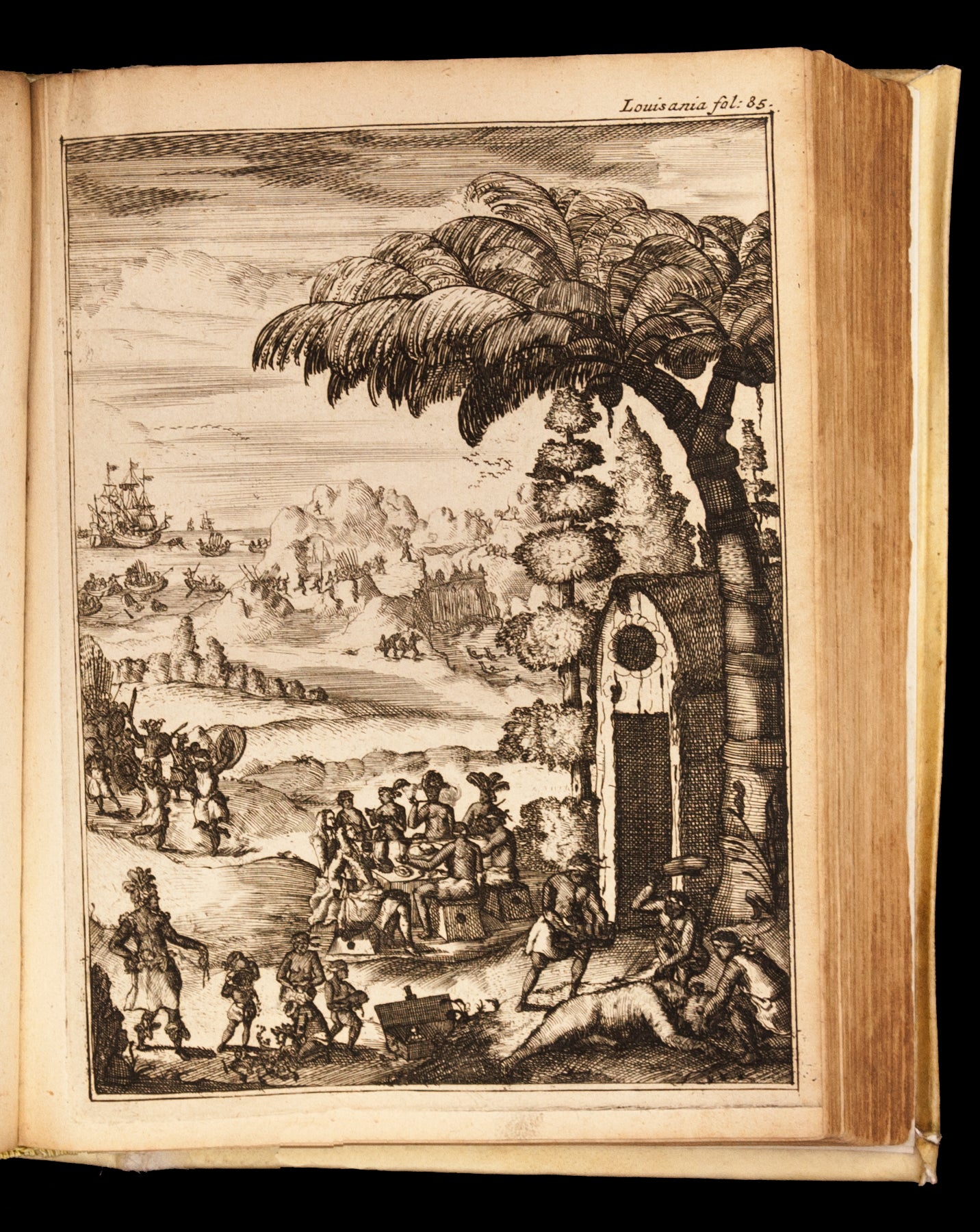
Four new plates appear in this edition (and the two in Denys’ Beschrijving are likely by the same engraver). While the original French editions contained only the map and two plates—depicting Niagara Falls and a bison—these depict scenes of daily aboriginal life, as well as interactions with the Europeans.
The Beschryving van Louisania was issued with a second title, Denys’ geographical and historical description of the coasts of North America. This work, which had first appeared in Paris in 1672 as Description Geographique, was only rarely sold separately. “The country over which M. Denys claimed to exercise jurisdiction under the King of France extended from Cape Canso, at the eastern extremity of Nova Scotia to Cape Rosier, at the mouth of Penobscot Bay. The author includes geographic and anthropological descriptions of the French territory, discusses native attire and customs, the lucrative bakkeljauw (codfish) fishery, and a chapter on the cold, snowy winters. One of the two plates illustrates the “Strange history of a Sea- or Merman” in Canso harbor (p. 44).
* * Bell, p. 263; Field 168; JCB 1539; Pequot 338; Sabin 31,357; Howes H-415; Alden-Landis 688/120; Streit II.2738; not in Church; Denys: Sabin 19,616, “usually found at the end of Hennepin’s Louisiana”; Alden-Landis 688/75
Price: $11,500.00