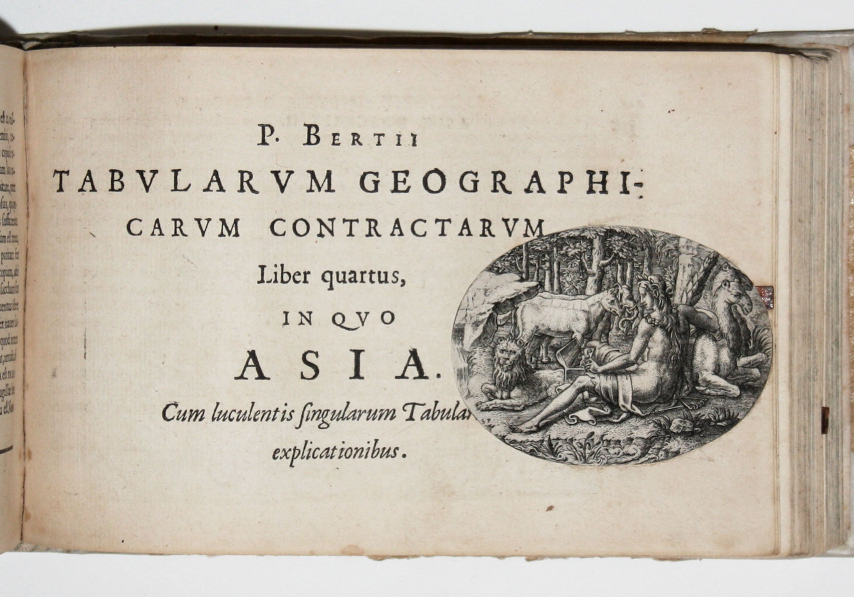
P. Bertij Tabularum Geographicarum Contractarum Libri Quinque… apud Cornelium Nicolai, Anno 1606.
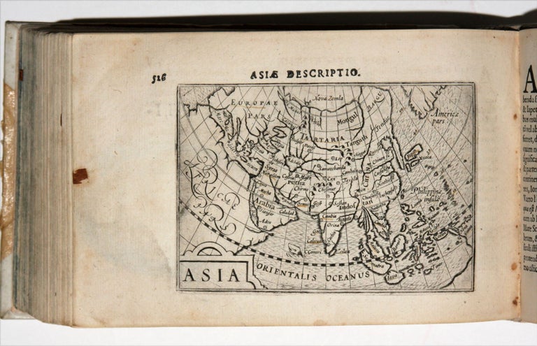
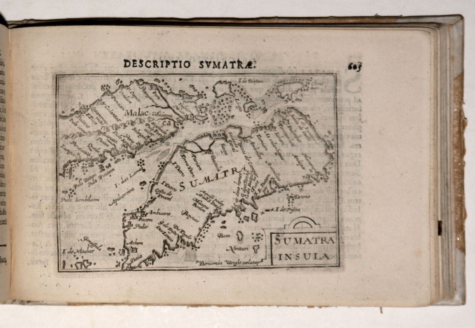
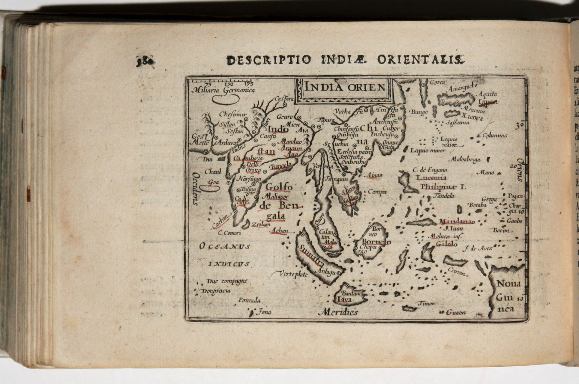
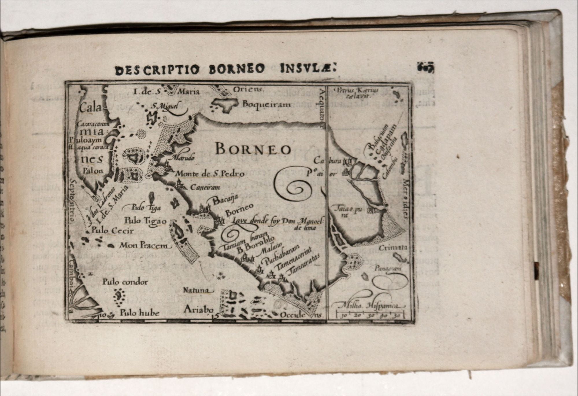
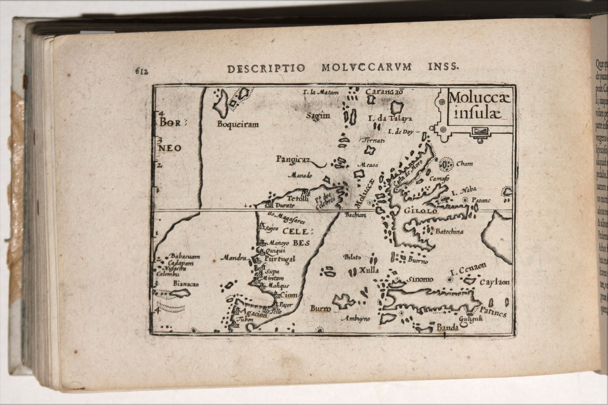
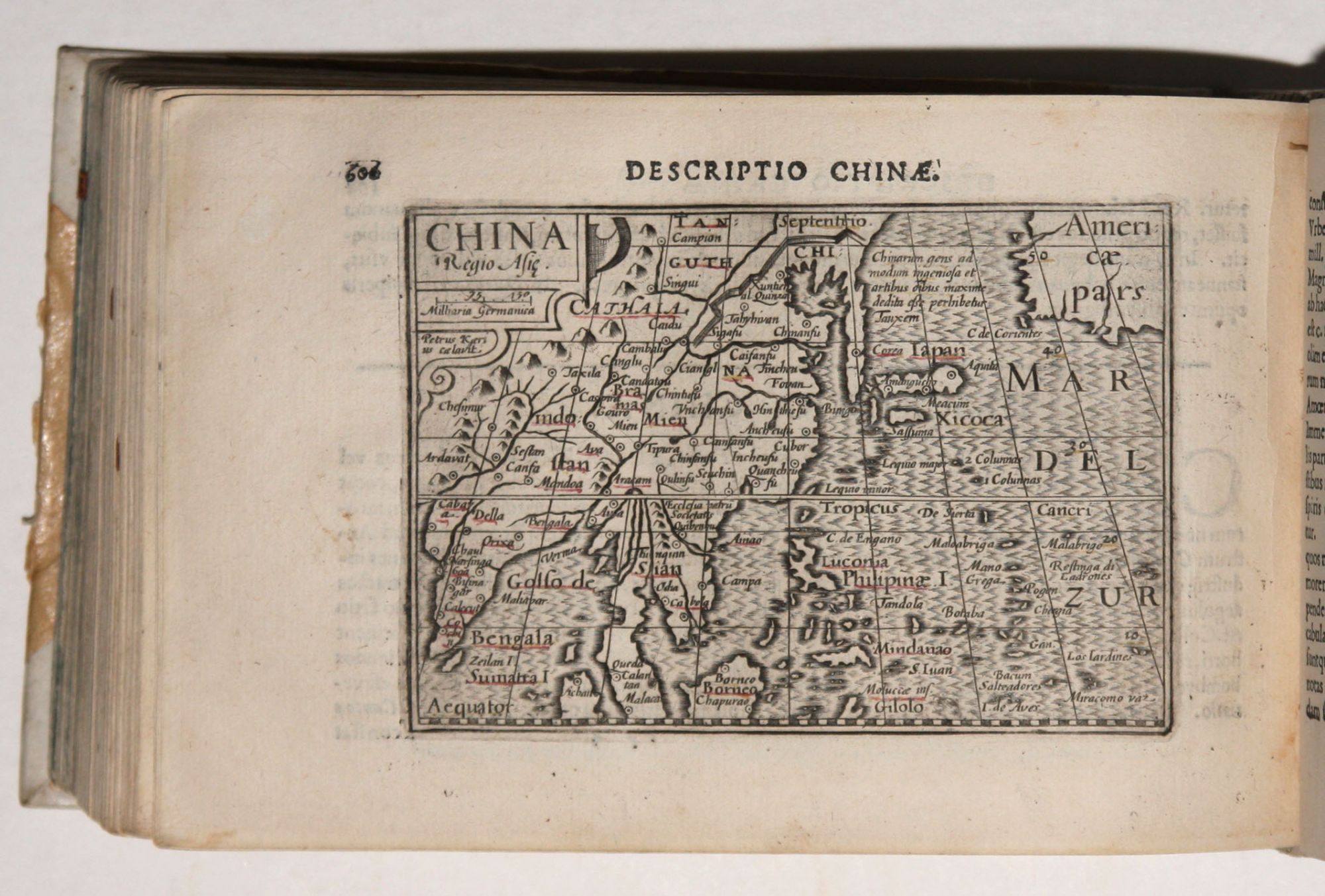
Oblong octavo; contemporary paper covered boards, backed & cornered with vellum; 174 maps & plates, all untrimmed; pasted-in etchings of allegorical figures at section headings, some ms. notations and underlining; a few quires somewhat toned, overall an excellent copy. An excellent example in an original binding of the work that set the standard for the small atlas. “The small maps are extremely well engraved; they are neat and clear and elegantly composed” (Van der Krogt, p. 373). A measure of their quality is that the maps “served many purposes in other books published in Amsterdam” (Ibid). The atlas was first published in 1598 by Barent Langenes, and its maps were engraved by the brothers-in-law, Jodocus Hondius and Pieter van den Keere (Kaerius); all later editions were published by Cornelis Claesz. In 1600, Petrus Bertius provided a new and much more scholarly text than had been in previous editions, and he also re-arranged the atlas’s contents according to Ptolemy; the present copy is the third Bertius edition. The atlas's maps were fresh and up-to-date, and unlike frequent practice in early atlases, here the text was based on the specific maps in the atlas rather than merely relying on generic descriptions. The atlas is notable for introducing maps of highly specific areas that previously were not the sole subject of a map. There are several of parts of Asia, including ones of the southern Malay Peninsula focusing on Singapore; separate ones of Sumatra, Borneo, Java, the Moluccas, and part of Indochina; and a number of regional maps of India. There is also a separate map of the Philippines, the second earliest of the island group. Another unusual map is one specifically of the Red Sea. Several Mediterranean islands are also individually mapped in the atlas, many of which are not normally seen as such, especially in a small atlas; they include Malta, Cyprus, Elbe, Corsica, Sicily, Sardinia, Crete, Zante, Cephalonia, Corfu, and the Balearic Islands. The atlas contains three maps devoted to Scandinavia that are thoroughly discussed by Ginsberg as is the atlas itself; see the reference below. The atlas’s two world maps are both signed by Hondius. Bertius was a Flemish philosopher, theologian, historian, geographer and cartographer, who published much in mathematics, history and theology. He is best known today as cartographer for his edition of the Geographia of Ptolemy (based on Mercator’s edition from 1578) its atlas. Van der Krogt 3:341:53. Shirley, R.W. (BL Atlases) T.LAN-1e; Phillips, P.L. (Atlases) 3409; cf. Ginsberg, W. Printed Maps of Scandinavia, pp. 162-68; Shirley (world maps) 211.
Price: $9,500.00