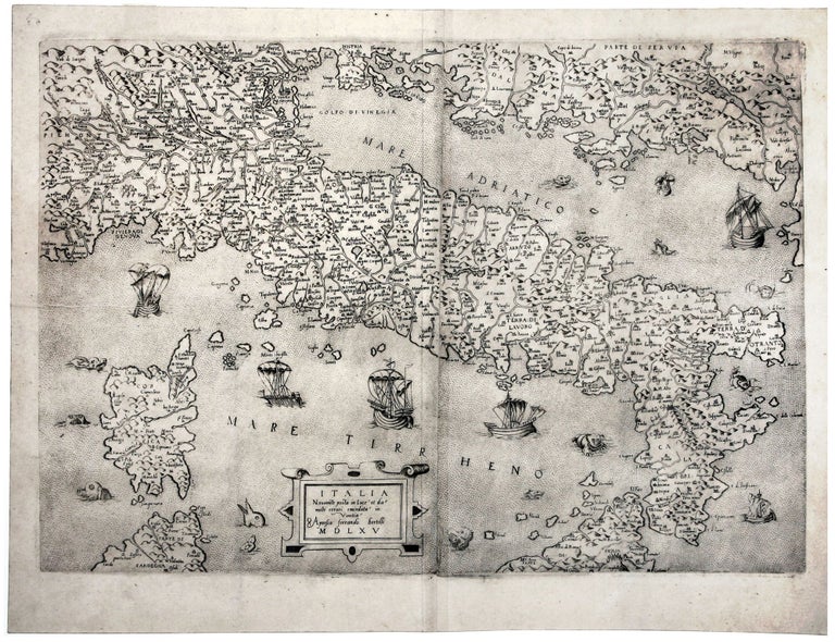
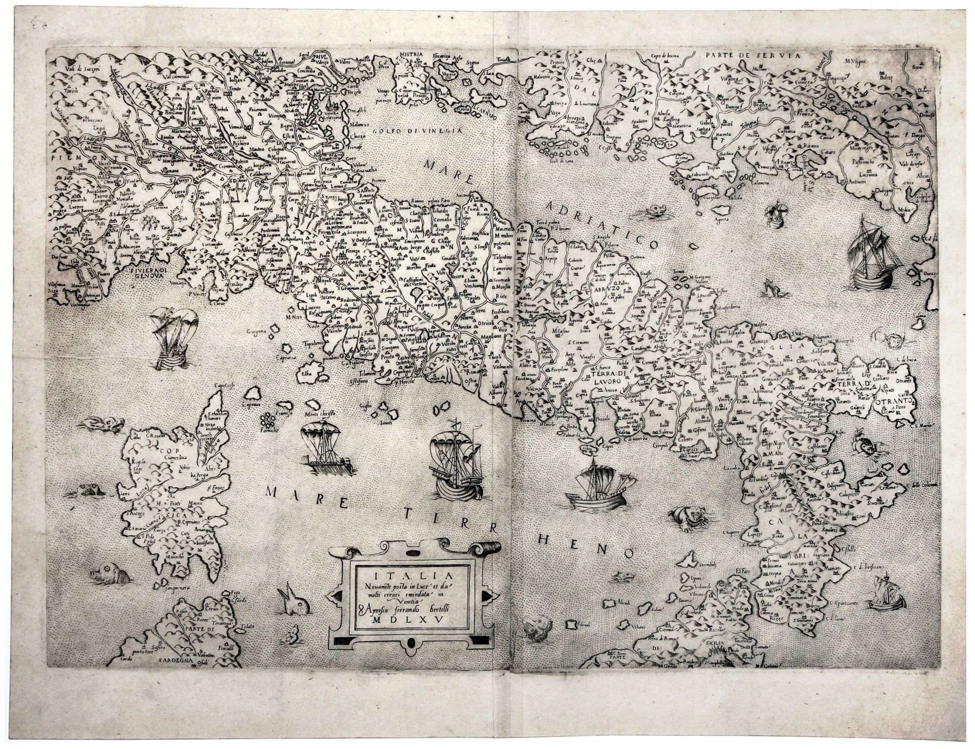
Italia Novame(n)te posta in Luce et da molti errori emendata.
2 joined sheets [56.5 x 39.0 cm]. Very good. Bertelli’s Italia Novamente posta in Luce, one of the rarest and most attractive La Freri maps of Italy. Borri reports that only a few examples of this finely engraved map have surfaced: “Di questa magnifica carta, quasi sconosciuta sino a pochi anni orsono, sono noti pochissimi esemplari …” He further observes that while based primarily on an anonymous map of 1544 (Borri, no. 33) and the Gastaldi map of 1548 (Borri, no. 32), Bertelli’s work is far more refined and detailed. Its title states that the map corrects numerous errors of previous works. The map includes hundreds of place names, all given a similar visual weight in the engraving (Bertelli’s Venice is embellished ever so slightly more than other towns), but it is Rome that has been placed at the very center of the engraving, a position befitting its role as the umbilicus in the ancient, medieval, and Renaissance worlds. Ferrando (or Fernando) Bertelli’s engraving was one of the most influential maps of Italy published by the ‘Lafreri school’ of mapmakers. Antoine Lafréry, or Antonio Lafreri (1512-77), was born in Besançon and worked in Rome from 1544. While Lafreri did create maps, he was primarily a dealer and publisher, and he assembled his large stock of maps and prints made by other printmakers from both Rome and Venice into composite atlases featuring a selection of fine Italian maps, tailored to the tastes of individual clients. The very few remaining examples of the present Bertelli Italia owe their survival today to having been preserved in such composite atlases. * S. Bifolco ens S. Ronca, Cartografia e topografia italiana del XIV secolo, pp. 71, 381; R. Almagià, Monumenta Italiae Cartographica, p. 16; L. Bagrow, History of Cartography, p. 88; R. Borri, L’Italia nell’antica cartografia, 1477-1799, pp. 47-8; R. Shirley, Maps in Atlases of the British Isles: A Descriptive Catalogue, vol. 1, pp. 381-4; R. V. Tooley, Maps in Italian Atlases of the Sixteenth Century, pp. 12-47.
Sold