Untitled Woodcut World Map.
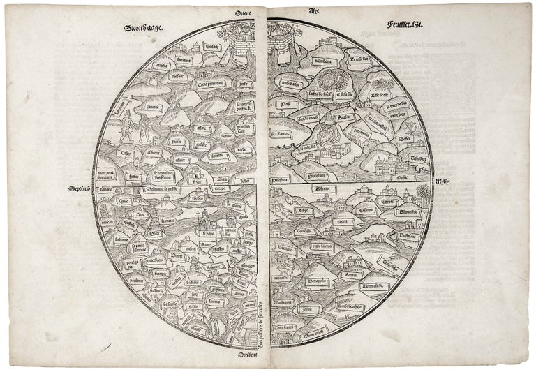
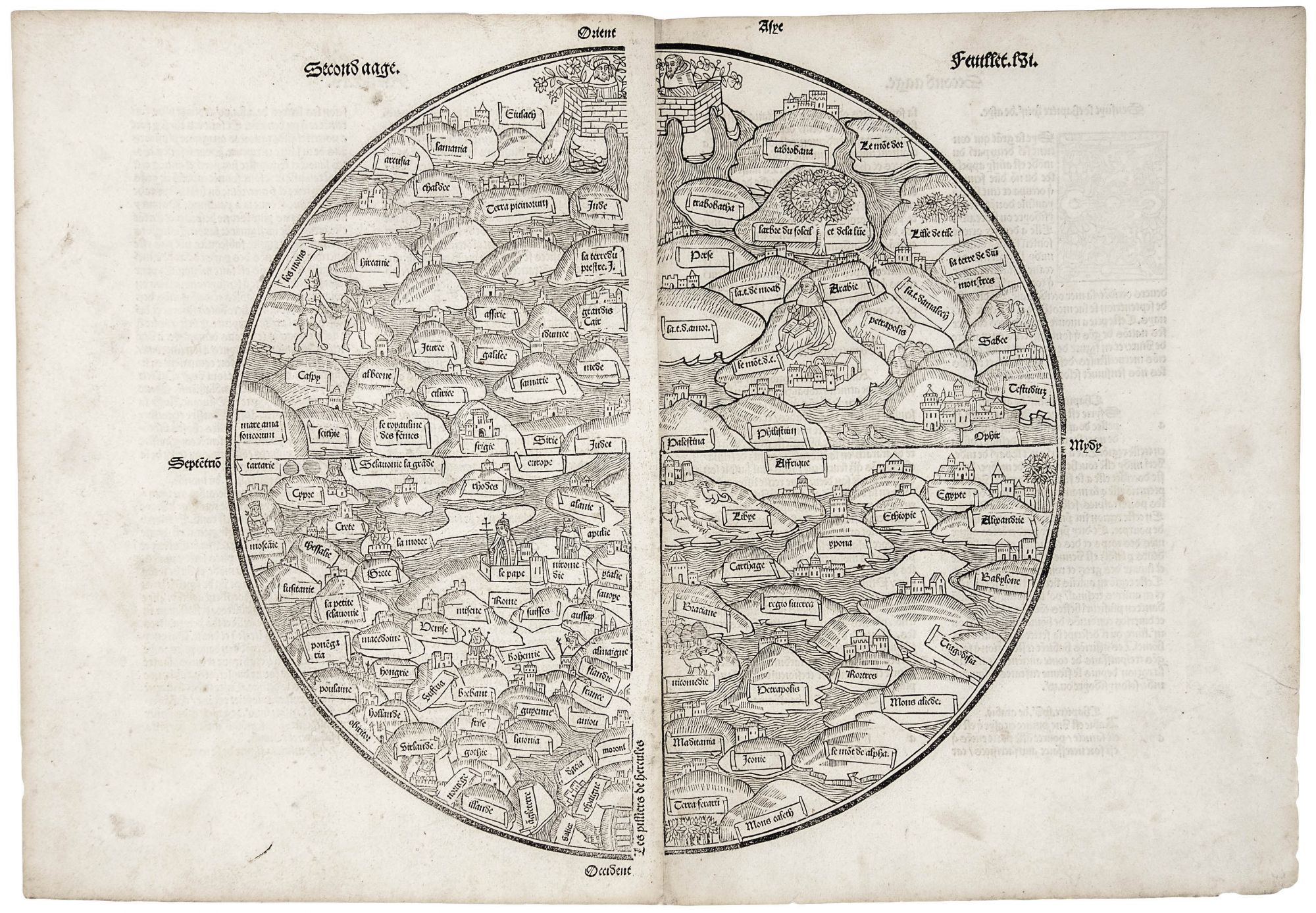
13 x 14 ½ inches, On two joined sheet. A touch of soiling, else a fine, untrimmed example with a firm printing impression. A very rare, true incunable edition of this medieval mappamundi from the first Lyons printing of 1491. One of the finest examples we've seen of this map in any edition. It is a direct descendant of the 1475 world map that was published in the Rudimentum Novitiorum, which Shirley describes (along with a map of the Holy Land) as “the first printed maps to try and show land forms and countries in topographical relation to each other.” This type of world map, termed a mappamundi, was part of a Christianized tradition of maps that dates back to the 8th century A.D. Crude, diagrammatic world maps, called T-O maps, are in essence the same type of map as this one but distilled to schematic form. Or as Campbell states, “the unknown draughtsman [of this map] …has attempted to add plausible geographical detail to the unyielding outlines of the T-O schema.” Both this mappamundi and T-O maps are oriented with east at the top and with Europe and Africa placed in separate quadrants at the bottom. Both also locate Jerusalem at the center. The presentation of the world on this mappamundi is fascinating from many respects, but especially so in the way the limits of the known world are portrayed, revealing much about the medieval state of mind. As Shirley states it, “the pillars of Hercules bar the way westwards at the bottom of the map.” At the northern limit of this world is the Sea of Amazons; at the east is Taprobana (Sri Lanka); and Africa does not extend south of Egypt. Thus, the most obvious way that the medieval world view contrasted with what is found in the Ptolemaic conception, for example, is in the proportion of land mass to water, which in the medieval conception has the six-sevenths of the earth surface comprised of land. It is a world view that hence actively militated against probing beyond the known world, since the world in this view was already pretty much entirely known. An interesting speculation surrounds the two figures within a walled orchard at the top. One commentator (see in Shirley no. 2) suggests that they may represent a Jew and Christian united in love of God. The 1475 edition of this map referred to above is of the greatest rarity; we have seen only three examples of it on the market in the last 35 years. After this 1475 edition, the woodblock for the map was re-cut twice: in Paris in 1488-89 and in Lyons in 1491 (as the example offered here) both appearing in a work entitled Mer des hystoires. Both editions were published as late as 1555. It is nevertheless one of the earliest editions of this map to appear on the market recently. Most editions that have recently come on the market have been 1517 and later. Moreover, it is only through the editions of this particular map that the collector is able to acquire this unique window into the medieval world. Other than the various T-O diagram maps and a few very rare broadsides, we not aware of any other maps that provide this medieval cartography in printed form.
* Shirley 17, cf. 2 & 15; Campbell, T. The Earliest Printed Maps, 217, pp. 148-49.
Sold