Yellowstone.
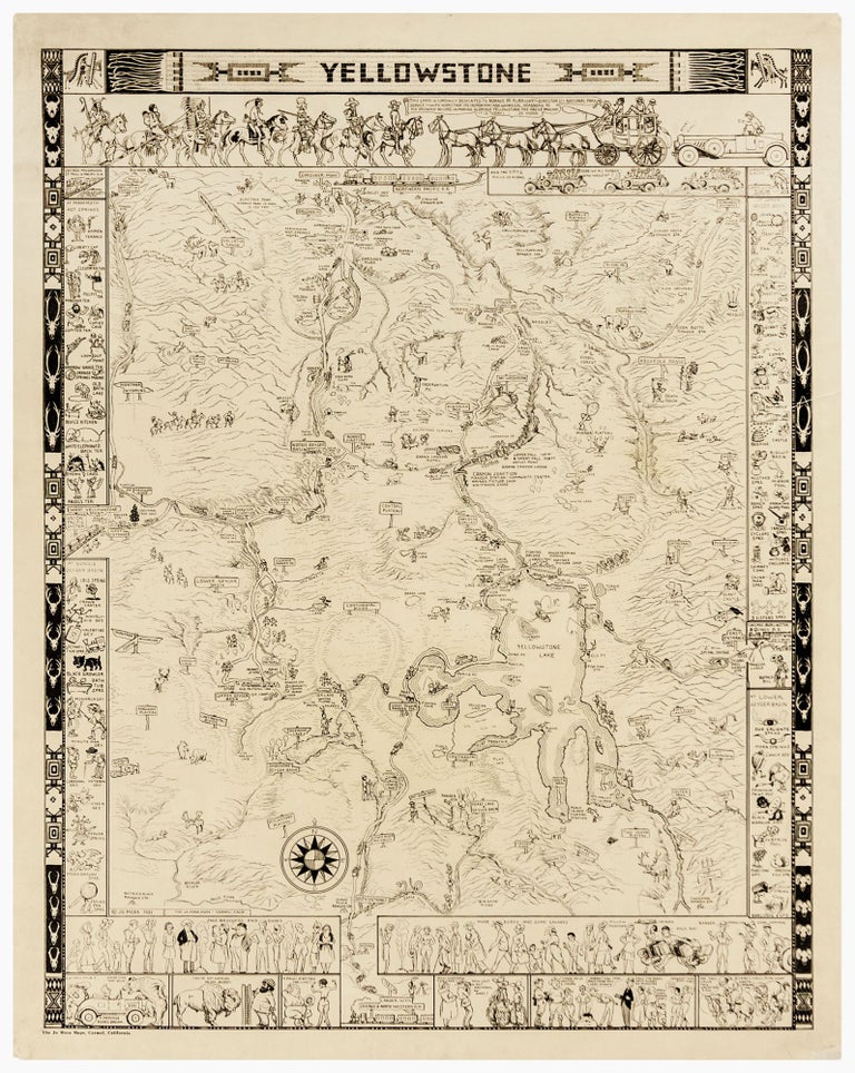
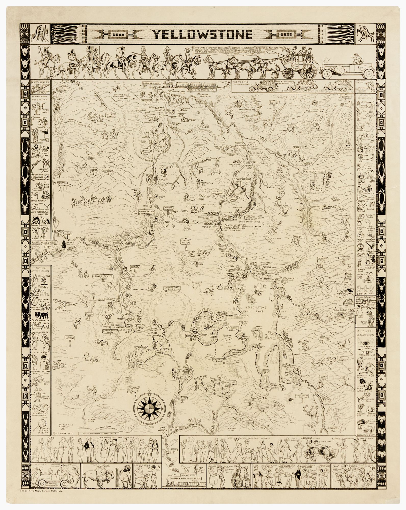
25 ½ x 20 inches. Backed with rice paper with some marginal mends, overall very good. An entertaining, pictoral map of Yellowstone National Park. This extremely rare first state of the map was printed in Mora’s shop in Carmel, California. The 1935 second state, bearing the imprint of J. E. Haynes in whose Yellowstone store it was sold, is itself scarce. This detailed map extends from the entrances at West Yellowstone and Gardiner in Montana, to Lander, Wyoming. The railway stations in Cody and Lander are shown to illustrate points of access for the park. The map shows and provides Mora’s inimitable cartoon imagery for over 60 individual geysers, springs and landforms. Ranger stations, stores and trails are also marked. Perhaps most entertaining are the depictions of locals, tourists and workers in the park: “sagebrushers,” “dudes,”and “savages” all vie for space in the vignettes around the map. It should be noted that “savages” here does not apply as a derogatory term for natives, but rather is used humorously to refer to the local park workers with whom he identified, as distinct from the hapless city-dwelling “dudes.” The Uruguayan-born Mora immigrated to California in his youth. After studying art in Boston, he returned to California where he would pioneer a playful pictorial style of cartographic art. His maps were full of humorous figures evoking daily life in the regions he depicted. His observations of Western character and society were not those of an outsider looking in; Mora had worked as a cowboy himself, and his experiences living in the west and with the Hopi and Navajo would inform not only his cartographic art but also his other illustrations, murals and sculptures. For the breadth of his work, he was often called the “Renaissance man of the West.”
Sold