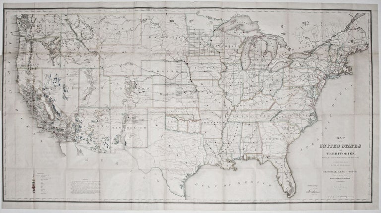
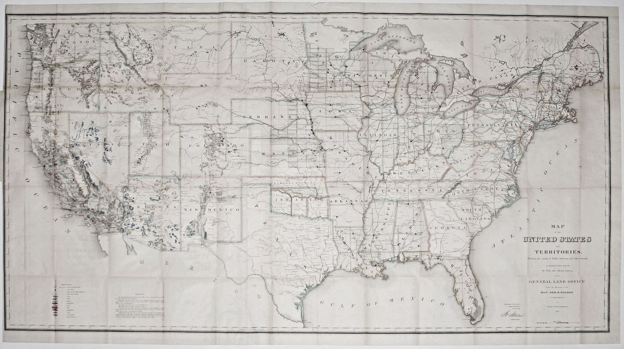
Map of the United States and Territories . .
28 x 55 inches, Lithograph with original wash coloring; a mended split at attachment point, else a bright fine example.
The first edition of the map that provided the definitive depiction of the United States at the conclusion of the Civil War. It would appear through the mid 1880’s in many, progressively updated editions. The map’s primary purpose was to record the progress of the surveys of the General Land Office. The General Land Office was responsible for surveying lands so that they could be sold and occupied in the United States in a theoretically orderly fashion, which was a practice that began in the Old Northwest Territory in 1787. However, the map provides much fascinating information beyond the surveys, notably the locations of mineral deposits and the progress of railroads throughout the country. The route of the Transcontinental Railroad, which would not be completed until a year later, is shown in its proposed form. Many other railroad lines, both completed and proposed, are included on the map.
In particular, the alluring vibrance of the map’s colorful representation of mineral deposits made it a powerful recruiting tool for emigrants. It is therefore not surprising that the map was often published with informational booklets in several languages; we are aware of editions in Swedish, German and French.
Sold