![Item #250010 Map No. 1 Rio Colorado Of The West…14 ½ x 34 5/8 inches. [With:] Map No. 2 Rio Colorado Of The West…. Baron F. S./ IVES VON EGLOFFSTEIN, J. C.](https://martayanlan.cdn.bibliopolis.com/pictures/250010.jpg?width=768&height=1000&fit=bounds&auto=webp&v=1508790307)
![Map No. 1 Rio Colorado Of The West…14 ½ x 34 5/8 inches. [With:] Map No. 2 Rio Colorado Of The West…](https://martayanlan.cdn.bibliopolis.com/pictures/250010_2.jpg?auto=webp&v=1508790307)
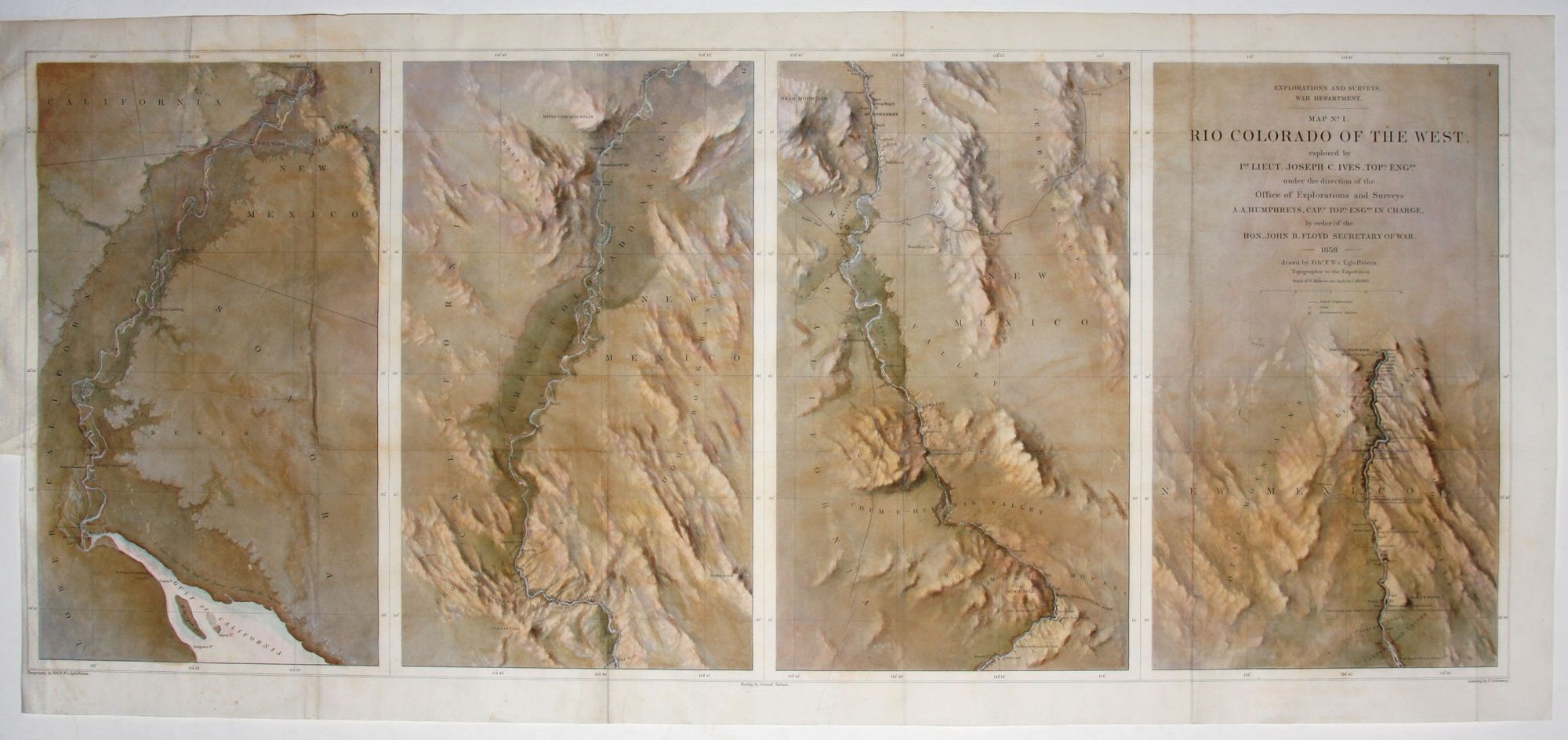
Map No. 1 Rio Colorado Of The West…14 ½ x 34 5/8 inches. [With:] Map No. 2 Rio Colorado Of The West….
14 3/8 x 34 ¾ inches, Lithographs with fine hand color. Minor wear at few fold intersections, mended tear at left in Map No. 2, else excellent condition.
This delicately beautiful pair provided the first mapping of the Grand Canyon “to reflect the physical, political, and geological complexity of this territory newly acquired from Mexico” (Hudson). In these works’ subtle evocation of the unique topography of the canyon, they attain a level of graphic realization suggestive of contemporary satellite imaging. This effect is enhanced by hand coloring of exceptional sensitivity that evokes the distinctive color palette of the region. Although commentators have derided the accuracy of these maps, Hudson explains that Von Egloffstein worked with limited tools and did not have direct experience of the northwest portion of the canyon. The maps accompanied the official report of the 1858 expedition through the region led by Joseph Christmas Ives; the route of the expedition is shown on the maps.
* Hudson, Alice in Cohen, P. Mapping the West, pp. 176-77.
Sold