Liber cronicarum cum figuris et ymaginibus.
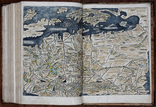
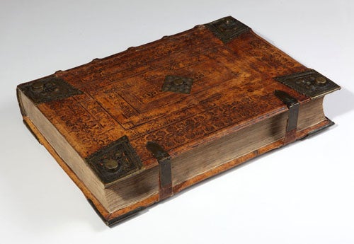
folio [17 x 12 inches], (20) ff. including title and T.O.C., 266 ff., (5) unnumbered ff. and (1) f. blank [the Samartian supplement, quire 55], 267-299 ff., (1) f. with colophon on verso, (1) f. blank. With the Text in 2 columns, 64 lines, in a rotunda type expressly designed for it. 1,809 woodcut illustrations from 645 blocks, of which 31 are double-page; spaces left blank for larger initials. Bound in contemporary blindstamped pigskin over beveled wooden boards with 8 diamond-shaped brass corner-guards and two brass centerpieces, two brass clasps intact. Some scattered marginal soiling, mostly marginal and minor marginal tears to foot of a handful of leaves (not affecting text); faint waterstain to head of last few quires. Double-page map of Europe hand-colored; world map lightly thumbed and slightly soiled with small marginal tear (1 cm) to foot of both leaves, but otherwise very good. An attractive and genuine example.
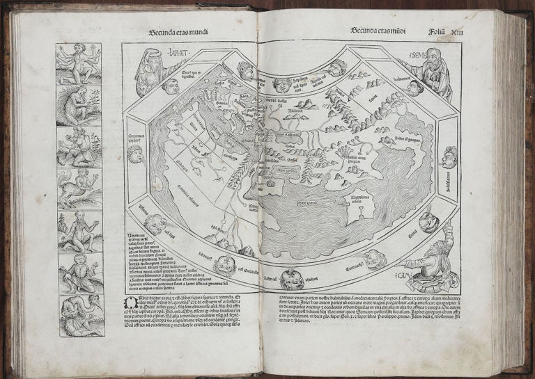
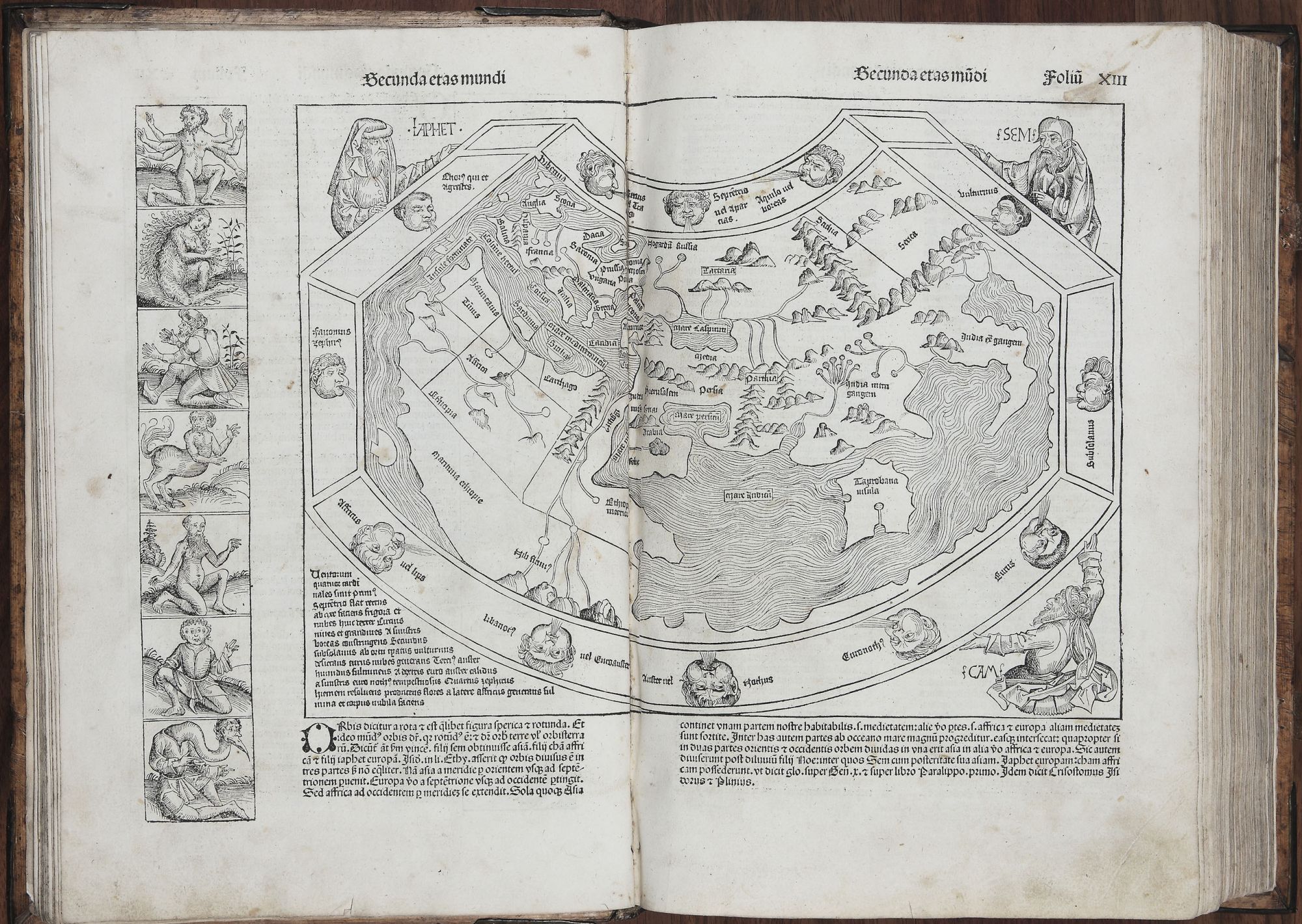
First edition and a handsomely bound copy of the first illustrated encyclopedia published at the dawn of the Age of Discovery, containing one of the earliest obtainable world maps, which presented the world as seen just prior to Columbus’ voyage and the rounding of the Cape of Good Hope by Dias. The general contours of the map are chiefly derived from the most important geographical work of antiquity, Ptolemy’s Geographia, which was recovered during the Renaissance. Of additional interest are the 21 illustrations on the map—seven on the map’s left side and 14 on the preceding page—depicting the grotesque, semi-human figures that were believed to inhabit the remotest corners of the earth. These were derived from the works of Pliny, Solinus and Herodotus as well as from medieval travellers’ tales. The map itself is encircled by twelve wind-heads, and in the corners are the three sons of Noah, symbolizing the volume’s ambitions as a comprehensive chronology of mankind from its origins to the present day.
Indeed, the Nuremberg Chronicle offers nothing less than a history of the world, and in its own fashion it expanded its readers’ knowledge of local cities and states just as the transatlantic voyages expanded the boundaries of the world. As a representative picture of 15th century geographical and historical knowledge, the work is unsurpassed among incunables, in which books of a religious and liturgical nature predominate. A milestone in the history of printing as well, Schedel’s monumental work contains more illustrations than had ever appeared in a printed book.
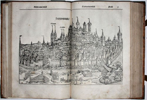
The magnificent woodcut views (of which 31 are double-page) are in most cases the first printed depictions of the cities and towns they represent, illustrating how 15th century readers pictured places that most of them would never visit. Many views, such as the important double-page woodcut of Jerusalem, were based on the most up-to-date reports of travellers.The colophon credits the artists Michael Wolgemut and Wilhelm Pleydenwurff for execution of the woodcuts—a detail of some import, since Albrecht Dürer was at this time an apprentice in their workshop.
The work’s author, Hartmann Schedel (1440-1514), was a physician and an important humanist whose outstanding library provided many of the research materials for this work. (Today Schedel’s private library is among the most precious collections of the Bayerische Staatsbibliothek in Munich.) A German edition of the Liber cronicarum followed later the same year.
* Goff S-307; Hain Copinger 14508; BMC II.437; Schreiber 5203; Wilson, The Making of the Nuremberg Chronicle (1976); Shirley, The Mapping of the World, 19; The World Encompassed 44.
Sold