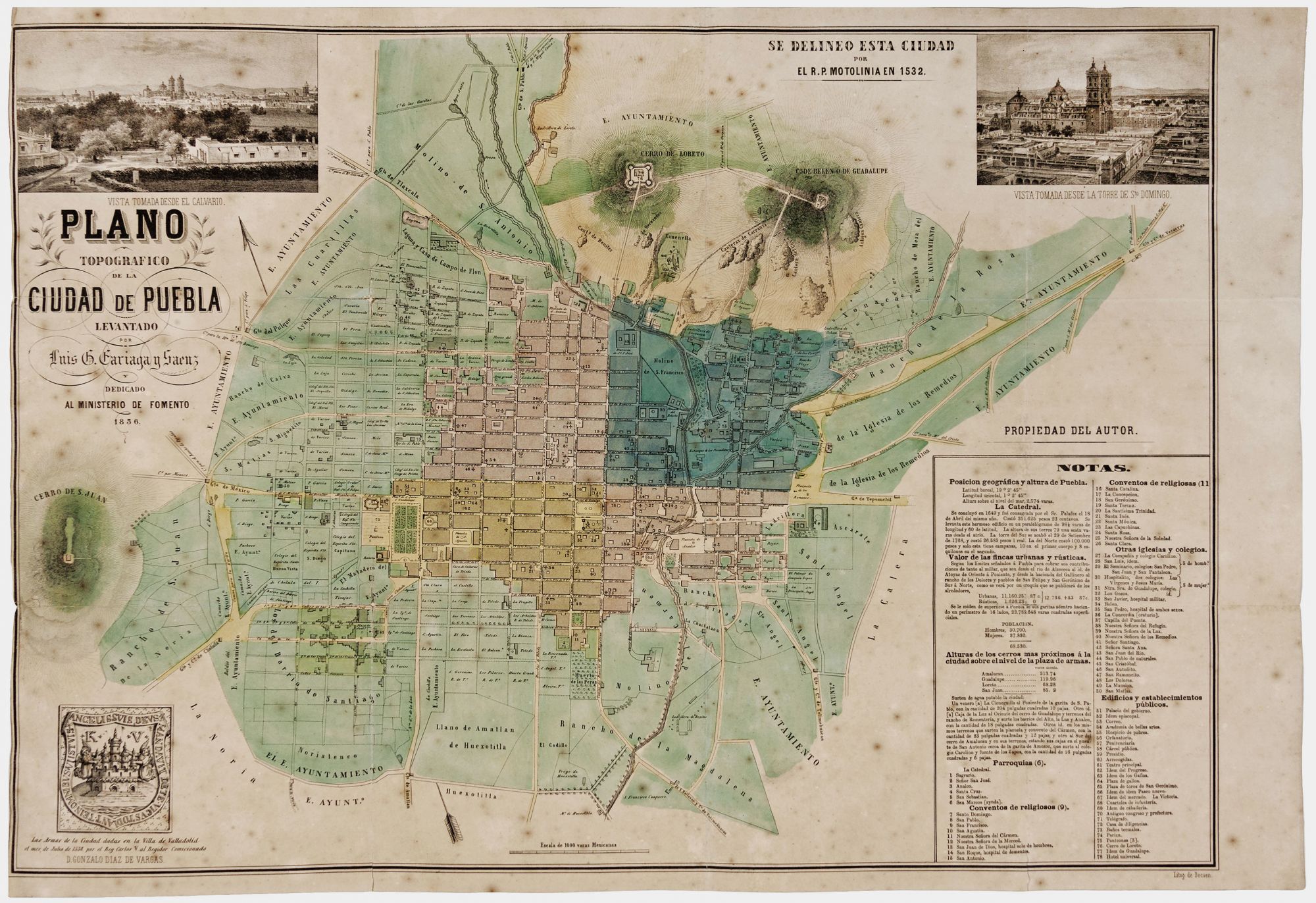
Plano Topografico De La Ciudad De Puebla….
16 ¾ x 23 5/8 inches, Lithographed folding map, here flattened, with original hand color. Lightly toned, few reinforced fold splits, light foxing, still very good overall. Rare, separately published, Mexican-published map of this very important, Spanish colonial city and the capitol of the state of Puebla. Mexico's fourth largest city, it is currently both an industrial powerhouse as well as an academic center. A numbered legend at lower right lists the city's major structures at the time; each is keyed to the plan. Diagrams of several structures are shown on the plan and streets are named. There are two nicely detailed views in the upper corners. The plan appeared during a fraught period in the city's history. It had been occupied by United States forces during the Mexican War until the signing of the peace treaty in 1848. Not long after in 1862, the Battle of Puebla was fought against French interventionist forces. Puebla was attacked again by the French forces in 1863, which occupied the city until 1866.