

A Complete Historical, Chronological, And Geographical American Atlas, being a guide to the history of North and South America, and the West Indies... to the year 1822.
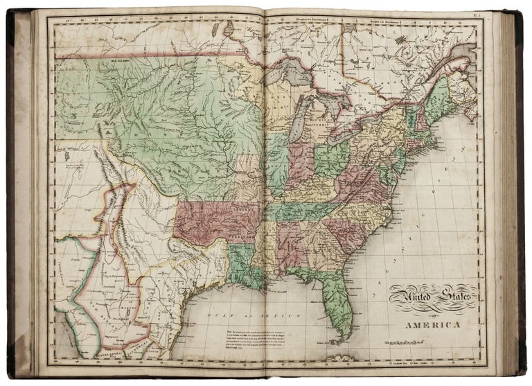
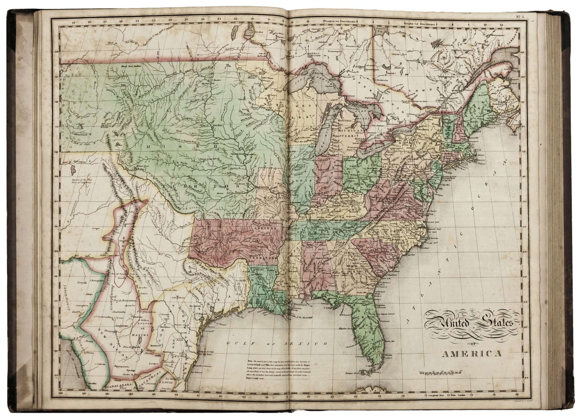
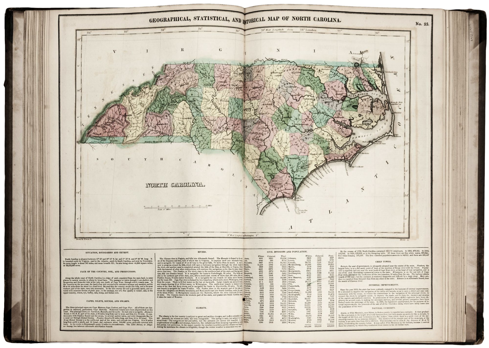
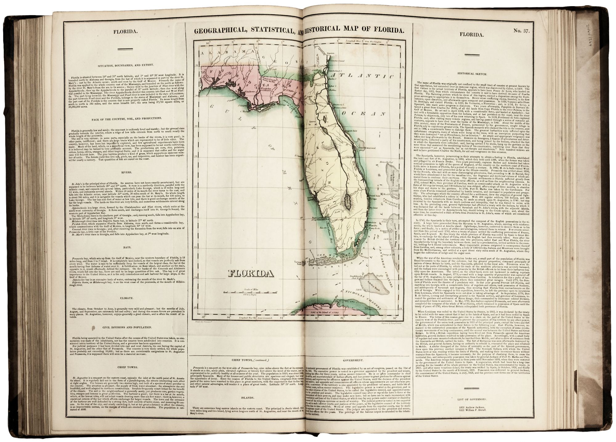
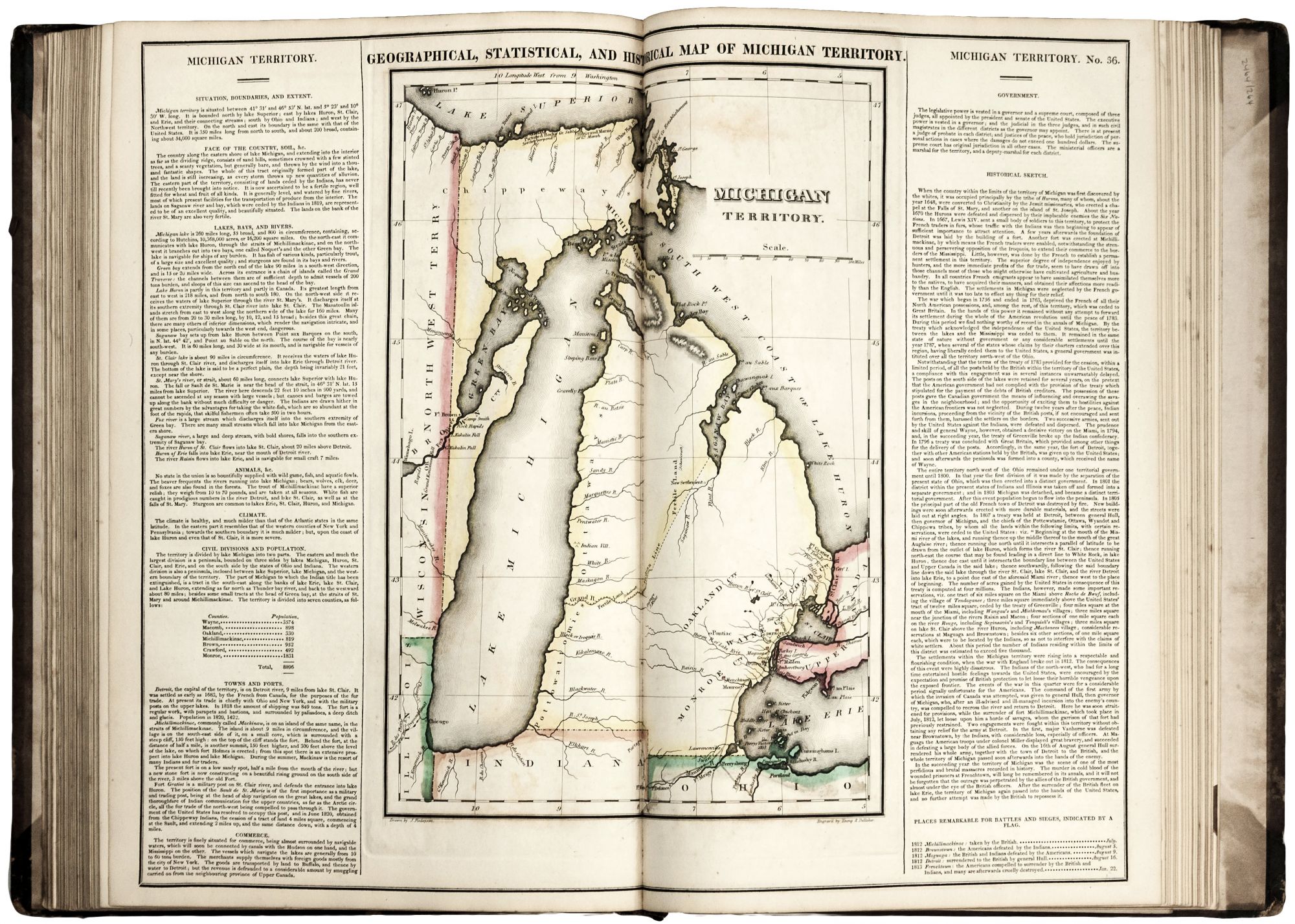
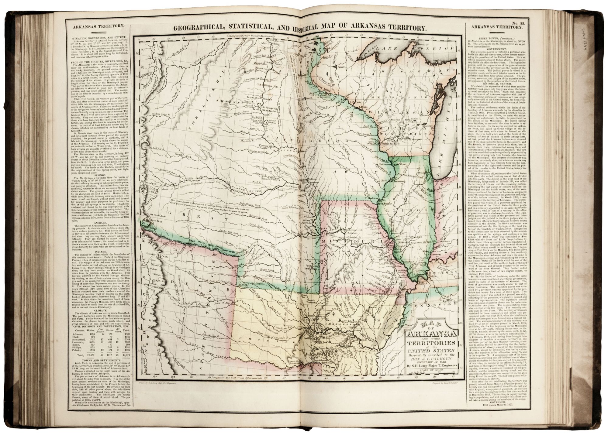
Folio., (3), (122) p.l., including 46 maps with period wash color. In the original publisher's binding of brown paper over boards, stained and worn, with black morocco spine, re-cornered; some waterstaining to prelim. leaves; maps excellent. An excellent copy in a contemporary binding of the first edition of an early American atlas with its maps having particularly vibrant coloring of the period. In addition to the atlas's strong concentration on the United States, it also provided thorough coverage of the Caribbean and Latin America; included are excellent maps of Cuba, Puerto Rico and the Virgin Islands, respectively. Maps of several states in this work were the first of their areas to appear in an atlas; these include Illinois (admitted 1818), Alabama (1819), Maine (1820), and Missouri (1821). Also important are the maps of the Florida, Michigan and Arkansas territories; Wheat calls the latter "the most interesting in the Atlas," as it was a printing of Stephen H. Long's manuscript map. One of the great early 19th century explorers along with Zebulan Pike, Major Long investigated the front ranges of the Rockies. This map, which traces the route of his expedition, is one of the most important of the area published in the nineteenth century. In addition, both the "North America" and "United States" maps in the atlas provide up-to-date views of the country at the time, with the former showing the routes of recent explorations, including Pike's and Long's. The Michigan Territory map includes the Upper Peninsula, which was added to the territory in 1818. The map of the Florida Territory in the atlas was the first we are aware of the area as a territory of the United States. Its acquisition from Spain was not consummated until 1821, though the process began in 1818. Moreover, it was not until March of 1822 that Florida’s territorial government was established by Congress. This fledgling government, with power strongly centralized in the office of governor, is described in some detail in the text of this map. The atlas’s precisely engraved maps signaled the growing professionalism of American mapmaking. It was also the first American atlas with maps to have full body coloring. The extensive text surrounding each map—providing geographic, political and cultural information as well as lengthy historical sketches—reflects a more literate consumer, who demanded a greater depth of knowledge than previous atlases supplied. Henry Carey was the son of Matthew Carey, who produced the first American atlas in 1795. Although there are only three separately dated editions of this atlas—1822, 1823 and 1827—Rumsey (no. 4403) has noted different states of these editions, based on changes made to individual maps. Philips Atlases 1373a; Rumsey 4403; Kaser, Mssrs. Carey & Lea of Philadelphia, pp. 29-30; Wheat, Mapping of the Transmississippi West II:81.
Price: $9,500.00