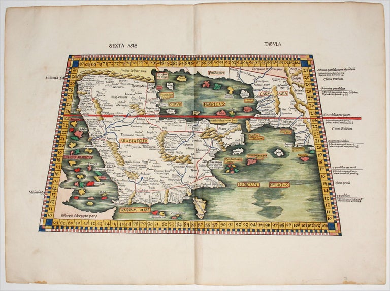
Sexta Asie Tabula.
12.25 x 2.75 inches, Fine condition.
A beautiful example, in bold, rare original color, of the ancient map of the Arabian Peninsula from the most important edition of Ptolemy’s Geographia of the 16th century. It is among the earliest acquirable maps to focus on the region, and it is among the most beautiful of any Waldseemuller we have handled in recent years.
The map was the most detailed of the Ptolemaic maps of the Peninsula produced to date. It includes territorial boundaries often omitted in earlier iterations of the map, as well as additional details – further rivers, for example – beyond those few which were included on maps of Arabia prior to 1513.
The atlas in which this map appeared is one of the most important cartographic records of the Age of Discovery. It was the first atlas to contain separate maps of parts of the world then just coming to light.
* Tibbetts, G. R. Arabia in Early Maps #13.
Sold