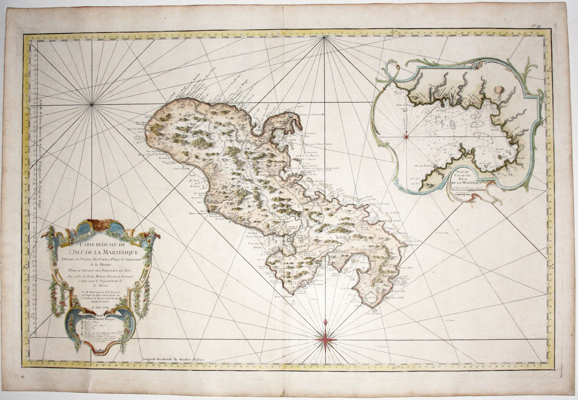
Carte Reduite De L'Isle De La Martinique.
Plate size: 58 x 89.7 cm (22.8 x 35.3 inches); Sheet size: 64.2 x 95 cm (25.2 x 37.4 inches). Fine hand color; on double-ply paper (as issued?). No. 79 printed in upper right corner. Few minor marginal mends not affecting printed surface, else excellent. A beautiful, large-scale, combined map and nautical chart of the Windward island, still under French control today. It was one of the many Caribbean sugar-producing islands, as evidenced by the several windmills on this map. It also shows military installations, towns, estates, roads, churches and parish houses and depicts the island's rugged, semi-mountainous topography. Within the large inset at upper right is the island's primary harbor, Fort-du-France Bay, on which sits its eponymous largest town; considerable navigational detail is provided. Jacques Nicolas Bellin (1703-1772) was the Hydrographer to the King and first chief hydrographic engineer of the Depot des cartes, plans et journaux du Ministere de la Marine. The agency supplied charts like the present one to the French Navy, at least in part from Bellin's own stock.
Price: $1,250.00