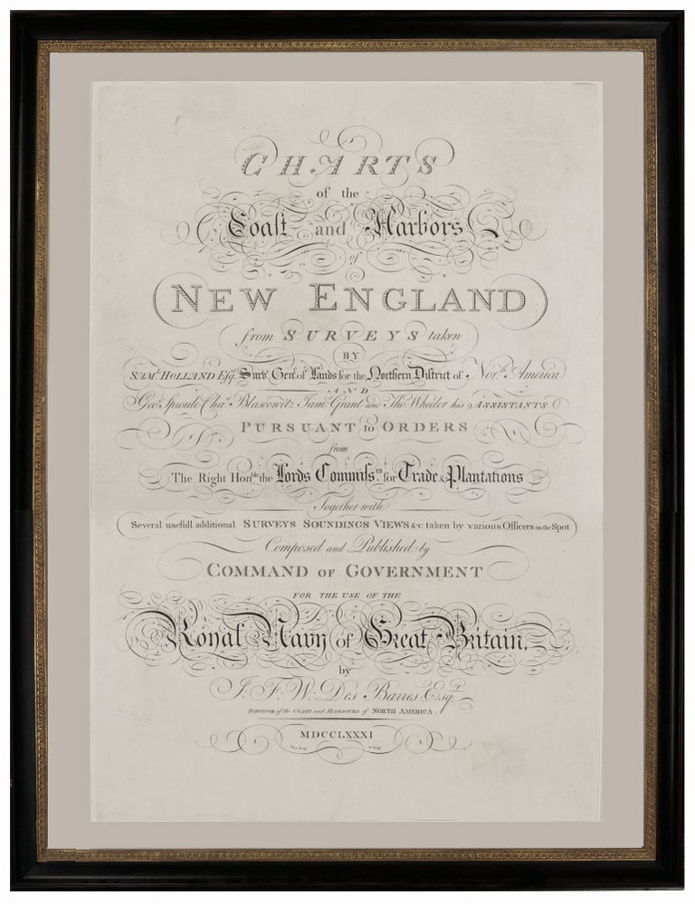
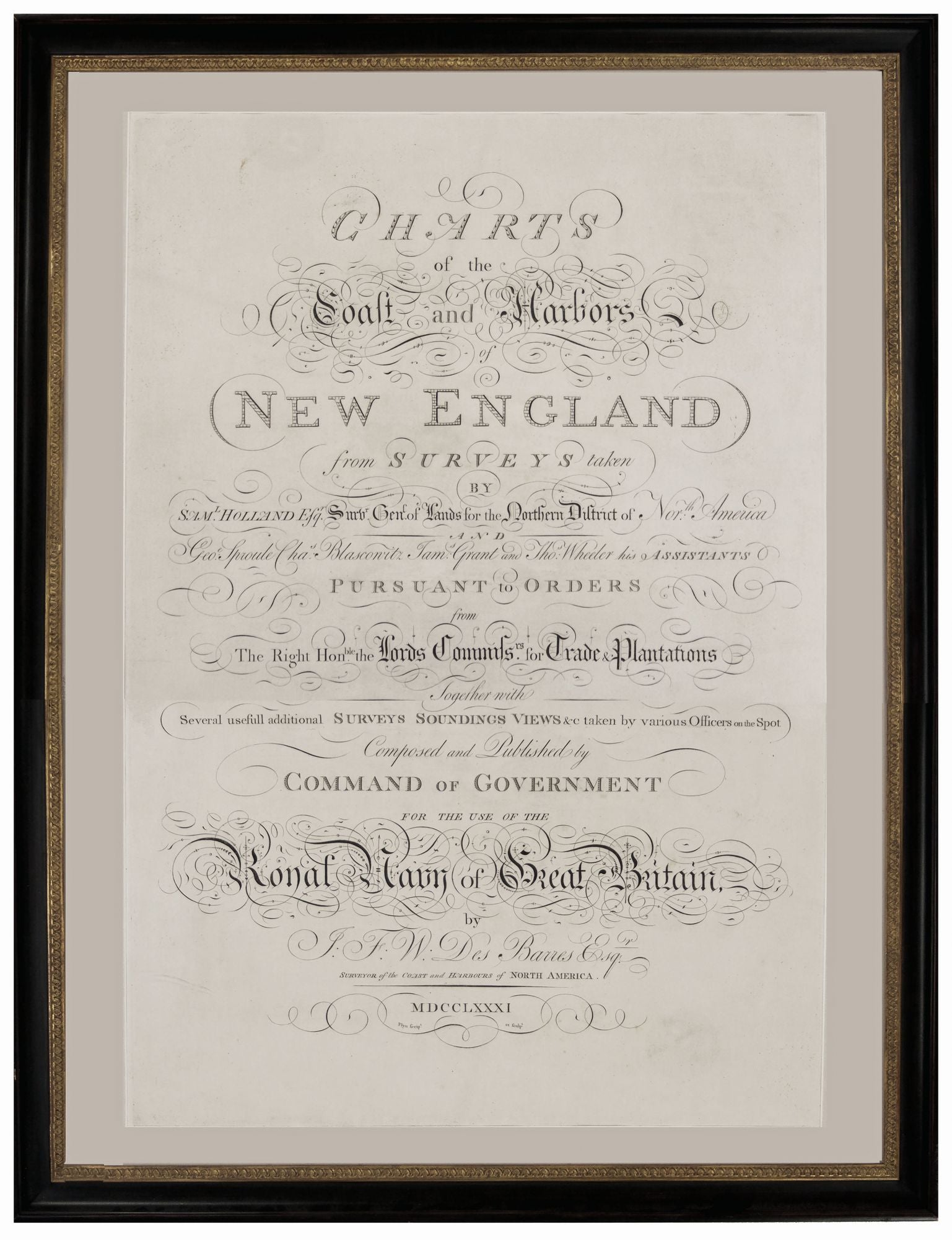
Charts of the Coast and Harbors of New England . . .
27 x 19 inches, Fine condition. Elegantly Framed. A truly remarkable feat of engraving, in which every line is in its own, distinctive typographic style, that served as the title-page of the highly important New England volume of the Atlantic Neptune, one of the most ambitious and well wrought productions of early cartography. Because of the quality of the surveying that underwrote this atlas, it raised the charting of the eastern seaboard to a level of accuracy well beyond anything previously seen. Beyond the virtuosity of the engraving displayed here--it's a sampler of the most elegant typographic styles of its day--the title-page also tells us much about the work itself. It acknowledges the primary role of Samuel Holland in the surveying of New England's coast and names his chief assistants. Although the Atlantic Neptune was an unusual hybrid of an official and commercial publication, much of the pomp and verbiage of the title-page points up its creation as having been at the behest of the highest levels of government. The engraver of this sheet is only identified as Flyn, who must be the J. Flyn (fl. 1761-1782), identified by Worms & Baynton William (see below), although this work is not mentioned by them. British Map Engravers, p. 238.
Sold