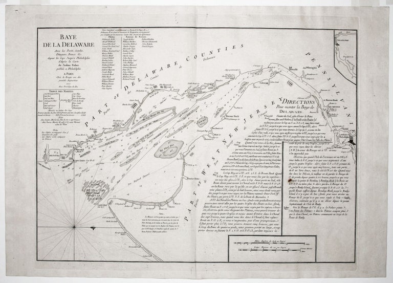
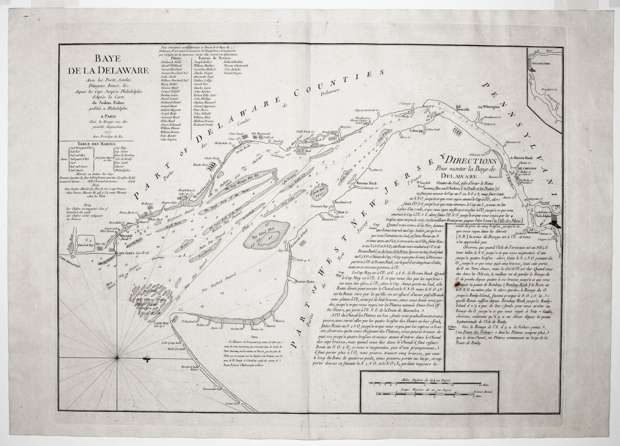
Baye De La Delaware….
18 ½ x 25 ¼ inches, One stain in text, mended worming in centerfold with slight loss; very good overall. An important chart of a vital waterway that provides access by sea for Philadelphia, the wellspring of the American Revolution as well as the largest city in the United States at the time. Prepared for the French navy the year the French joined the American cause, the chart was the best available at the time. Its navigational information is ample and includes depths, hazards, channels, as well as extensive textual sailing directions. It was only this very scarce second state of the chart that provided sailing directions. The chart is further valuable as a historical resource for the lists of pilots and ship owner it provides. The chart was first published by Joshua Fisher in Philadelphia in 1756 but did not extend all the way to Philadelphia, which was rectified in a 1775 edition; it was then published in England by Faden in 1776. This edition, however, did not include the sailing directions and was not as finely engraved as Le Rouge’s. Georges-Louis Le Rouge (c. 1712-c. 1790) was the most prolific publisher of maps and charts of North America during the period of the American Revolution. He published both an atlas of charts, in which the present work appeared—the Naptune Americo-Septentrional—and the Atlas Ameriquain Septentrional, also in 1778, described as “the best collection of French maps for North America during the Revolutionary War” (Cobb, Krieger). A former German military officer, Le Rouge established a successful map business in Paris and attained the title of “Ingenieur Geographe du Roi.” Snyder, City of Independence, pp. 270-71, fig. 184.
Sold