
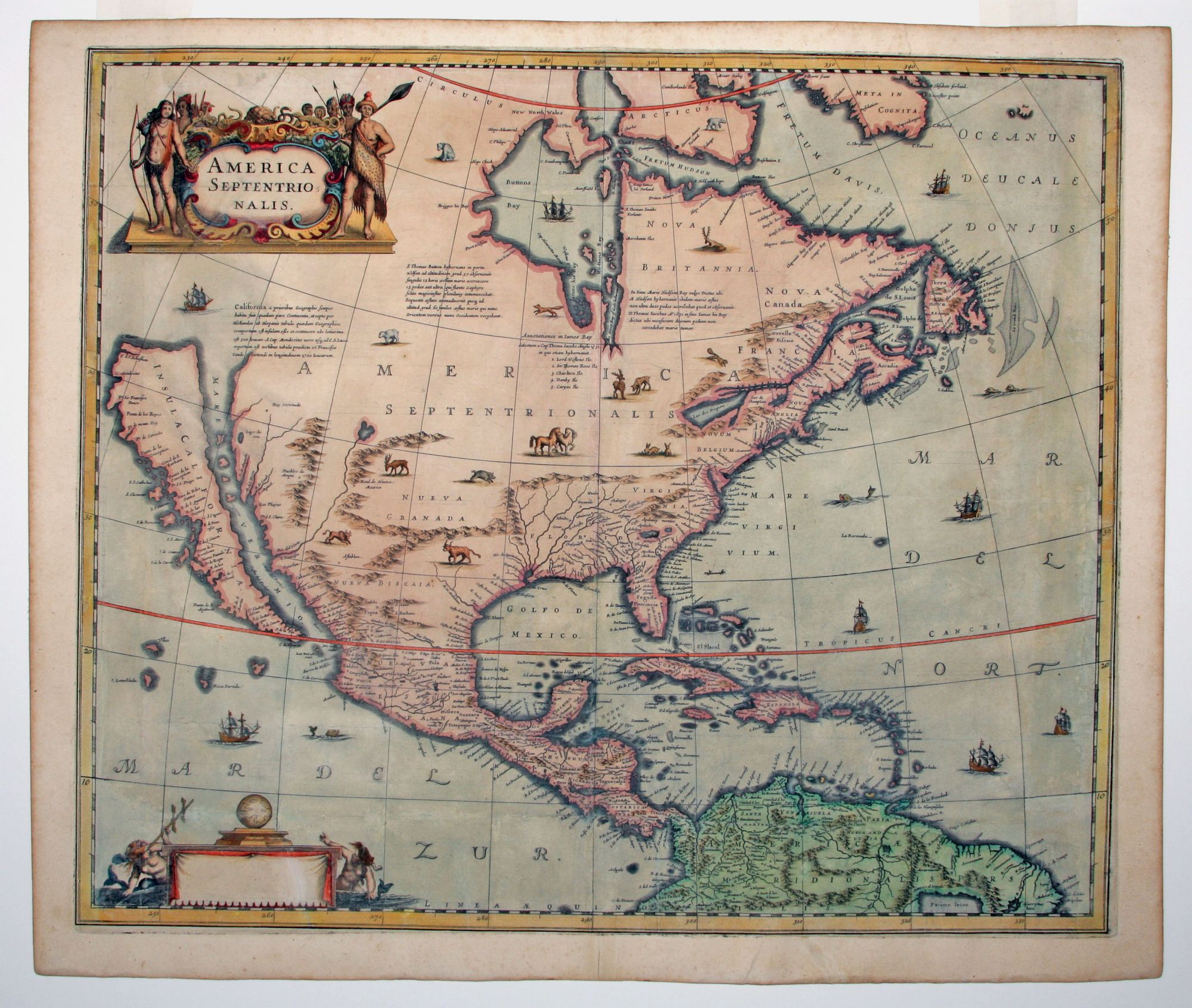
America Septentrionalis.
18 1/4 x 21 1/2 inches, Fine hand color; considerable restoration to side margins but little engraved surface affected, some repaired tears & splitting but all expertly done; fair. The now seldomly seen first state of an important, early Dutch map of North America. It one of the first Dutch atlas maps to show California as an island, preceded in this regard by only the Hondius world map of 1633. A note on the map recounting the story of the origin of the California-as-an-island myth refers to a Dutch captain who obtained a map of California depicted as an island from a captured Spanish ship. The note even provides the dimensions of the island. The Jansson-Hondius map was thus an important conduit for bringing the island myth into the cartographic mainstream. Further, Tooley noted the map was also "first attempt in Holland to add lakes connected to the St. Lawrence." One of these lakes on the map is in the approximate shape and position of Lake Ontario. This was also one of a very few, early Dutch maps specifically of North America (as opposed to the entire Western Hemisphere). Aside from the rare De Jode map of 1593, this is the only folio-sized map of North America produced during the entire Dutch Golden Age. The map’s ornamentation is also noteworthy, including some of the earliest illustrations of animals associated with the American West, such as a Longhorn steer, buffalo, and wild horses. Burden 245, state 1; McLaughlin, California as an Island, no. 6; Tooley, America, p. 311; Goss, North America, p. 72; Karpinski, p. 89.
Sold