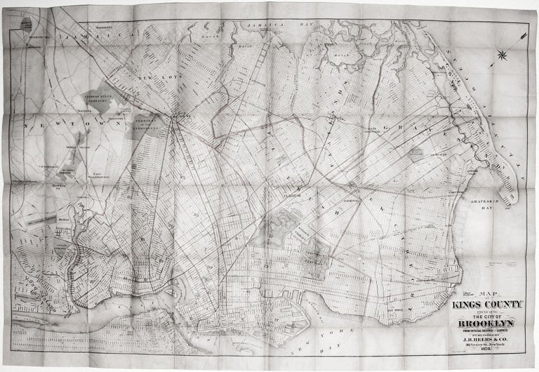
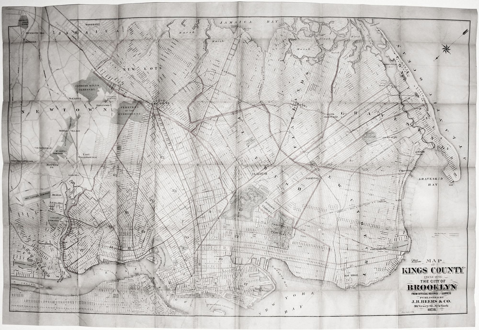
Map of Kings County Including The City Of Brooklyn From Official Records And Surveys.
25 1/2 x 40 1/4 inches, Lithograph with original hand color. A few fold reinforcements, lightly toned, overall very good.
An excellent cartographic portrait of Brooklyn after a period of explosive growth following the Civil War. From its ship building role during the war, Brooklyn expanded its industrial and commercial bases in the post-war years. At the time of this map, Brooklyn was the third largest city in the United States. Streets for the entire borough (then county) have been at least laid out, and a system of rail transport, both steam and horse-powered, knits together the area. (The name "Brooklyn" would not come to refer to all of King's County, as depicted here, until the formation of greater New York City in 1898. At the time of this map, "Brooklyn" was one of six towns in King's County, though by far the largest and most densely populated.) Although this map was published five years prior to the opening of the Brooklyn Bridge, it shows the structure ("East Riv. Suspension Bridge"), whose construction began in 1869.
* Three OCLC locations: British Library, N. Y. State Lib., N. Y. Hist. Soc. Lib.
Sold