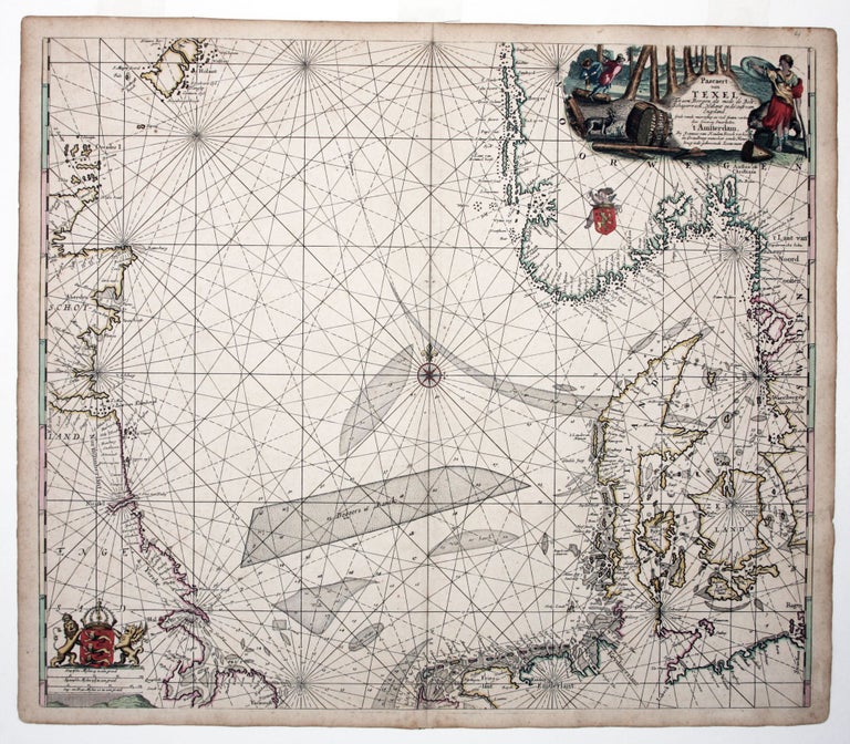
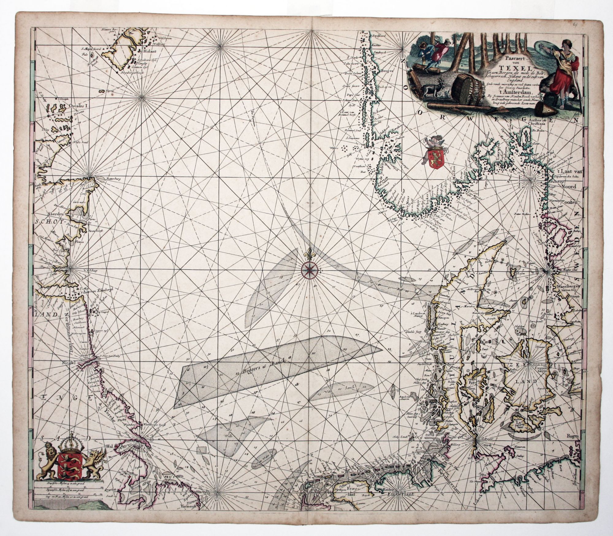
Denmark/ Norway/ Sweden/ British Isles..
[Amsterdam, c. 1690]
Pascaert van Texel tot aen Bergen….
20 x 23 ¼ inches. Fine original color; thick double-ply paper as issued, excellent condition.
A very attractive nautical chart of the North Sea, including the eastern coastline of Scotland and northern England, Denmark, Sweden and Norway. The attractive cartouche shows a logging scene, alluding to Norway’s timber trade. The Van Keulen firm was a leading supplier of charts, instruments, and maritime related books of uncommon longevity. It remained a family-controlled business until 1823 and then continued to operate under another owner until 1885.
* Ginsberg, W. Sea Charts of Norway 1585-1812. 8B.3a; Tooley in MCC 71 part II, 371.
Sold
See all items in
Antique Maps
See all items by J. VAN KEULEN