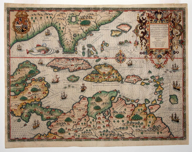
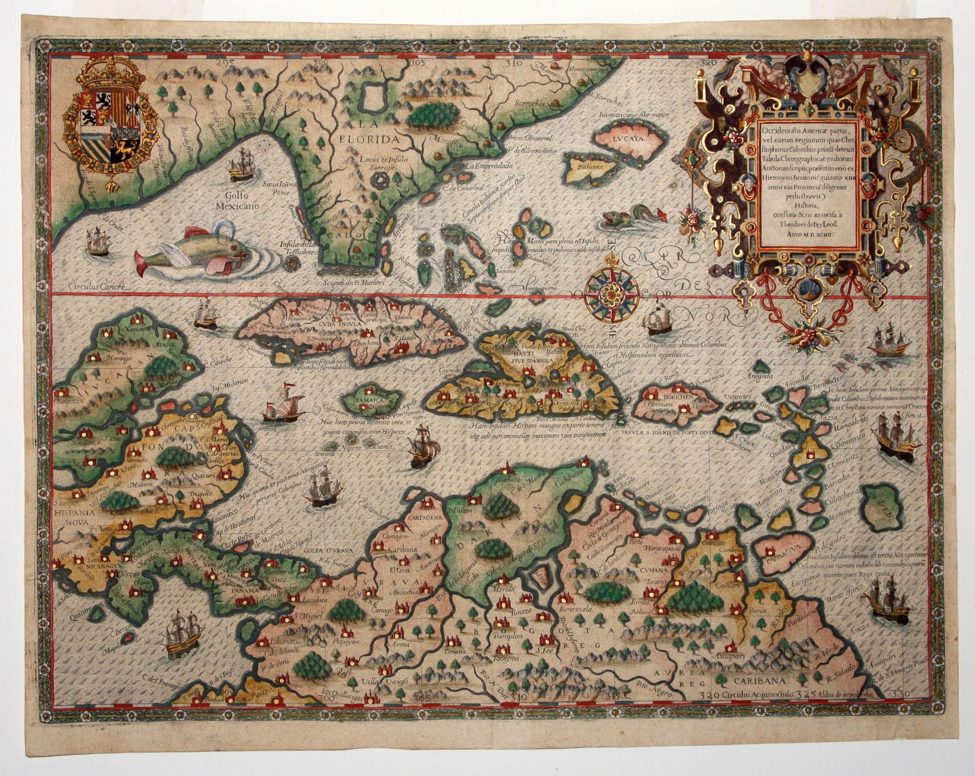
Occidentalis Americae partis, ve, earum Regionum quas Christophorus Columbus . .
13 x 17 ¼ inches. Superb hand color, heightened with gold; top margin extended with reinstatement of small portion of decorative border, few small mends, still a most attractive example.
One of the engraving masterworks of early cartography, this is arguably the most beautiful early map of the Caribbean – here with superb color heightened with gold. The map’s engraver, Theodore De Bry, was trained as a goldsmith, and the intricacy inherent in this craft can be seen in this map’s wondrously complex cartouche, one of the most elaborate to be found on an early map. The map also includes representations of Columbus’ ships and various notes regarding his discoveries. It appeared in Book IV of De Bry’s Grands Voyages with text by Benzoni. De Bry’s work, more than any other illustrated book up to its time, shaped the way Europeans pictured the New World and its inhabitants during the Discovery Period. Florida is shown flattened in the south after LeMoyne.
* Burden 83.
Sold