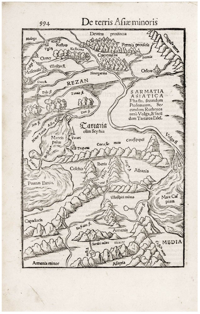
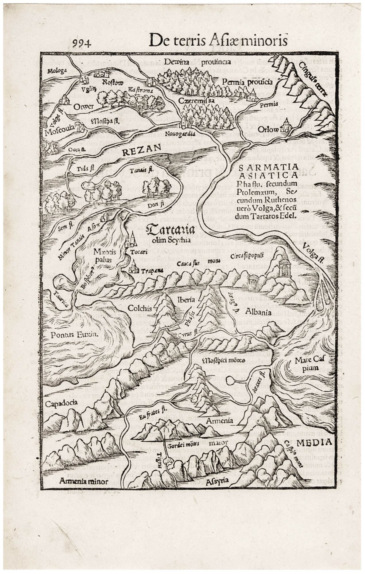
Caucasus/ Armenia/ Russia.
[Basel, 1554]
Tartaria olim Scythia.
9 ¾ x 6 ½ inches, Fine condition, with a bold, sharp strike. A very attractive, early woodcut map of the easternmost extent of Europe, reaching from Russia in the north to Syria and part of Persia in the south. The map is centered on a mountainous region between the Black Sea and the Caspian Sea. The toponymy of the map is a blend of modern terminology and classical place names (drawn largely from Ptolemy). The northern regions, in particular, reflect contemporary knowledge. The Don River and the Volga are both shown, and Muscovy is depicted with its chief cities of Moscow and Novgorod. In the south, ancient names hold sway.
Sold
See all items in
Antique Maps
See all items by S. MUNSTER