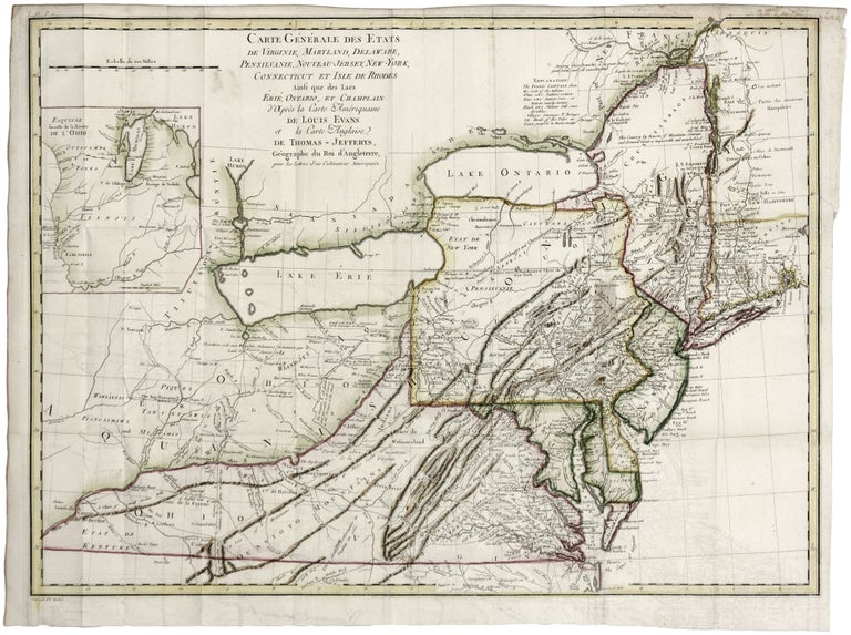
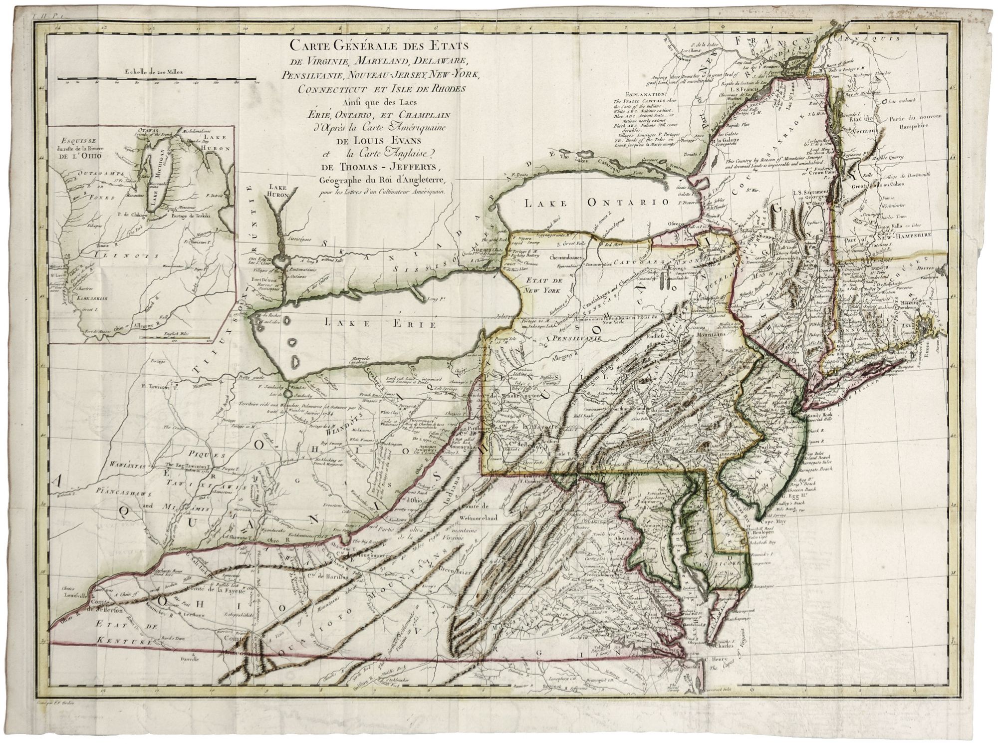
Carte Generale De Etats De Virginie, Maryland, Delaware, Pensilvanie, Nouveau-Jersey, New-York, Connecticut et Isle de Rhodes amsi que des Lacvs Erie, Ontario et Champlain.
18 ¾ x 25 ¾ inches, Fine hand color; few mended splits in right margin just entering surface, folds but no wear, excellent.
Updated edition of Evans' monumental and rare map, called by Schwartz "the most ambitious performance of its kind undertaken in America up to that time;" also hailed by McCorkle as “one of the most important maps made in the colonial period.” Evans' map was one of the very first to map the trans-Appalachian area with general accuracy. For this edition of the map, Crevecoeur added detail not just pertaining to New England, as McCorkle states, but more significantly in the Great Lakes region from French sources. St. Louis appears on the map; the Portage of “Chikago” is shown among other such features known to the French that did not appear on the Evans. The Niagara River region shows more detail of tributaries and includes Fort Erie. Throughout the frontier regions, newly added place names indicate growing American influence. For example, both Kentucky and Vermont are named on the Crevecoeur version of the map. Kentucky is referred to as a state, although it would not become one officially until 1792. There are early references to important cities in these areas as well: Louisville, and Leestown, which was the first Anglo-American settlement on the north side of the Kentucky River and is now part of Frankfort. While much of “Etat de Vermont” remains empty, Putney, Bennington, and Dartmouth College are shown. In showing Indian tribes, the map distinguishes between nations that were at the time “extinct” or “nearly extinct” and those that were “still considerable.”
* McCorkle, 787.6.
Sold