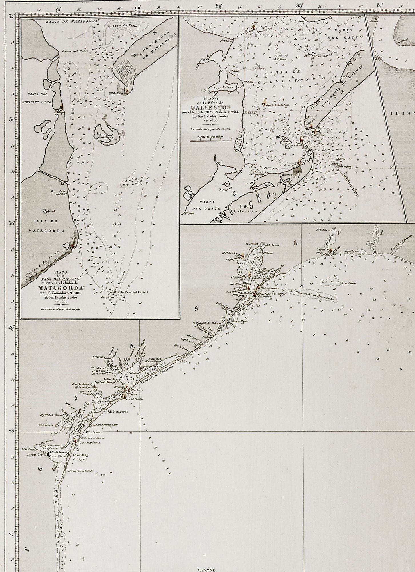
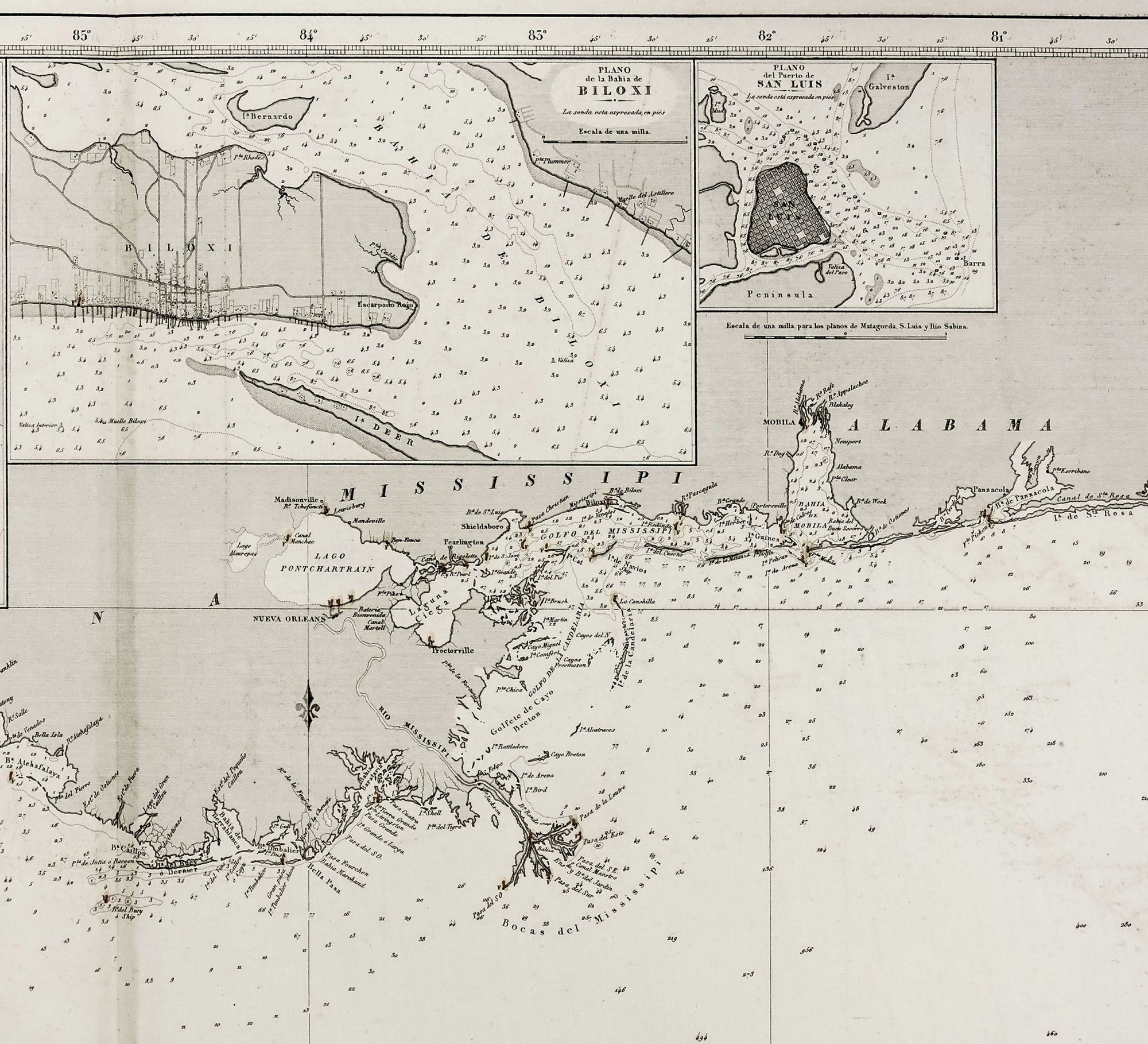
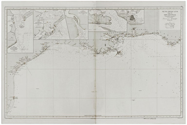
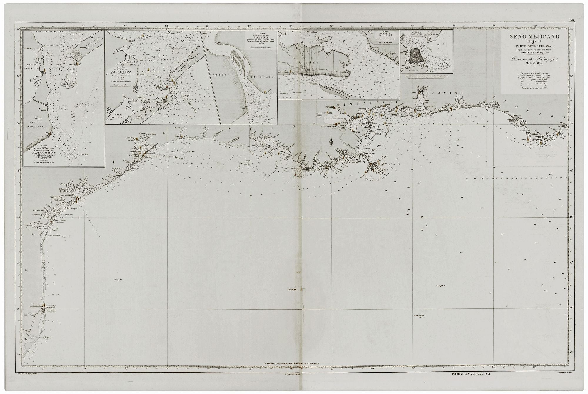
Seno Mejicano Hoja II. Parte Setentrional….
23 ¾ x 38 inches, Blind stamp of the Direccion de Hidrografia. Lighthouses colored in red and yellow; mend along lower centerfold, else excellent. A very scarce, elegant Spanish chart of the Gulf Coast including the entire Texas coastline and extending east to the Florida Panhandle. Three of its insets relate to Texas; they are of the Matagorda Inlet, the Galveston Inlet and Bay, and the mouth of the Sabine River. The chart also provides excellent detail of the Mississippi Delta region, and another inset focuses on Biloxi. The chart's cartographer and draftsman was Tomas Bryant, and it was issued by Spain's official chart publishing and storage agency, the Direccion de Hidrografia. In 1788, it succeeded the Casa de Contratacion and remained in existence until the beginning of the 20th century.