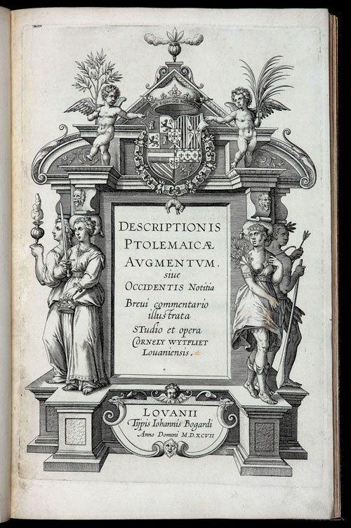
Descriptionis Ptolemaicae Augmentum sive Occidentis Notitia Brevi commentario illustrata Studio et opera Cornely Wytfliet Louaniensis. Lovanii Tijpis Iohannis Bogardi Anno Domini M.D.XCVII.
Small folio, (3) p.l., 104 pp. (numeration corrupt—95 actual pp) (1) blank & 19 double page, numbered maps interleaved in text (world map unnumbered as called for). In handsome, later, brown morocco binding by Alix; a.e.g.; title in gilt on spine; marbled end papers, internally few faints stains, else fine throughout.
A legendary rarity--the true first edition of the first atlas of the Americas. The first complete copy on the market in well over twenty years. All told only seven complete copies of the first issue, first edition have been located: Alden cities two (NYPL and Huntington); three additional institutional copies are noted on OCLC* (U. of Minn., Lehigh, U. of Chicago); and Gallup cites two in private collections. One of these latter is the copy reproduced in the TOT facsimile atlas; this same copy is also described by Koeman.
Two distinct editions of the Descriptionis Ptolemaicae Augmentum appeared in 1597. They can be easily distinguished by pagination: the first edition has 104 pp., and the edition which was reset later the same year, has 191pp. Our copy conforms to the 1597 ‘A’ edition described by Skeleton, including the numerous errors in page numeration recorded by Skeleton and Gallup and even by the presence of the final blank. A minor qualification of this statement is the fact that the maps in our copy are interleaved in the text rather than placed together after the text, which in all likelihood was done in the process of re-binding. The true first edition is recorded neither by Phillips nor Sabin, which cites the 191 pp. edition issued the same year. In the last ten years, two incomplete copies of the first edition have come to market - one at auction and one in a dealer’s catalogue – both selling for substantial sums.
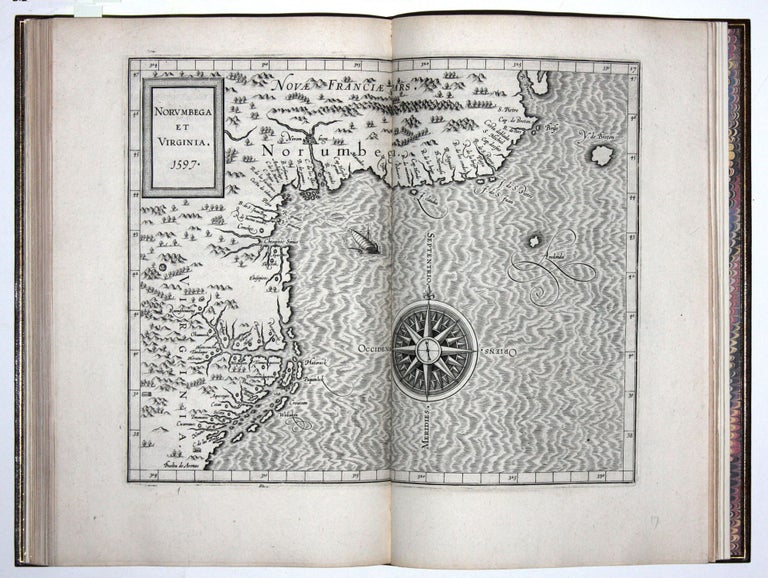
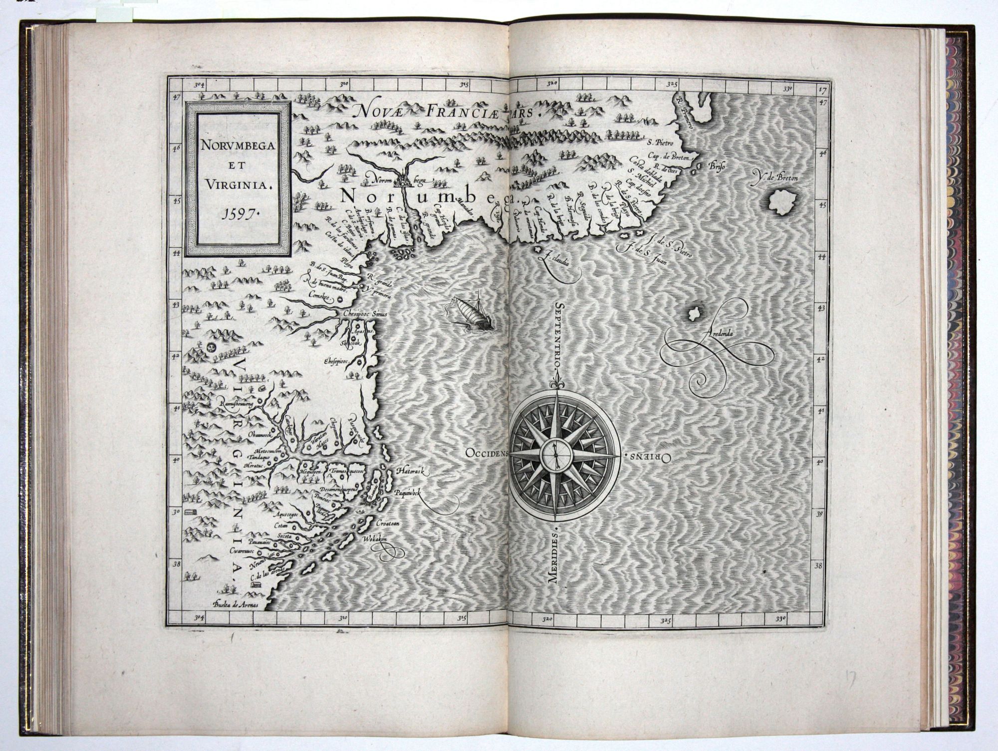
"As the first general geography of America, the text of Wytfliet's work may, at least in some degree, have contributed to dispel many of the errors regarding the New World . . . In the history of early cartography, the maps in Wytfliet's Augmentum play the same part for the New World as Ptolemy's do for the old hemisphere, and they give us . . . a valuable summary of the early cartography of America" - Nordenskiold, Facsimile Atlas. Many of Wytfliet’s 19 maps are among the earliest regional maps of North America. The map of California, for example, is the earliest separately printed map of that area; "Anian Regnum" of the northwest coast and Alaska is the first to focus exclusively on the area. Wytfliet's "Norumbega" is "the most accurate antecedent to Joannes de Laet's 1630 "Nova Anglia, Novvum Belgium et Virginia" -Schwartz, The Mapping of America, p. 83. The map of the Southeast has a distinctive delineation of Florida that influenced later maps.
*Several other 1597 editions of the atlas are cited in OCLC, but only the ones mentioned above are true first issues of the first edition.
* Skelton, R. A. Introduction to TOT Facsimile edition; this edition not in Sabin, Phillips; Alden 597/70; Koeman Wyt 1 A (copying Skelton collation); The World Encompassed, 204; Gallup, D. “The First Separately Published Atlas…” in PBSA Vol. 76, no. 1; (Maps:) Burden 100-107.
Sold