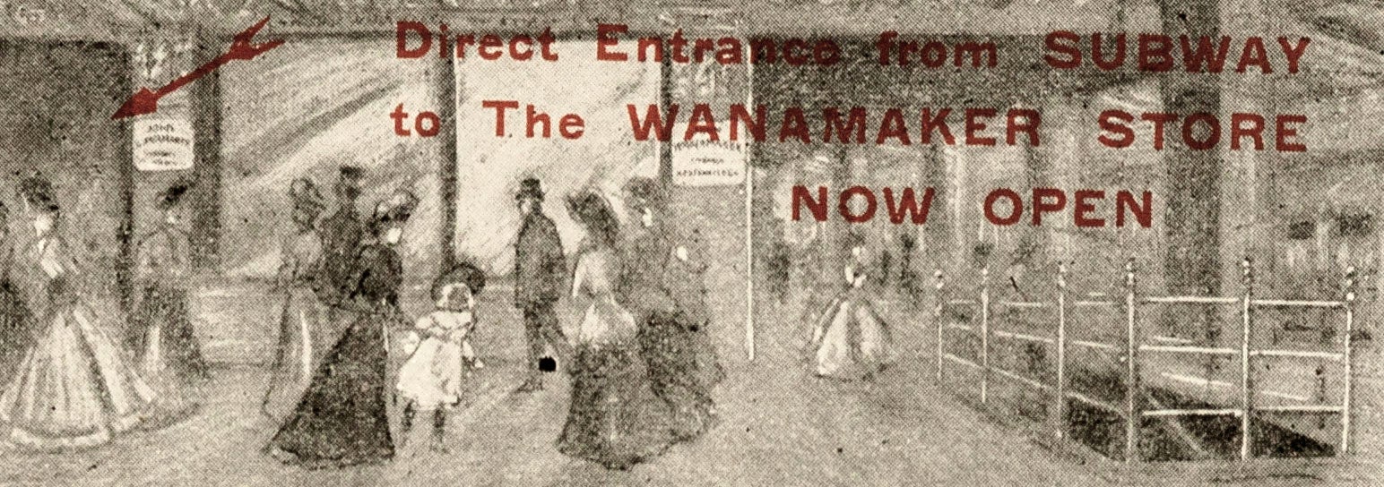
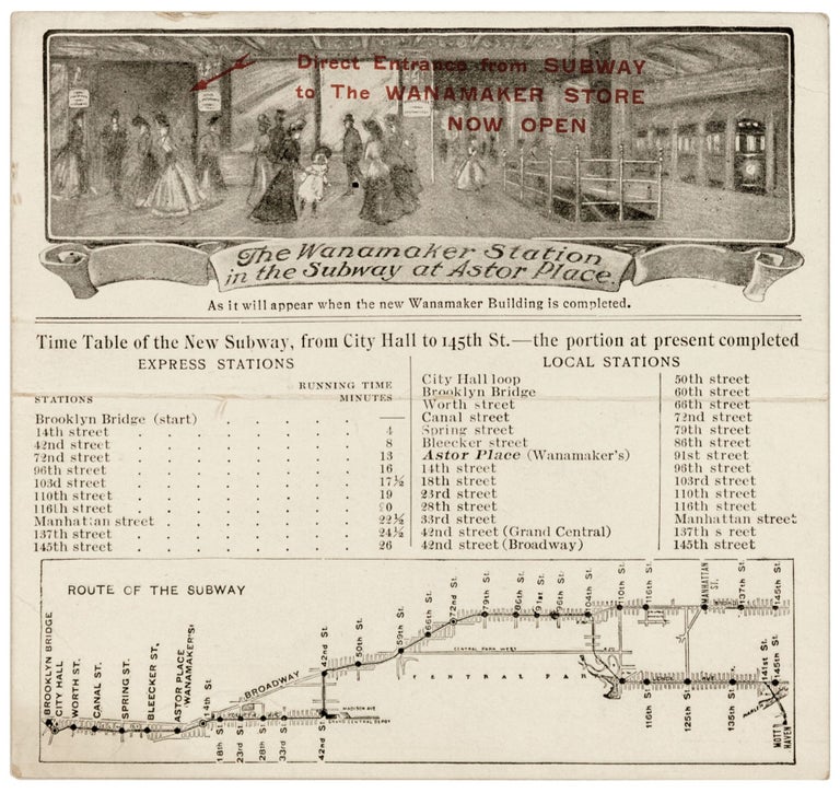
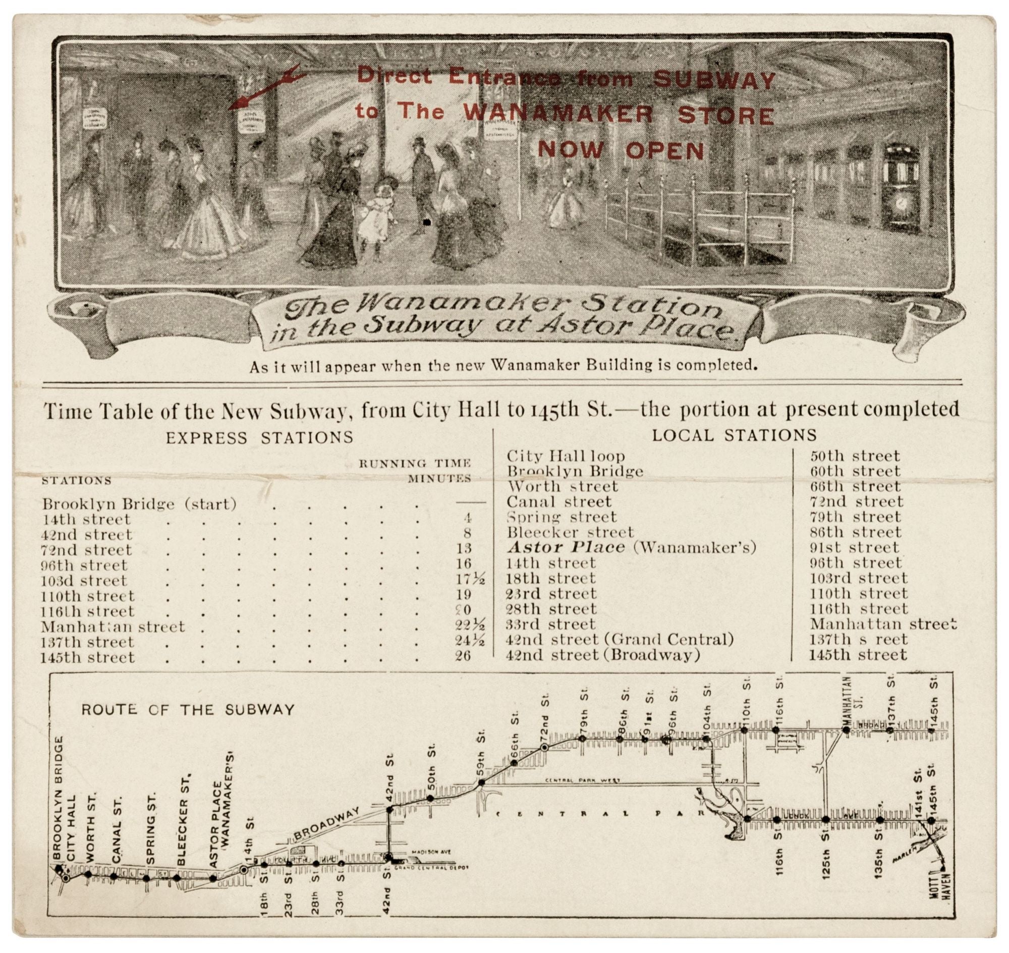
The Wanamaker Station in the Subway at Astor Place.
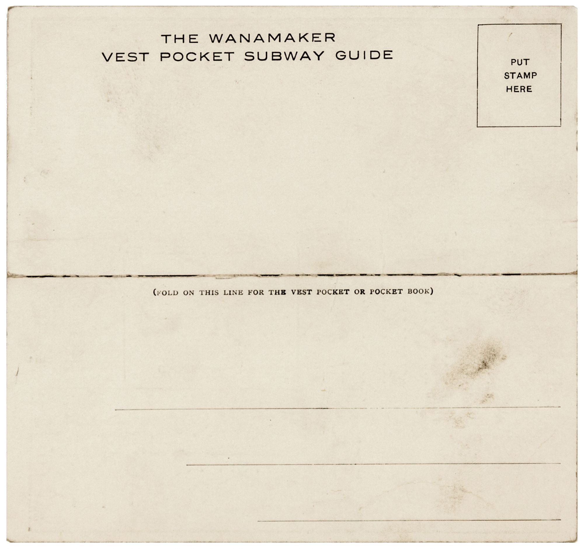
5 x 5 ¼ inches. Below which are two tables each listing Express and Local stations with running times between Express Stations. Subway map titled, ROUTE OF THE SUBWAY. With red hand-stamped notation, “Direct Entrance from Subway to the Wanamaker Store Now Open”. On folding card stock. Very slight edge wear, else excellent. One of two known examples of "[New York City's] first subway map to be distributed…" in New York City(Manhattan in Maps, p. 147). It was the first in the long line of printed subway maps the public came to depend upon for nearly a century to follow. The Wanamaker map was created the year subway service began in New York City, 1904, and the company immediately began distributing the map in advance of the opening of its Astor Place location. That they continued to do so is indicated by the hand-stamped notation on this example announcing the opening of the store, which took place in 1907. There were naturally as well maps of the city's first subway line, the IRT, prior to this one, but these were made for planning, administrative and informational purposes and were not intended as portable guides to the subway for public use, as this one clearly was. In fact, the city did not produce a guide map to the subway system until 1915; until that point such maps were solely produced by commercial entities, particularly hotels and insurance companies. We have searched institutional archives, map market and auction records and for other examples of this remarkable work, including at the New York Public Library, the New-York Historical Society, the Durst New York Collection at Columbia. In the Durst Collection we did find a postcard, on which appears the same image of the Astor Station subway station interior as on our item but without the map. With the exception of the book cited below, this item is not referenced in the cartographic literature relating to New York City--including Stokes and Haskell, nor is it referenced in the numerous histories of New York City and specifically its subway system that we consulted. It does not appear in the excellent web site on the history of the New York subway system that includes a list of maps: https://www.nycsubway.org/wiki/Historical_Maps It is little wonder this map was produced by the Wanamaker Department Store, a notably innovative retailer that pioneered practices of the department store that we take for granted today--price tags, guarantees and refundable returns, restaurants on premises, white sales, even one might say, the very concept of shopping as a recreational experience. Wanamaker was also farsighted enough to realize the subway would become the city's primary mode of transportation. So convinced was the company of this that it prevailed upon the city to build one the stops of its first subway line, the IRT, at Astor Place, on the site of what would become Wanamaker's palatial store. Depicted on this item is the projected station itself, in which a subway train can be seen to the right and display windows of the Wanamaker store in the foreground. (The previously mentioned red hand-stamp notation points out the entrance.) This practice would be adopted by later retailers such as Macy's and Bloomingdale's. The company cleverly sought to take full advantage of its location vis a vis the subway by directly mailing to its customers the present item, which is called "THE WANAMAKER VEST POCKET SUBWAY GUIDE." The map shows the "portion at present completed" of the IRT line, which ran from the Brooklyn Bridge/ City Hall to 145th Street and Broadway. This first IRT line opened on October 27, 1904. As seen on the map here, the original line didn't run entirely on the west side as it does today. From 14th Street it turned to run up the east side along the route of today's 4, 5 and 6 Lexington Avenue lines; it then veered back west along the path of the present Times Square Shuttle (S Train). From there it ran up Broadway to 145tth Street. On the map (assuming the black line along the subway's route represents the completed portion of it), it terminated at 104th Street at the time of the printing of the map. The map also shows a branch line, which would be completed in 1905, that would terminate in Mott Haven in the Bronx. A quaintly optimistic detail on this guide, and one that would not be repeated on most future subway maps, is a table providing "running times" between express stops. The Wanamaker Company originated in Philadelphia, opening that city's first department store, and expanded to New York in 1896, when it purchased a six-story edifice known as the "Iron Palace," at Broadway between 9th and 10th streets. It quickly became one of the city's leading department stores. A yet grander, 14-story Wanamaker's would be built adjacent to this one and opened on September 24, 1907. It boasted 32 acres of retail space, an enormous restaurant and an auditorium. The company lasted until 1955, when the building was sold; it was destroyed by fire the following year.
* Augustyn/ Cohen, Manhattan in Maps (1997 edition), pp. 148-49; cf. Jackson, K. T. Encyclopedia of New York City, p. 1235.
Consulted: Brian J. Cudahy (1995). Under the Sidewalks of New York: The Story of the Greatest Subway System in the World. Fordham Univ Press. ISBN 978-0-8232-1618-5; Cunniff, M. G. (September 1904). "The New York Subway". The World's Work: A History of Our Time. VIII: 5347–5364; Cunningham, Joseph; de Hart, Leonard (1993) [1976, 1977]. A History of the New York City Subway System; New York Transit Museum (2004). The City Beneath Us: Building the New York Subway. W. W. Norton & Company. ISBN 978-0393057973.
Sold