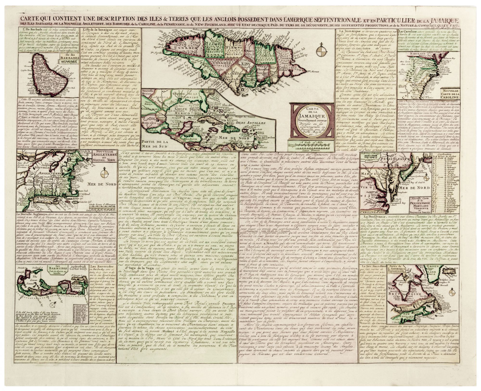
Carte Qui Contient Une Description Des Iles & Terres Que Les Anglois Possedent Dans L’Amerique Septentrionale, Et En Particulier De La Jamaique.
16 x 20 ½ inches. Fine hand color; reinforced at folds, else excellent. An attractive and interesting sheet from Chatelain's Atlas Historique depicting and describing British territorial claims in North America and the West Indies. New England, Virginnia, the Carolinas, Canada, Bermuda, and Barbados are all shown. A map of Jamaica takes pride of place front-and-center, with an inset map of the whole Caribbean. Each are accompanied by informative descriptions of the population, history, and produce of the territories depicted. The descriptions should not be taken as authoritative. For instance, the position of New England is described as being “situee au nord de Mariland & au sud de la virginie” (situated to the north of Maryland and south of Virginia.)
Sold