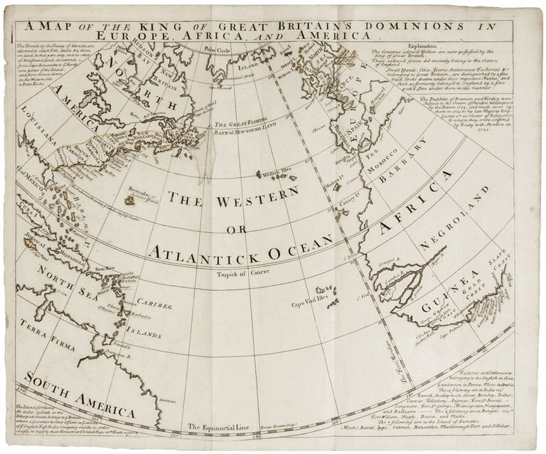
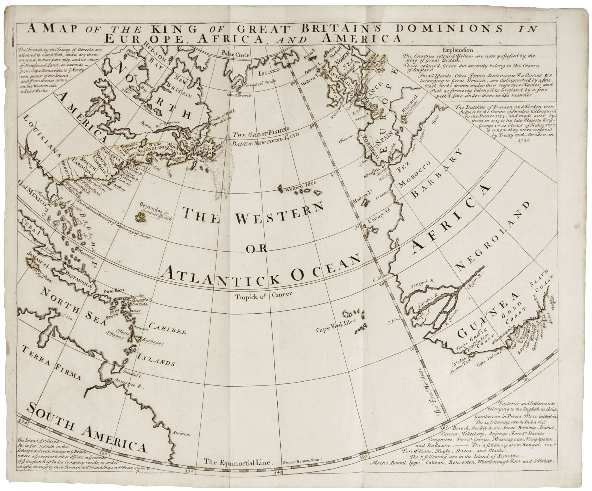
A Map of the King of Great Britain’s Dominions in Europe, Africa and America.
14 ½ x 17 ¼ inches, Original outline color; vertical folds, still fine condition. This scarce map of the coasts of the Atlantic Ocean north of the Equator displays the British colonial holdings, exclusive of those in India. The map attempts to reinforce British colonial claims in the region shown, and it further illustrates that Britain’s reach at the time fully embraced what has become known as the Triangular Trade, in which finished goods were sent from Europe to Africa; enslaved Africans were sent across the Atlantic to the American colonies; and finally, produce from the slave plantations was sent back to Europe. The map shows clearly the British presence at each corner of the trade. The map details the eastern coasts of North and South America, the West Indies, Great Britain, Spain and Portugal and part of France, Morocco and the western coast of Africa. In North America the map names Nova Scotia, New England, New York, Pennsylvania, Maryland, New Jersey, Virginia, North Carolina, South Carolina and Georgia (first recognized as a colony in 1733). In Africa, referred to as "Negroland," the Grain Coast, Gold Coast and Slave Coast are all denoted. English-held posts and forts are named and underlined; English territories are outlined in yellow. The text of the map explains the color code used on the map and summarizes the Treaty of Utrecht, which delineated the colonial relationships of France and Britain in North America. OCLC lists five institutional holdings, including the American Antiquarian Society, John Carter Brown Library, University of Chicago, Florida State Library and Wisconsin Historical Society.
The map is undated and has been assigned various dates of 1740 (American Antiquarian Society), 1752 (John Carter Brown), and even “1759-1763?” (Wisconsin Historical Society). The conservative coloring in North America, confining British territory to east of the Appalachians, certainly allows us to date it to before the 1763 Treaty of Paris. Despite the vertical folds and relatively thin paper of the map, we have found no record of it having been published in a book. Perhaps it accompanied a now very rare, as yet unknown pamphlet.