Untitled Woodcut Diagram….
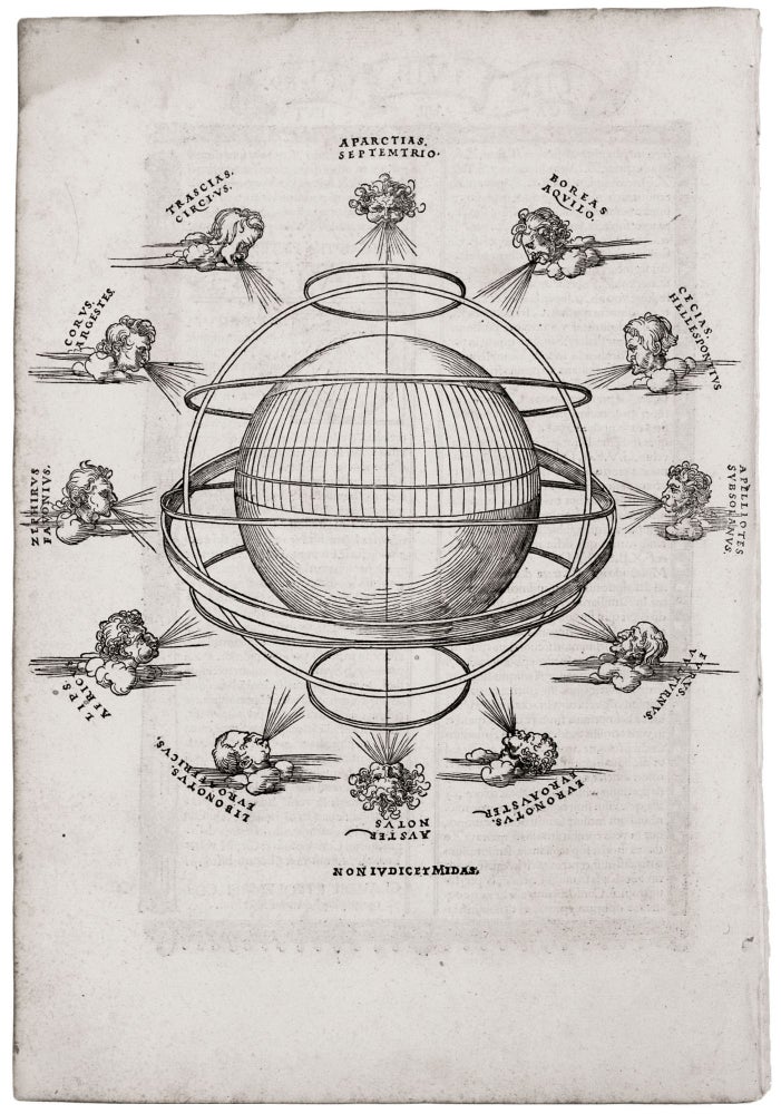
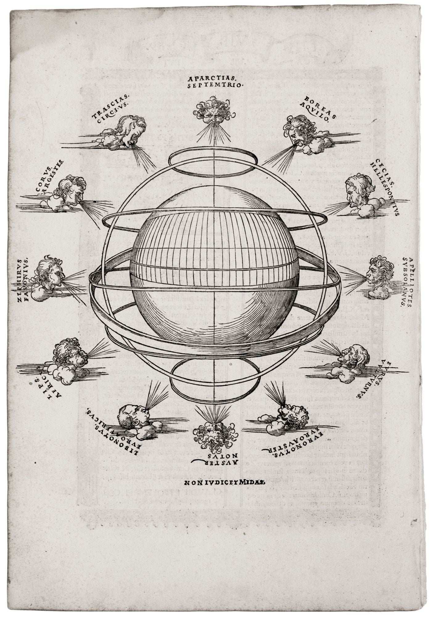
10 ½ x 10 ½ inches. Some marginal chipping, else excellent. This elegant woodcut diagram, surrounded by wind-heads, illustrates Ptolemy’s third projection – the most complex and precise of that geographer’s methods for illustrating the surface of the globe in two dimensions. This fine woodcut contextualizes the grid of the projection in relation to the rest of the world, which (though unexplored by Ptolemy’s Roman Empire) was understood to exist as a sphere. In addition to twelve named wind-heads, the diagram also includes the arctic and antarctic circles, the equator, the tropics of Capricorn and Cancer, and the ecliptic. Ptolemy, fl. AD 127-180, in essence, mapped the Roman Empire at its fullest territorial extent, which was reached under the Emperor Trajan, who reigned from 98-117 AD. Though his geographical work was lost to the West during the middle ages, its rediscovery in the 15th century provided the foundation for nearly all mathematical mapmaking of the 15th and 16th centuries.
Sold