
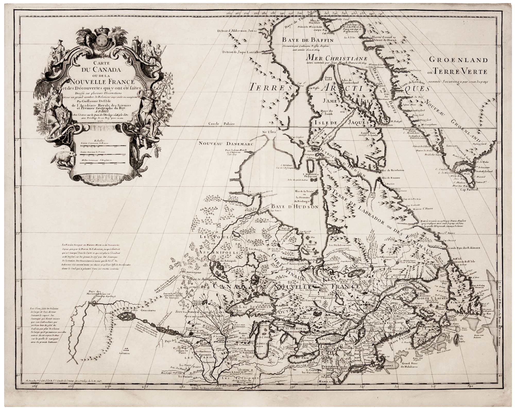
Carte Du Canada ou De La Nouvelle France . .
19 ½ x 25 ½ inches. Lower margin extended with virtually no loss, else excellent condition. Attractive example of “one of the most outstanding maps of either the seventeenth or eighteenth centuries.” (Kershaw) It provided the best delineation of its period of the Great Lakes and has been noted by Tooley as the first map to place Detroit "only two years after the founding of that village by Cadillac." An entertaining aspect of the map is the addition of the "Riviere Longue" and other features to the west based on the largely fictitious reports of Louis Armand de Lom d'Arce, Baron de Lahontan. Although Delisle depicts the river and indicates the point at which the Baron de Lahontan's journey is supposed to have ended and his secondhand reports from natives began, De l’Isle himself is skeptical: "…a moins que le dit Sr. de Lahonton n'ait invente tout ces choses ce quil est difficile de resoudre etant le seul qui a penetre dans cest vastes contrees" (Unless the Seigneur de Lahonton has invented all of these things, which is difficult to resolve, he being the only one who has penetrated this vast land.) The map includes a note referring to a large body of salt water to the west--"…sur la quelle ils navigant avec de grands bateaux"—a possible, early reference to the Great Salt Lake or a tantalizing hint of an easy passage to the Pacific.
* Schwartz/ Ehrenberg, pp. 136-7, pl. 80; Tooley, America, p. 20, entry 38,p. 315; Karpinski, p. 40.
Sold