Clark’s Own Account of the Lewis & Clark Expedition
With the Landmark Map
American West.
LEWIS, M. & CLARK, W./ LEWIS, S./ LONGMAN, ET AL.
[London, 1814]
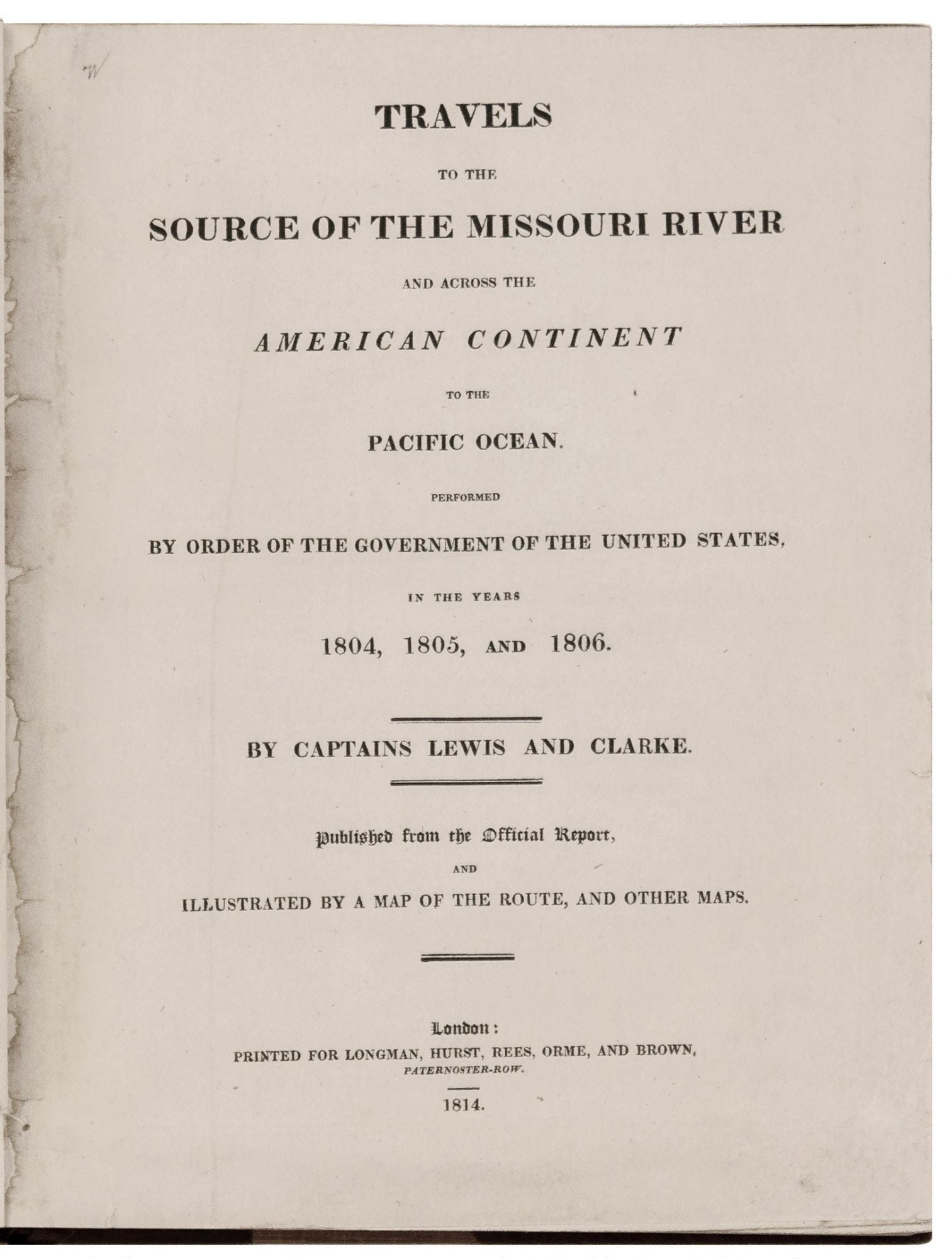
Travels to the Source of the Missouri River and across the American Continent to the Pacific Ocean performed by Order of the Government of the United States, in the years 1804, 1805, and 1806.
First. xxiv, 663pp. plus large folding map, threesingle-page maps, and one page of ads. Large, thick quarto. Modern three-quarter russet morocco gilt, gilt edges, excellent condition; occasional toned pages otherwise very bright and fine. Large folding map backed with cloth, few marginal mends and fold separations with no loss, excellent overall.
A handsomely bound, complete, first English edition of Lewis and Clark’s momentous expedition account, which signaled the opening of the American West. The American edition of this work, published in Philadelphia also in 1814, has become very rare and commands proportionate prices. Wheat (Map 317) points out that this English edition was a faithful rendition of the American “except for a few minor variations.” Described by Wagner-Camp as "the definitive account of the most important exploration of the North American continent," the book describes the expedition to explore the newly acquired Louisiana Purchase, undertaken from 1804 to 1806 by ascending the Missouri River to its source, crossing the Rocky Mountains, and reaching the Pacific Ocean. In total, the expedition covered some eight thousand miles in slightly more than twenty-eight months. It brought back the first reliable information about much of the area it traversed, made contact with the Indian inhabitants as a prelude to the expansion of the fur trade, and advanced by a quantum leap the geographical knowledge of the continent.
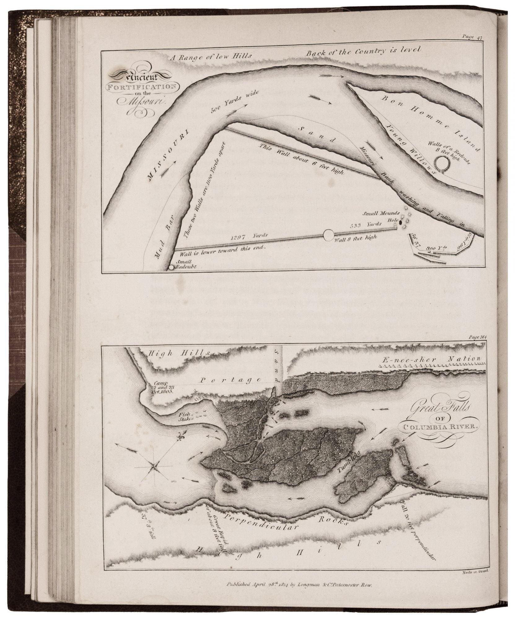
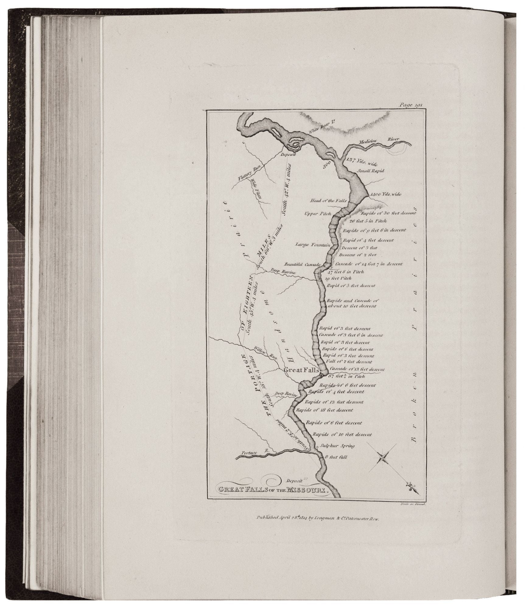
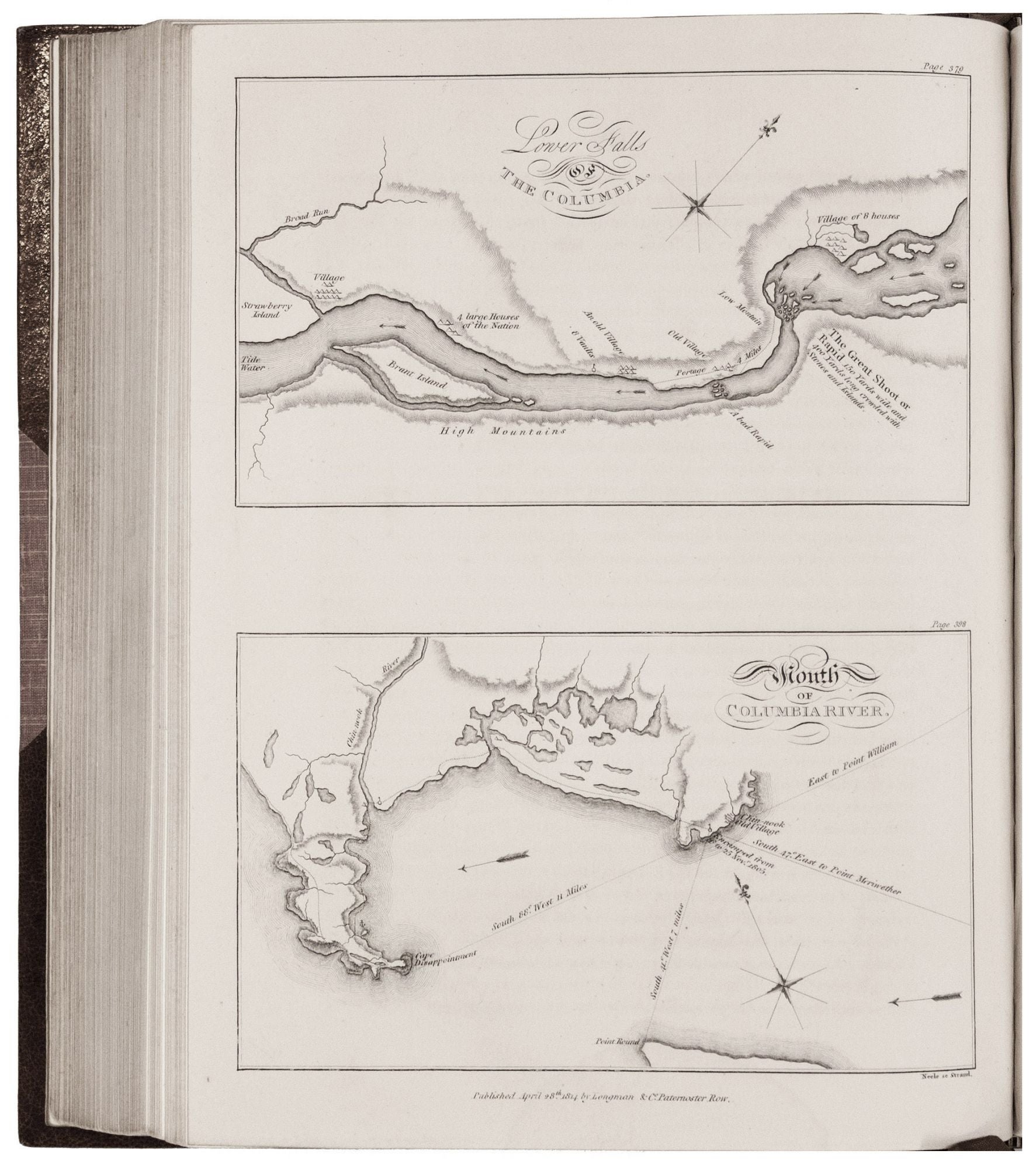
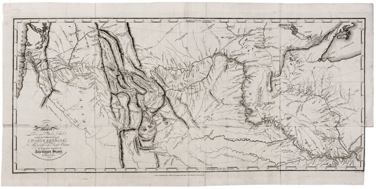
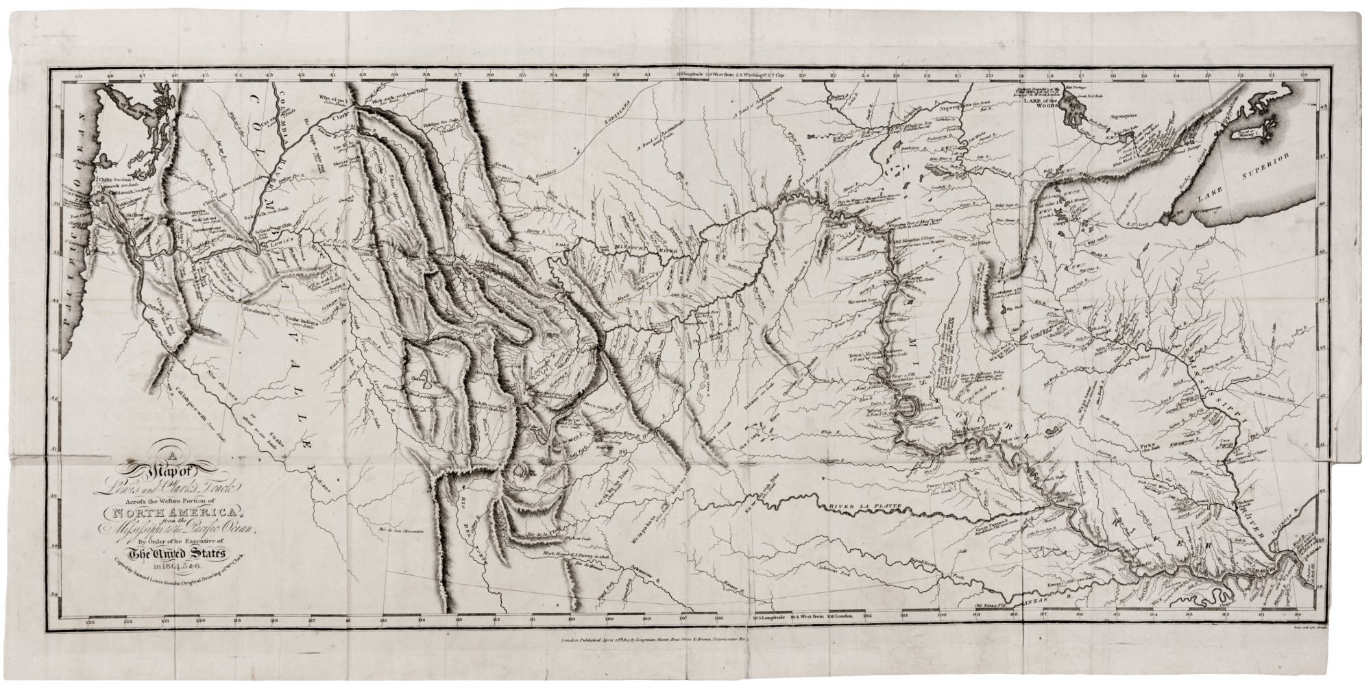
It would be difficult to overstate the contribution to geographic knowledge of this, the printed version of William Clark’s painstakingly compiled manuscript map of c. 1810 that is included here. Mentioning only a few of the map’s innovations immediately suggests its paradigm-shifting importance. For the very first time, the Rocky Mountains are seen as a complex series of distinct ranges rather than a monolithic single range. The Continental Divide is depicted for the first time as well as the drainage systems of all major rivers of the west. The possibility of a Northwest Passage across the continental United States was effectively put to rest by this map. The Cascades, the coastal mountain ranges, and the Pacific coast from the Puget Sound to the northern coast of California are all delineated with general accuracy for the first time on this map. And this just begins the litany of the map’s achievements. Wheat concludes in calling this “a map of towering significance [that] remained so for thirty years, until men had been through the area many times, and until the region had been mapped by many persons…[The] countless place names it gave to the face of America remain today as an ineradicable cultural heritage” (II, p. 59).
Because of the tragic death of Lewis on October 1811 (whether by murder or suicide has never been determined), the publication of the account was delayed until 1814, when the Philadelphia edition was issued. This London edition followed later that year, and it is in fact a much finer production than the American first edition.
* Wheat 317, cf. 316; Cf. Howes L 317; cf. Cohen, Mapping the West, pp. 94-96.
Sold