
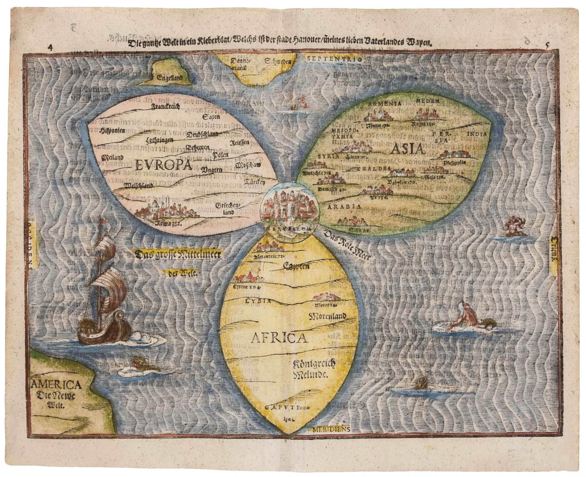
Die gantze Welt in ein Kleberblat / Welches in der Stadt Hannover / meines lieben Vaterlandes Wapen.
12 x 15 ¼ inches, Fine hand color; minor mend in centerfold, else excellent. One of the most distinctive, early cartographic curiosities: a woodcut, cloverleaf-shaped map of the world with Jerusalem at the center. The map echoes the style of medieval mappae mundi, with Jerusalem at its center and with each of the leaves of the trefoil representing the continents of Asia, Africa and Europe in the highly schematic fashion of the T-O map. It is the only map available to the collector today with this striking configuration. America occupies the lower left corner of the woodcut, and the Red Sea can be seen labeled in the notch between Africa and Asia. The map is also a celebration of the cartographer's native city of Hanover, whose trefoil arms provided the inspiration for its design. However, the map’s placement of Jerusalem at the center reflects that city’s pivotal role in Christian thinking toward the end of the 16th century and emphasizes the subject of the book in which the map was published, Itinerarium Sacrae, which was a study of the Holy Land. cf. Shirley 142; Nebenzahl, Maps of the Holy Land, pp. 88-9.
Sold