![Item #11038 A Chart Shewing Part of the Sea Coast of Newfoundland From the Bay of Bulls to little Placentia…Iohn Gundy Anno 1715. [with inset:] A Draught of the Harboour of Trepassey in Newfoundland. John/ MOUNT GAUDY, PAGE.](https://martayanlan.cdn.bibliopolis.com/pictures/11038.jpg?width=768&height=1000&fit=bounds&auto=webp&v=1536181292)
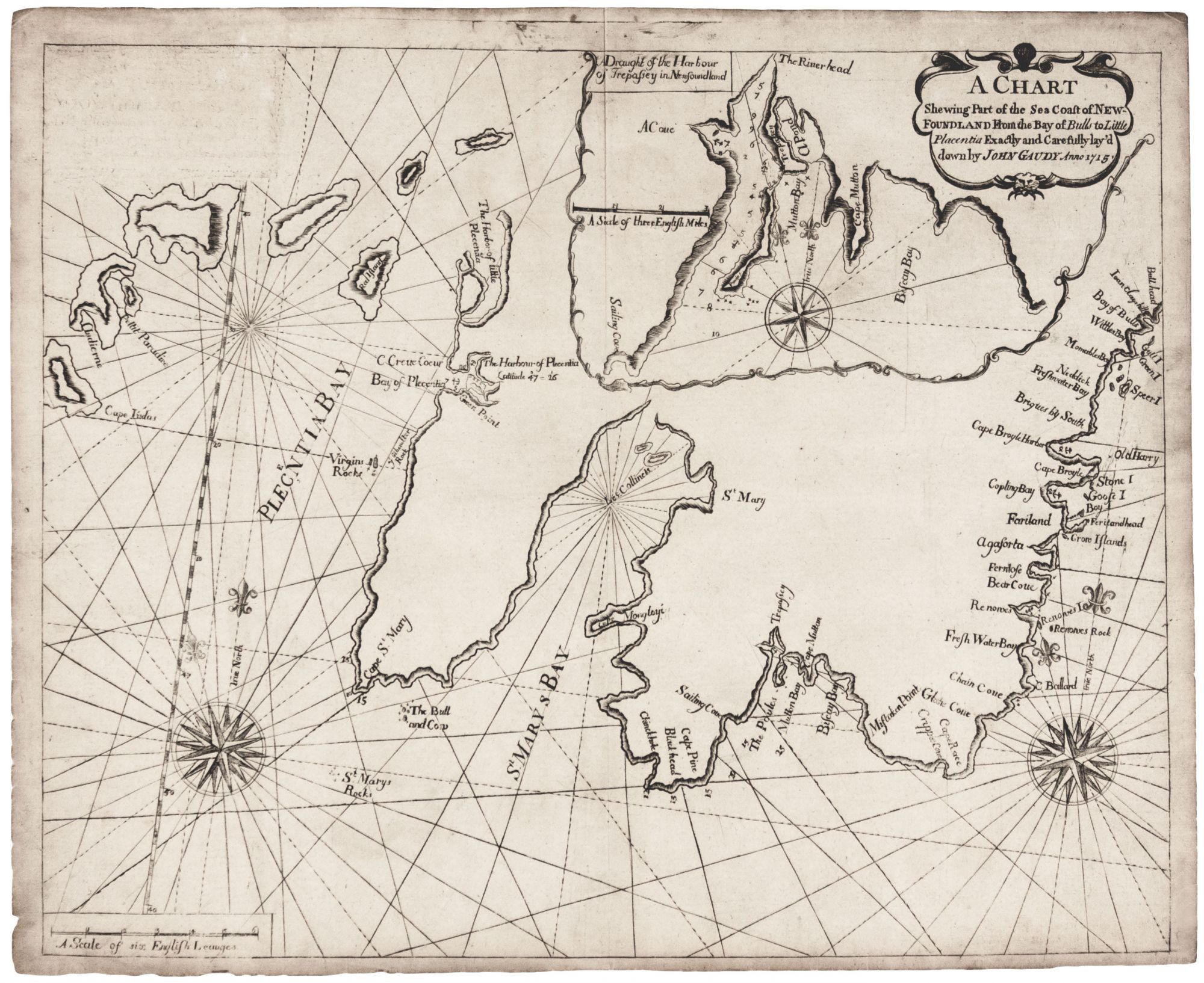
Avalon Peninsula/ Southeast Newfoundland/ Canada.
[London, 1721/ ?]
A Chart Shewing Part of the Sea Coast of Newfoundland From the Bay of Bulls to little Placentia…Iohn Gundy Anno 1715. [with inset:] A Draught of the Harboour of Trepassey in Newfoundland.
17 ½ x 21 ¾ inches, Lightly toned, else excellent with a strong impression. Judging by its dark printing impression, this was likely an early issue of this chart of harbors in the southeastern portion of Newfoundland, along the southern and some of the eastern portions of the Avalon Peninsula. Trepaassey Bay appears in a separate inset chart. The chart appeared in the most widely used English nautical atlas of the 18th century, The English Pilot. This durable chart appeared in editions of Book IV of the atlas from 1721 to 1778.
Sold
See all items in
Antique Maps
See all items by John/ MOUNT GAUDY, PAGE