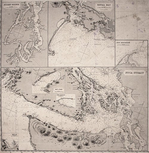
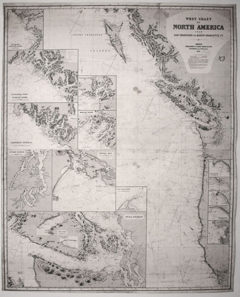
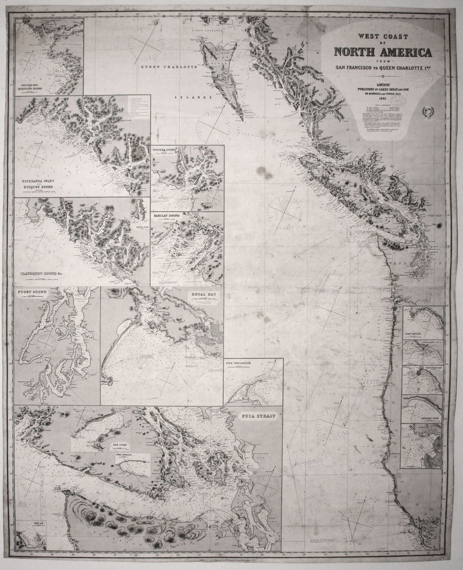
West Coast of North America from San Francisco to Queen Charlotte Ids.
51 x 40 3/4 inches, Courses marked in pencil & ink; 1882 date stamped below title; re-mounted on new, heavy blue paper with original trade label affixed, some staining & soiling but very good of this type. A superb, working nautical chart of the west coast from San Francisco Bay to just north of Queen Charlotte Island with outstanding detail for Puget Sound and Vancouver Island. The main chart is augmented with 16 inset details that include ones of Puget Sound, the Strait of Juan de Fuca, Nootka Sound, and Royal Bay in Victoria on Vancouver Island. James Imray (1803-1870) was London’s leading seller of fine nautical charts and sailing directions as well as navigational equipment. Imray himself directly managed the chart end of the business. Initially a bookseller and binder in Cheapside, Imray in 1836 joined with Michael Blachford, a sea chart publisher based in London. The partnership flourished and soon began to compete with the larger firm of Norie and Wilson. In 1846 Imray bought out Blachford, taking over as sole proprietor. Through various partnerships over the years, the company has survived to this day, now specializing in charts for yachting and fishing.
Sold