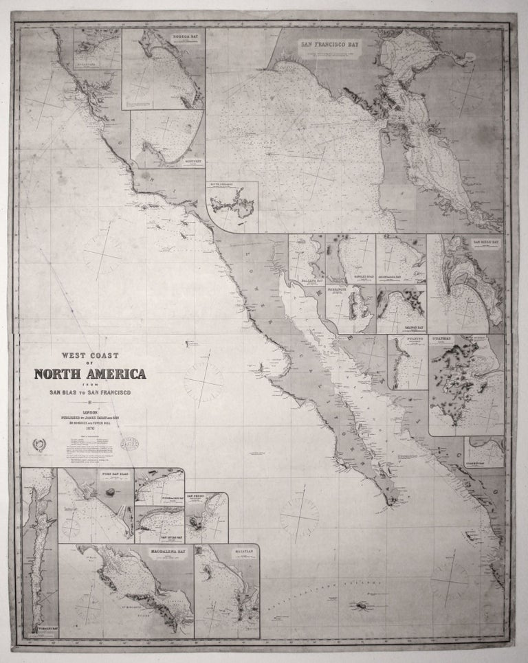
West Coast of North America from San Blas to San Francisco….
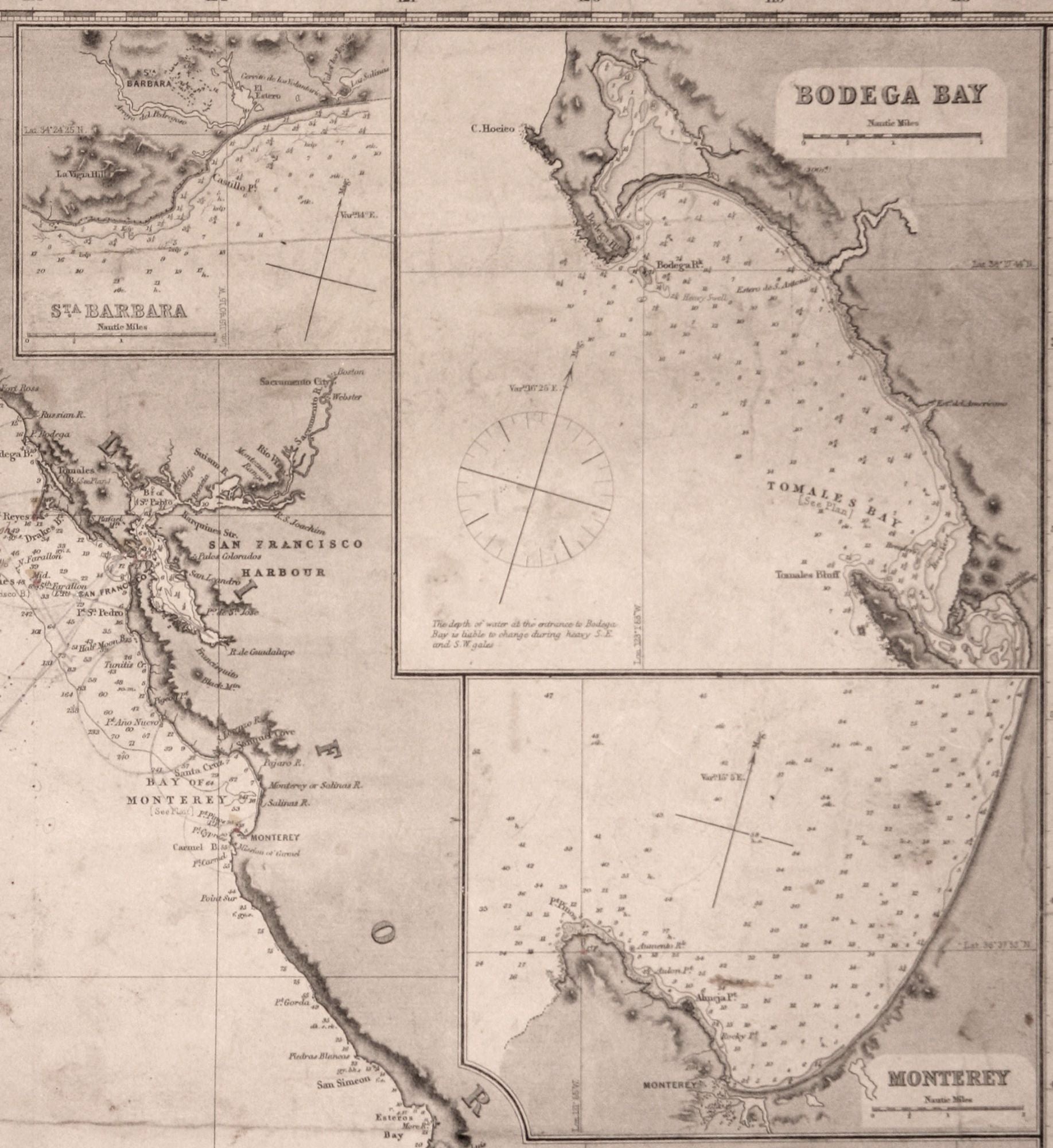
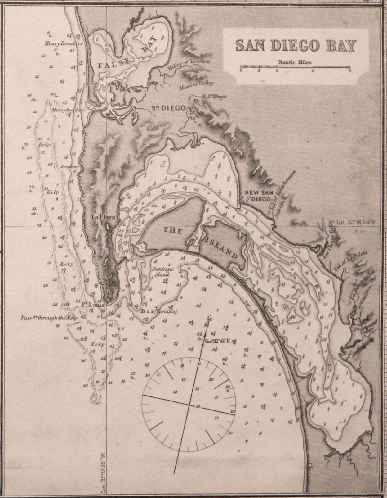
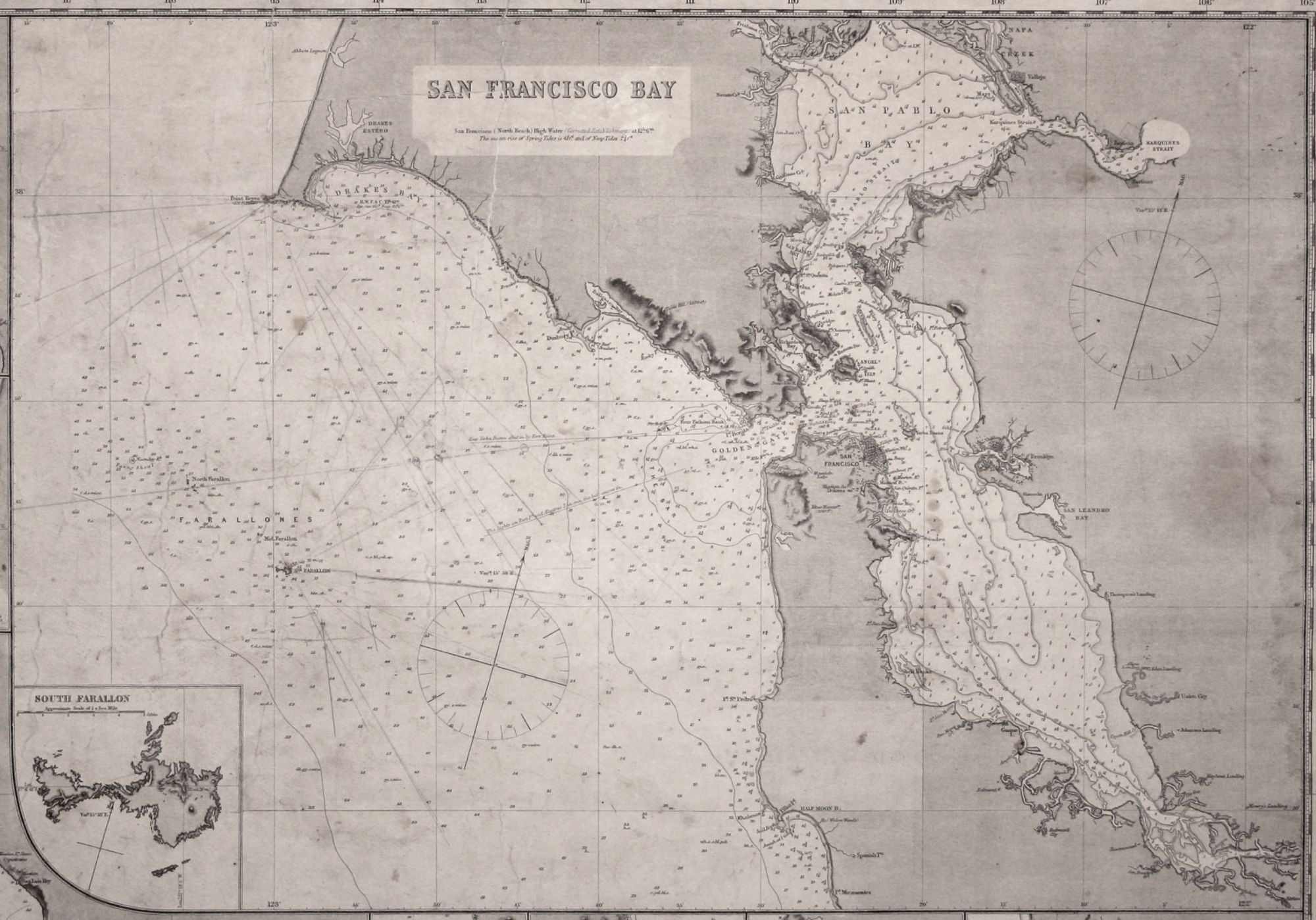
50 x 40 inches. Mounted on new, heavy, blue paper with original trade label affixed. One fairly long closed tear at top, minor staining, else very good. An excellent nautical chart covering the California coast from San Francisco to the southern tip of the Baja peninsula and including the adjoining coast of lower California and Mexico. Among the chart's 21 harbor insets are ones of Santa Barbara, Monterey, San Diego and a very large one of San Francisco. The numerous courses marked on the chart in pencil and ink suggest it had been much used aboard ship. Several of these are in the San Francisco area and one in the Pacific is marked "Tacoma for Valparaiso" and is dated 1885. James Imray (1803-1870) was London’s leading seller of fine nautical charts and sailing directions as well as navigational equipment. Imray himself directly managed the chart end of the business. Initially a bookseller and binder in Cheapside, Imray in 1836 joined with Michael Blachford, a sea chart publisher based in London. The partnership flourished and soon began to compete with the larger firm of Norie and Wilson. In 1846 Imray bought out Blachford, taking over as sole proprietor. Through various partnerships over the years, the company has survived to this day, now specializing in charts for yachting and fishing.
Sold