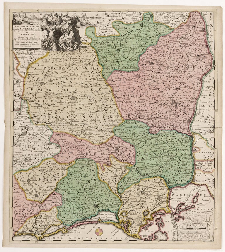
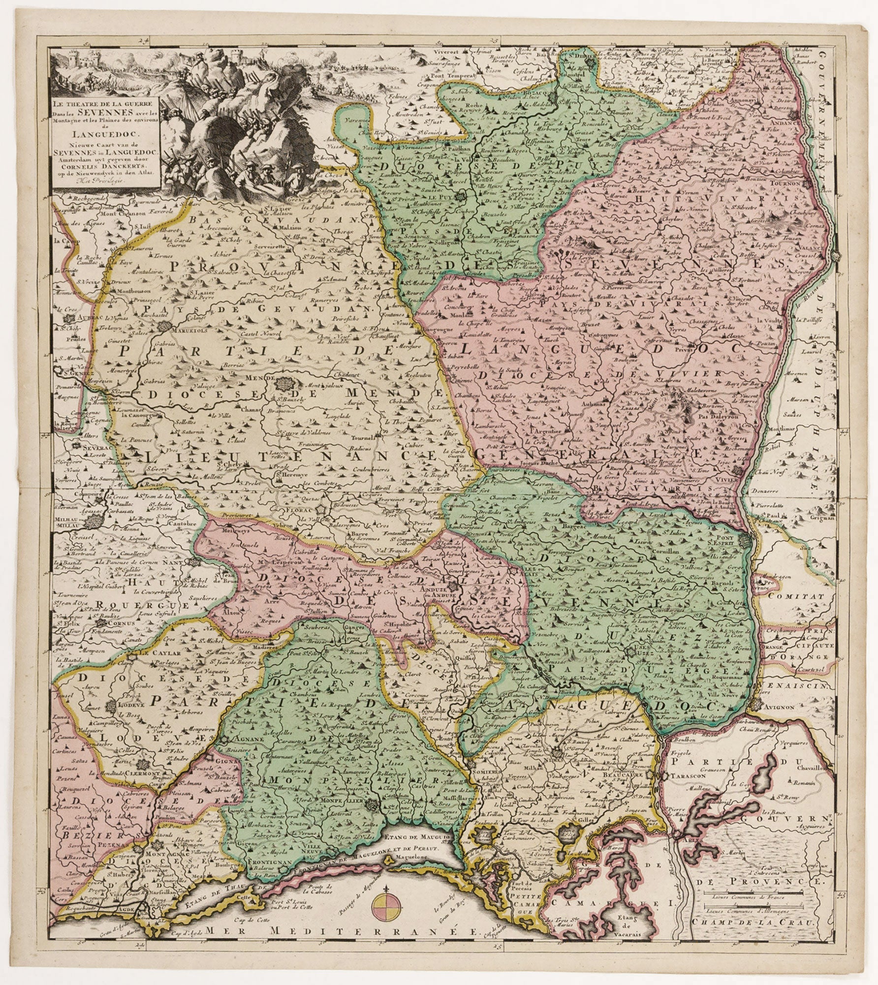
Le Theatre de la Guerre Dans les Sevennes avec les Montagne et les Plaines des environs de Languedoc.
22 ½ x 19 ½ inches. Fine original color; fine condition. A beautifully engraved and colored map of the Cévennes region during the Camisards’ revolt. This was arguably the world’s first guerilla war. Between 1702 and 1704, approximately three thousand Protestant partisans – the Camisards – kept at bay ten times their number of Catholic troops loyal to Louis XIV. Though France had maintained official tolerance for Protestantism since the Edict of Nantes in 1598, Louis XIV’s revocation of the Edict in 1685 brought on a period of repression, destruction and exile of France’s protestant population. In the early 18th century, the heavily Protestant Cévennes region (on which this map focuses) became the heart of resistance. Although the hottest part of the war was over by 1704, fighting continued until 1710 and a final peace was not brokered until 1715. In addition to the Cévennes mountains, the map shows part of the Languedoc region in the south of France. Montpelier, Nimes and Avignon all appear on the map. The finely-engraved cartouche depicts, sheltered in rocky mountain crevasses, the Camisards, named after the linen smocks the peasant guerillas wore instead of uniforms (the original “black pajamas.”)
Sold