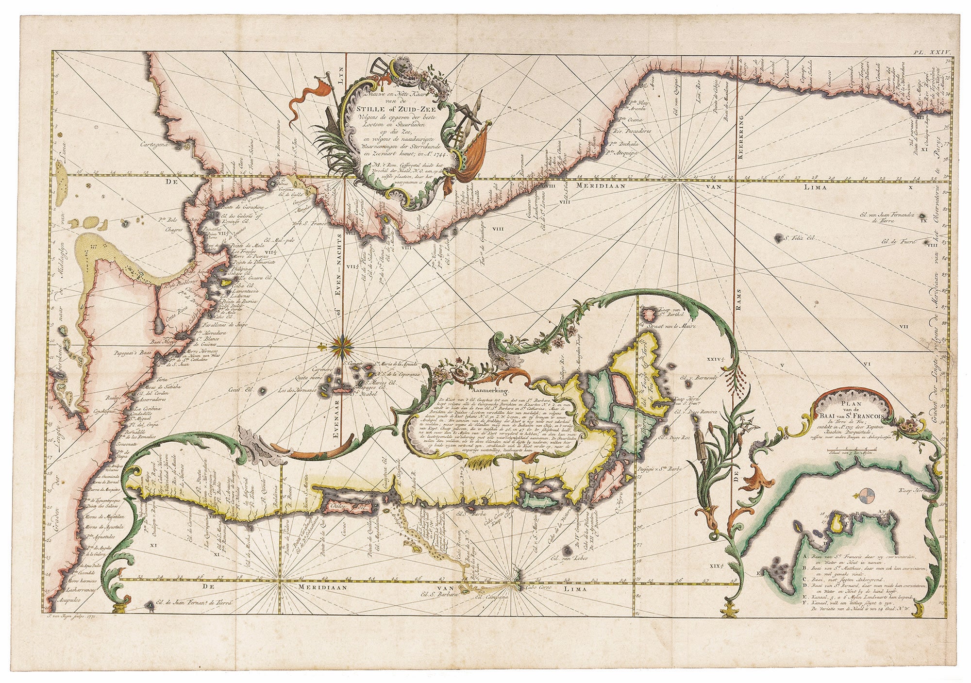
Nieuwe en Netter Kaart van de Stille of Zuid-Zee….
13 x 21 inches, Fine hand color; right margin reinforced, mended worming at right with slight loss; very good. This very rare, little known map of Central America, the Pacific coast of South America, and Patagonia is among the most elegantly engraved we have seen. In the work's intricate format, the primary map is the Pacific coast of South America and of Central America, laid across the top in an eastern orientation. The large, elaborately bordered inset along the bottom is of the Chilean coast and Patagonia. The smaller inset at lower right has a detail of what is here called the "Baai van St. Francois," a wide, deep inlet near Cape Horn at southern extreme of Patagonia. There is every indication that this map appeared in a rare atlas by the Dutch geographer and astronomer, W. A. Bachiene, Atlas toto opheldering… Maastricht, 1785. Like the other maps in atlas, this one is signed and dated (1771 here) by the talented engraver Jan van Jagen. Strangely, however, neither the Phillips copy nor the copy of this atlas cited by Koeman have this map. In both cases, the American section of the atlas ends with plate XXIII; this map is marked plate XXIV. It is probable this map was added to later issues of the atlas, which would account for its rarity. Also, Shirley, see below, says that Bachiene modelled his maps after those in Bowen's 1747 Complete System of Geography; yet we find no map by Bowen that resembles this one. Cf. Phillips, Atlases 657; Koeman Bac 2A; Shirley, British Library Atlases T.BACH-3a.
Sold