Persia.
[Basel, 1552]
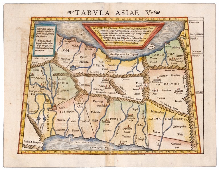
Tabula Asiae V:.
10 ½ x 13 ½ inches, Fine hand color; a few centerfold mends, very good. An attractive woodcut map of what is now Iran and Iraq, from Sebastian Munster’s modernized edition of Ptolemy’s Geographia. Consequently, this map shows the placenames of this region that would have been in use during the 2nd century.
Sold
See all items in
Antique Maps
See all items by S./ PTOLEMY MUNSTER, C.