Distance Maps. Map of the Atlantic States….
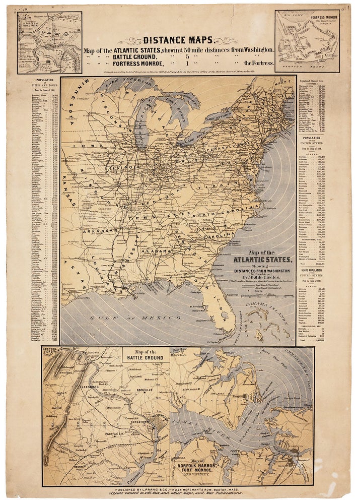
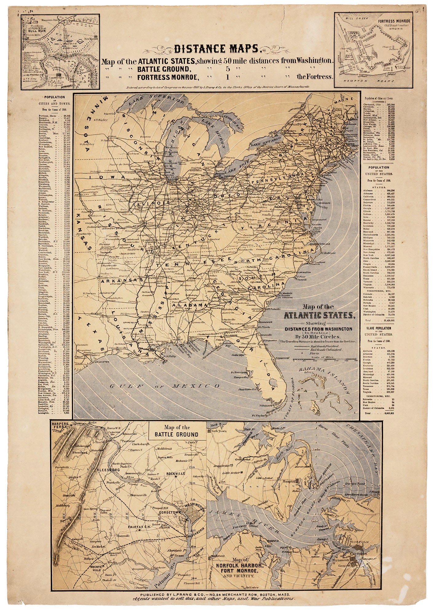
22 ½ x 14 ½ inches, Three-stone lithograph. Lightly toned, a few mended edge splits, else excellent. This rare broadside was one of the earliest maps designed to provide the public with a geographic orientation to the Civil War, focusing on the Washington, D.C and Virginia areas. The Boston-based Prang firm became a leading supplier of such maps throughout the war. Tellingly, along the bottom is the following solicitation--"Agents wanted to sell this, and other Maps, and War Publications"--presumably in anticipation of a great demand for war-related maps. Notably, one of the work's inset maps--at upper left--provided a very early depiction of the alignment of forces at the First Battle of Bull Run, fought on July 21, 1861. The large, primary map, displaying the eastern United States, indicates by means of concentric circles distances from Washington, D. C. in 50-mile increments. It also highlights rail lines. At lower left, the "Map of the Battle Ground," shows the general area in which the Battle of Bull Run was fought. The map lower right inset details Norfolk Harbor, Hampton Roads and the mouth of the James River. The inset at top right depicts Fort Monroe and the major buildings within its walls. Tables along the sides note the populations of cities, towns, states and territories as well as the slave populations of states and territories, with the latter totaling just shy of four million. One way that the resourceful Prang promoted his maps was to sell them at newsstands or as a premium for newspaper subscribers and include with them red and blue pencils to plot the progress of the opposing forces. Treating the war as something of diversion in this manner reflects the early date of this map; no doubt, such an attitude must have worn thin as the years passed, and the suffering seemed interminable. Due to their ephemeral nature, these maps are quite rare today especially in good condition. Records show only one other example of this one appearing on the market in the last 30 years.
Sold