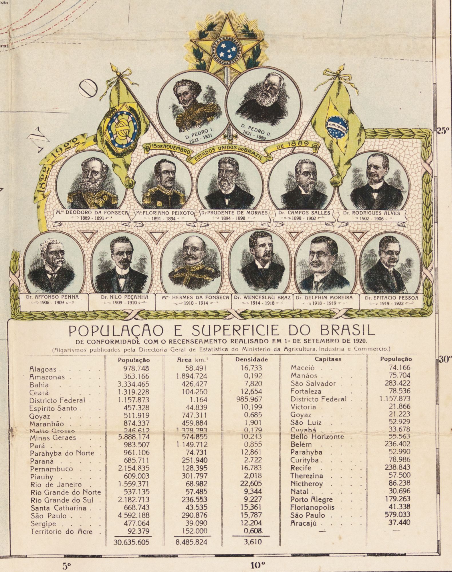
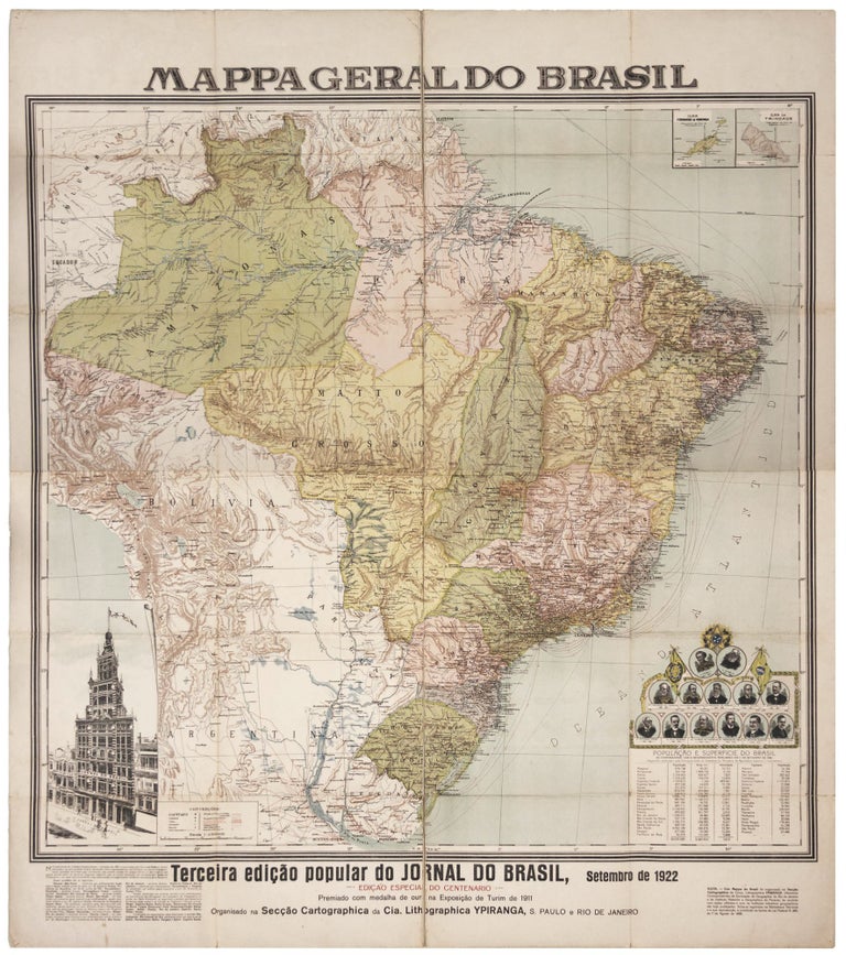
Mappa Geral do Brasil./ Terceira Edicao Popular Do Jornal Do Brasil, Setembero De 1922. Edicao Especial Do Centenario.
44 x 26 inches, Color offset print. Folding map consisting of two large sheets mounted on linen. Very slight fold wear, else excellent. Separately published. Rare, elegantly printed, vibrant map of Brazil commissioned by the Jornal do Brasil, a leading daily newspaper (which it still is), to commemorate the centenary of its independence. The map was published in São Paulo by the cartography division of Companiha Litographica Ypiranga, a popular printer of books and ephemera. Each of Brazil's 22 primary political divisions (20 states, 1 territory, and 1 Federal District) are highlighted in their own bright colors. Also, they are delineated with their new boundaries according to the 1921 Brazilian Conference on Interstate Boundaries (as explained in the text, lower-left corner). At lower right are portraits of the country's rulers from its founding (two emperors and 11 presidents), and at lower left is a large vignette of the sponsoring newspaper's building. The table at lower left has symbols representing the various sizes of major cities and towns (including state capitals); the locations of lighthouses; the delineation of overland and submarine telegraph lines and radio telegraph stations; the routes of railway lines; as well as oceanic and inland shipping routes. The statistical table at lower right details the populations, land areas, population densities, and capital cities (with their populations) of each Brazilian state, all according to the 1920 census. The present, special Centennial Edition of the map, the third, was by far the most visually impressive of the editions. It was first published in 1911 by the firm of Hartmann-Reichenbach. Due to their ephemeral nature, all editions of the map are very rare today. The present 1922 Centennial Edition seems to be especially so; we can trace only a couple of other examples. Revista do Instituto Geografico e Histórico da Bahia, no. 48 (1923), p. 519.
Sold