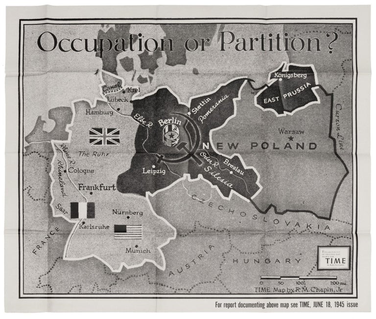
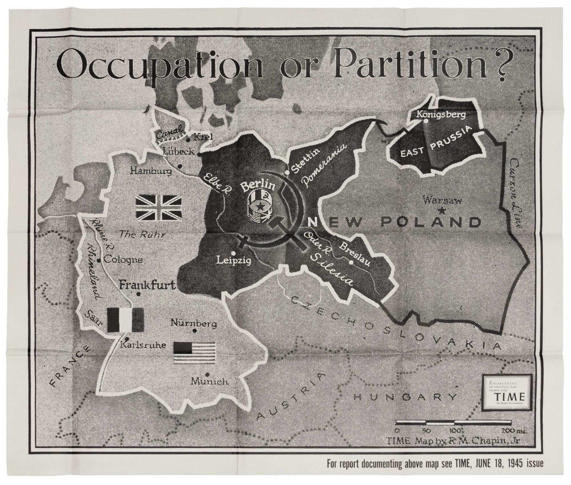
Occupation or Partition?
33 x 38 ½ inches, Offset print in black and white. Fine condition. This very scarce, dramatically designed poster map is a rare illustration of the brief period when Berlin was entirely occupied by Soviet forces. Berlin finally fell to the Soviets a little over a month before (May 2, 1945) this work was published. Even though the London Protocol of 1944 stipulated the city would be partitioned among Russia and three allied powers, the American and British sectors were not handed over to them until July of 1945. In the brief interim, the Soviets confiscated per agreement as much of West Berlin's industry and infrastructure as they could. The question mark following the poster's title seems to suggest doubt as to whether the partition agreement would be honored. The poster is an enlarged version of a map that originally appeared in the June 18, 1945 issue of Time Magazine. It is apparently rare in this large format: we found neither OCLC listings nor map market records for it. Chapin, who was with Time from 1933 to 1970, was a pioneer in the use of maps in magazine illustration. "American cartographer Robert M. Chapin Jr. revolutionized journalistic cartography with his innovative technique of adding visual information to the maps… 'I try to dramatize the news of the week, [Chapin has said] not just produce a reference map like those in an atlas'…Chapin’s journalistic cartography became world renowned because of the rigorous geographical details of his maps, and it was (and still is) regularly used as reference material by the American National Library, NASA, the Army andthe Navy, as well as by foreign governments, American and international schools and history book publishers." Elson, R. T. TIME: The Illustrated History of the World's Most Influential Magazine (Beaux Arts Editions).
Sold