Sardinia/ Sicily/ Malta..
[Basel, 1552]
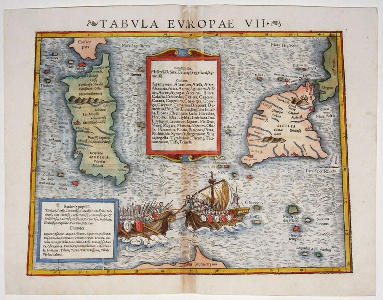
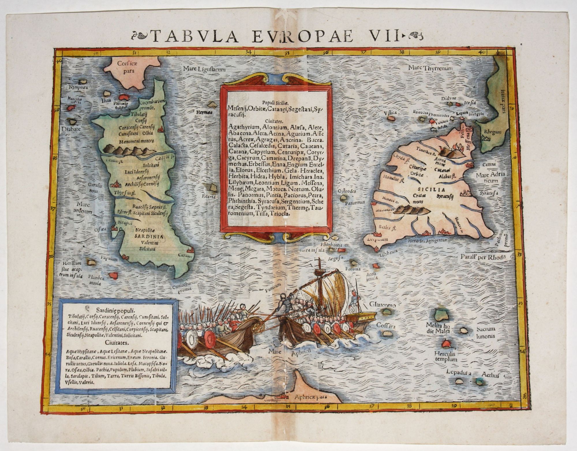
Tabula Europae VII.
10 ½ x 13 ½ inches. Fine hand color; centerfold reinforcement with minor loss, else very good condition. An attractive woodcut map focusing on Sardinia and Sicily, depicting these areas as they were known in the second century A. D., with place names appropriate to that period. Two galleys fully laden with soldiers are about to engage in battle in the vignette at bottom center. Given the map's period of depiction, the clashing forces were likely Roman and Alexandrian. The framed blocks of text supplement the maps by listing the names of tribes and cities on the two primary islands.
Sold
See all items in
Antique Maps
See all items by S./ PTOLEMY MUNSTER, C.