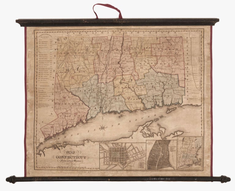
Map of Connecticut from actual Survey….
19 x 22 inches. Copperplate engraving with hand coloring. Original wash color, refreshed; expertly conserved & re-mounted on archival linen, with original wooden rollers; usual age toning & cracking, but stable, very good. Scarce, early edition—the second according to Thompson—of this then very up-to-date map of Connecticut; it was also printed from one of the most oft-used plates of a 19th century American map. As Thompson explains in the note for item 78, fully five different publishers, to as late as 1858, used the plate from which this map was printed. Successive editions added towns as they were incorporated as well as other details. This edition, for example, added the then recently incorporated towns of Prospect (1827), Avon (1830) and North Branford (1831). Most later editions were issued as pocket maps and are not as rare on the market as the first two. This edition was clearly issued as a small wall map, which is one factor explaining its rarity. Along the bottom are plans of New Haven and Hartford and a map of New England. At right is a profile of the Farmington Canal. The state's governors are chronologically listed at left. As Thompson notes, the date appears in small numbers at center below the map.
* Thompson, Maps of Connecticut, no 85.
Sold