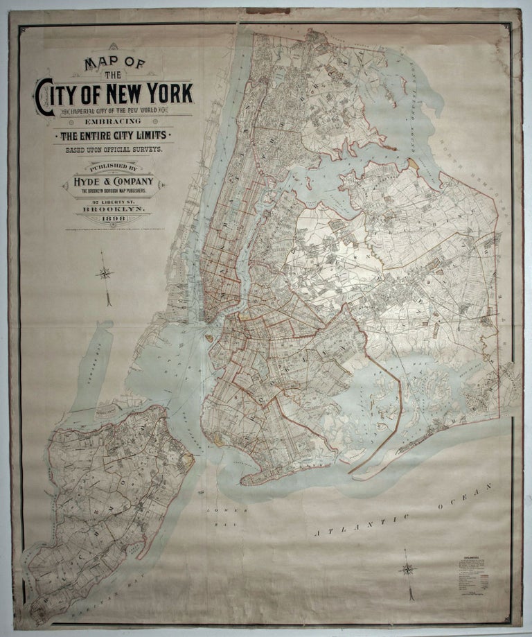
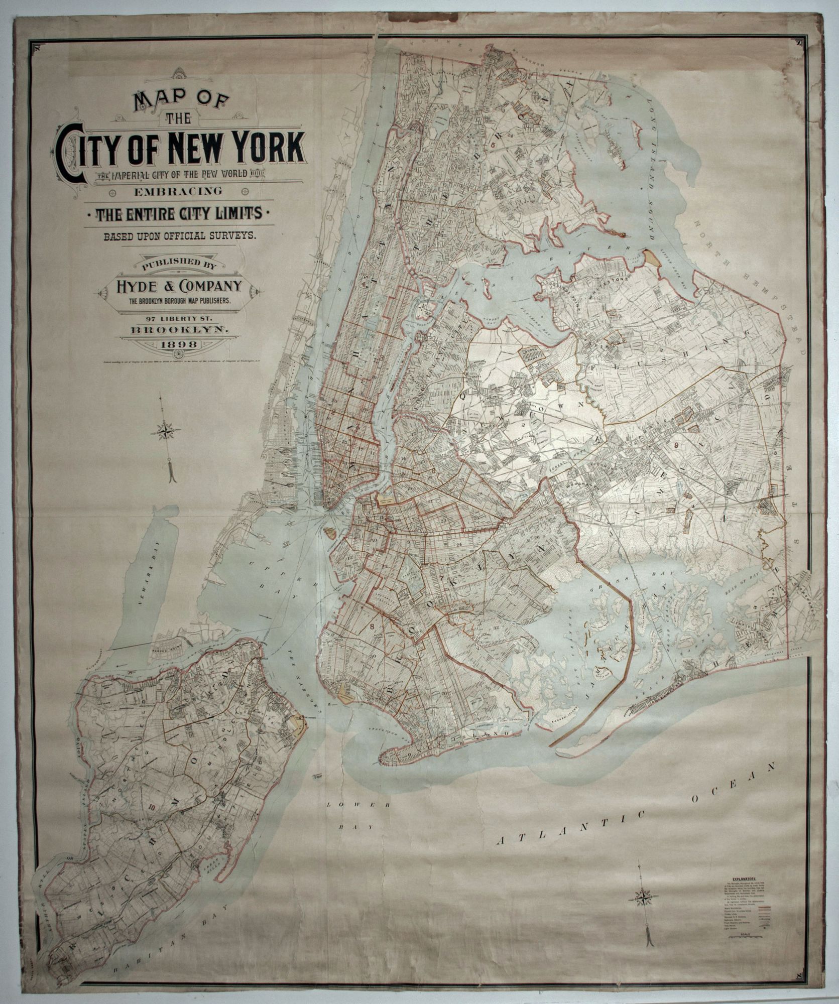
Map of the City of New York, the Imperial City of the New World, embracing the entire city limits. Based upon official surveys….
Four joined sheets, mounted on linen as issued, together 67 x 81 ¼ inches. Lithograph with bright period color; occasional abrasion, light water staining at top right; soiling toward bottom, a few closed splits in margins, else a bright, excellent example, especially for its size. This very rare wall map is the earliest we are aware of to display New York City as presently constituted, the result of the consolidation of the five boroughs on January 1, 1898. The map's title trumpets the creation of what is termed "the Imperial City of the New World." Also, this richly detailed work, based as stated in the title on official surveys, was the nearest at the time to an official map of the newly expanded city. Louis Risse's mammoth plan that also celebrated the creation of Greater New York City did not appear until 1900. We have found only a single market record for the Hyde plan, that being a copy in atlas form, and only four examples of it were located in institutional collections, three in atlas form (NYPL, Princeton, Queens Borough Public Library) and one as a wall map as here (President's Office of the Borough of New York). The map was published in Brooklyn by Hyde and Co., later the Hyde Map Company, which fashioned themselves as stated in the map's title as, "The Brooklyn Borough Map Publishers." The company produced both maps and atlases, primarily of Brooklyn, Queens and Long Island, that were mainly large-scale, highly detailed works for the use of the insurance industry. And while this map was evidently not for this purpose, it clearly embodies the level of detail the company was noted for. Included we can find trolley and both elevated and stream train lines, topography especially wetlands, and the names of property owners in the city's undeveloped sections. Haskell, D. C. Manhattan in Maps, no. 1530; not in Stokes; cf. Augustyn/ Cohen, Manhattan in Maps, pp. 130-133.
Price: $9,500.00