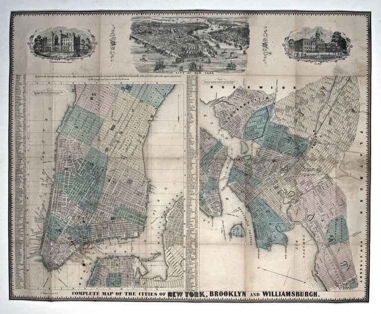
Complete Map of the Cities of New York, Brooklyn and Williamsburgh.
18 x 22 ¼ inches. Lithograph with original color; reinforced with rice paper; wear at folds with minor loss, very good condition. Archivally framed. Attractive, separate maps New York City and Brooklyn, from a period when both as well as Williamsburg were still independent cities. At the top center is a birds-eye view of the entire city showing its harbor teeming with sailing ships and steamers. New York University, then just over twenty years old, appears in the upper left corner. City Hall, with citizens strolling in the park before it, is shown to the right. Streets on the maps are clearly delineated and easily found using a coordinate-based key. The northernmost extent of the Manhattan map is 51st Street, but the shading indicates that points north of 14th street were still scarcely more than countryside at the time. Two columns listing streets are keyed to the maps.
* Haskell 962.
Sold