
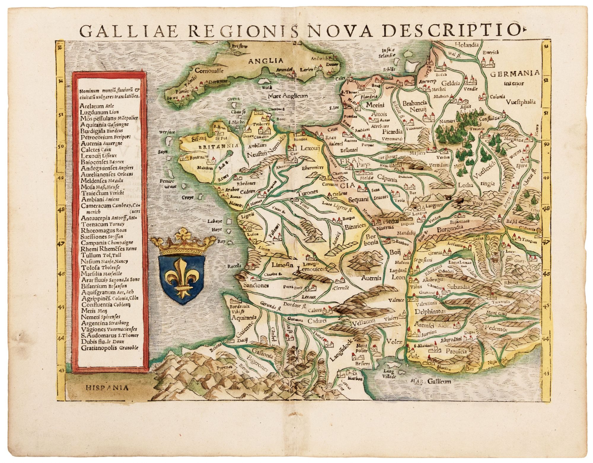
France.
[Basel, 1559]
Galliae Regionis Nova Descriptio.
10 ¼ x 13 ½ inches, Fine hand color; excellent. One of the earliest printed modern maps of France, in an attractive example from Munster’s Cosmographia – for more than fifty years the best reference for the literate layperson wishing to learn about the rest of the world. While Munster’s general topography for the region is derived largely from the 1486 Ulm and the 1513 Waldseemuller editions of Ptolemy, the place names are modern rather than ancient.
Sold
See all items in
Antique Maps
See all items by S. MUNSTER