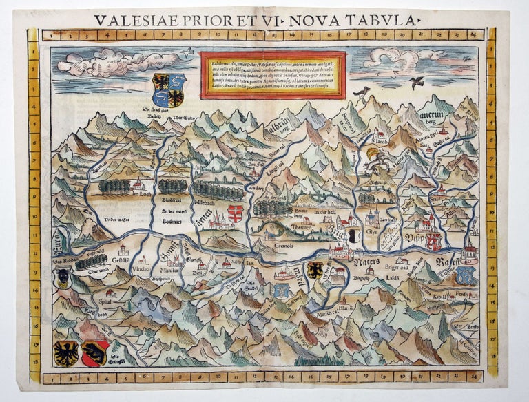
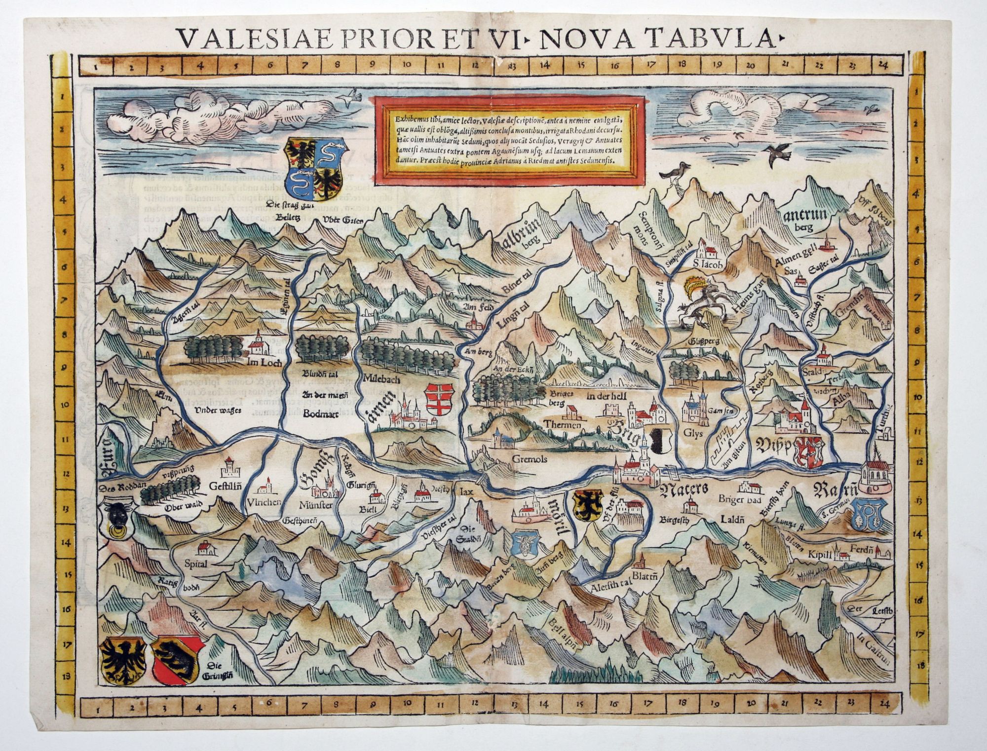
Valais/ Swiss Alps.
[Basel, 1552]
Valesiae Prior Et VI Nova Tabula.
11 ½ x 14 ¾ inches. Fine hand color; centerfold reinforced with some mended wormholes, very good. This beautiful map, vividly evoking the mountains of the Swiss Alps, is the earliest printed modern map of Upper Valais, the part of the Alps surrounding the headwaters of the Rhone river. The destination village of Saas-Fee is shown (Sas on the map). The map is oriented to the south. From the rare 1552 Geographia edition, the only one to feature coordinate bars provided at top and bottom of the maps.
Sold
See all items by S. MUNSTER