Balkans/ Bulgaria/ Romania/ Turkey/ Greece..
[Basel, 1552]
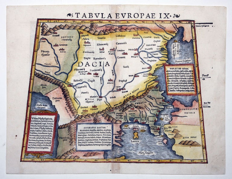
Tabula Europae IX.
10 ½ x 13 ¼ inches. Fine hand color; excellent.
A map focusing on the historical area called “Dacia,” a large region of central-east Europe, to the north of Greece, now primarily occupied by Bulgaria and Romania. This map’s geography dates from the second century A. D., and in fact it was not until this period that Dacia was finally conquered by the Roman Empire under Trajan. Also on the map are northern Greece, the upper Aegean, the Dardanelles, and Constantinople. The map is based on data left by the Alexandrian geographer and astronomer, Claudius Ptolemy, who mapped the known world of the Roman Empire at its approximate high water mark.
Sold
See all items in
Antique Maps
See all items by S./ PTOLEMY MUNSTER, C.