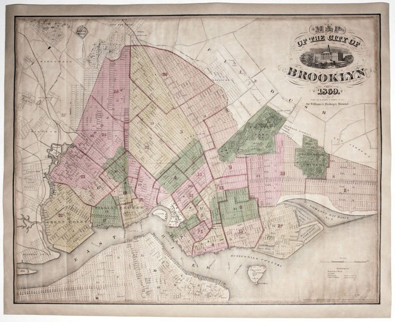
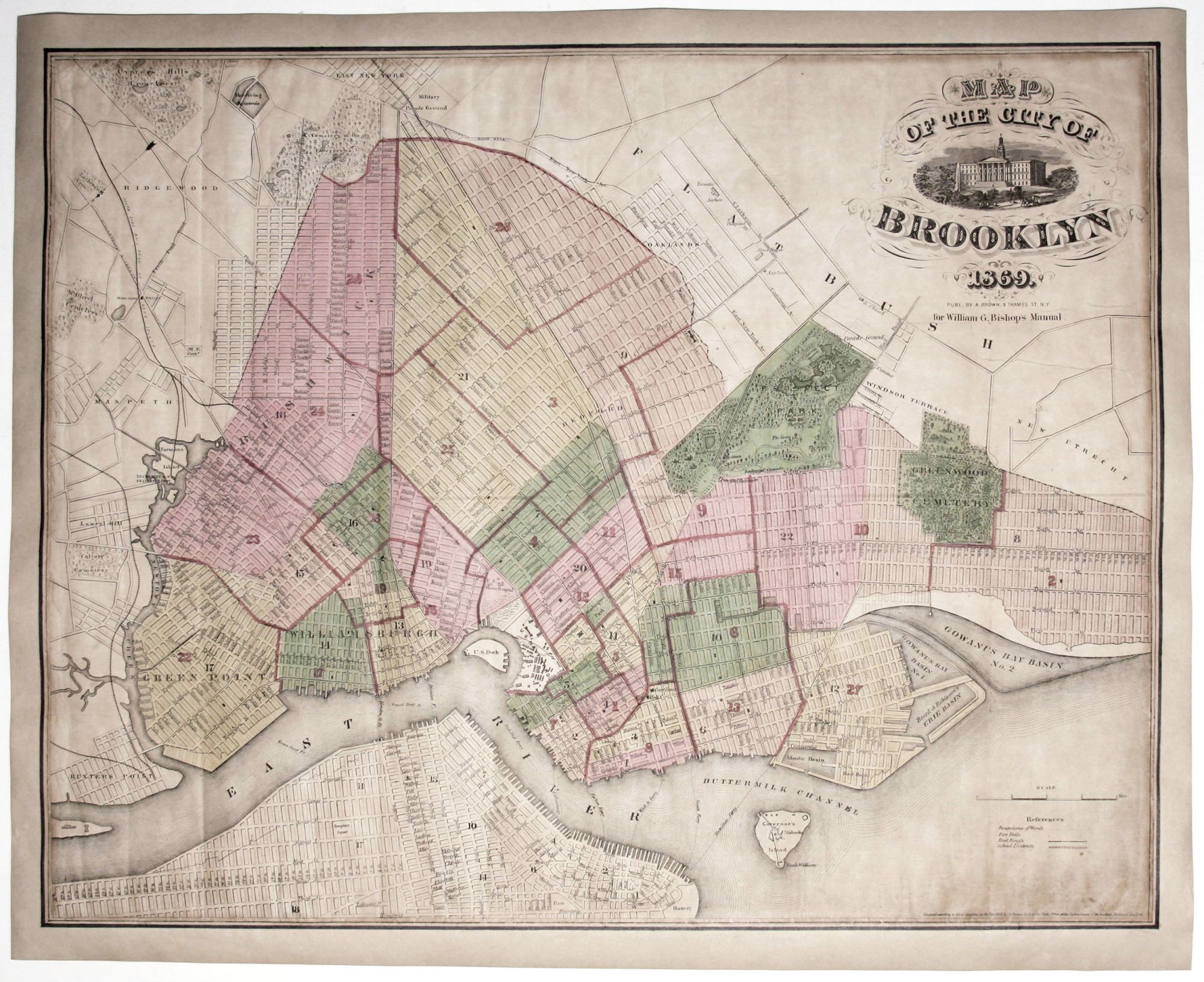
Map Of The City Of Brooklyn 1869.
17 ¾ x 22 ½ inches. Lithograph with hand color; lightly toned, ex-folding map here expertly mounted on rice paper with margins extended, outer border largely reinstated by hand, still very good overall. A vibrantly colored example of one of the most attractive 19th century maps of Brooklyn, and that is very scarce on the market. Brooklyn is here displayed as the major city it rapidly became in the second half of the 19th century. It was incorporated with the consolidation in 1855 of Brooklyn, Greenpoint, Bushwick and Williamsburg. It was around this time that the term 'Kings County' began to fall out of popular usage in favor of "Brooklyn" for the newly created city. By 1865, four years before this map was printed, Brooklyn had become the third largest city in the United States, following New York and Philadelphia. Unlike New York City with its uniform grid imposed on most of Manhattan, Brooklyn can be seen here as a city of many, disparate grids, reflecting its creation from several independent communities. Prospect Park, then as now a dominant feature on the map, was completed just two years prior to this map's publication, making this one first maps to show Olmstead's other masterpiece. The map identifies important buildings, bridges, train lines, and 'plank roads.' Also noted are public buildings and lands such as the Lunatic Asylum, the Hospital, the Alms House (these former at the outer edge of the city), the Military Parade Grounds, the Marine Hospital and the Navy Yard. Also shown are the many ferries connecting Brooklyn with lower Manhattan seen at lower left. This map was published by A. Brown of 9 Thames Street, New York, for inclusion in William G. Bishops Manual of the City and Corporation of Brooklyn. The imprint states it was copyrighted in 1861, which was when it first appeared. William Bishop (fl. c. 1855 - 1877) was intermittently the city clerk of Brooklyn from about 1860 to the early 1870s. One of the duties of the city clerk was to publish an annual report detailing the government, progress, urban planning and development of the city. The resulting Manual of the Common Council of the City of Brooklyn was published each year of Bishop's tenure as city clerk. The first Brooklyn manual was published in 1855 following the consolidation of the city and was subsequently published under various names and in various forms until 1888.
Sold