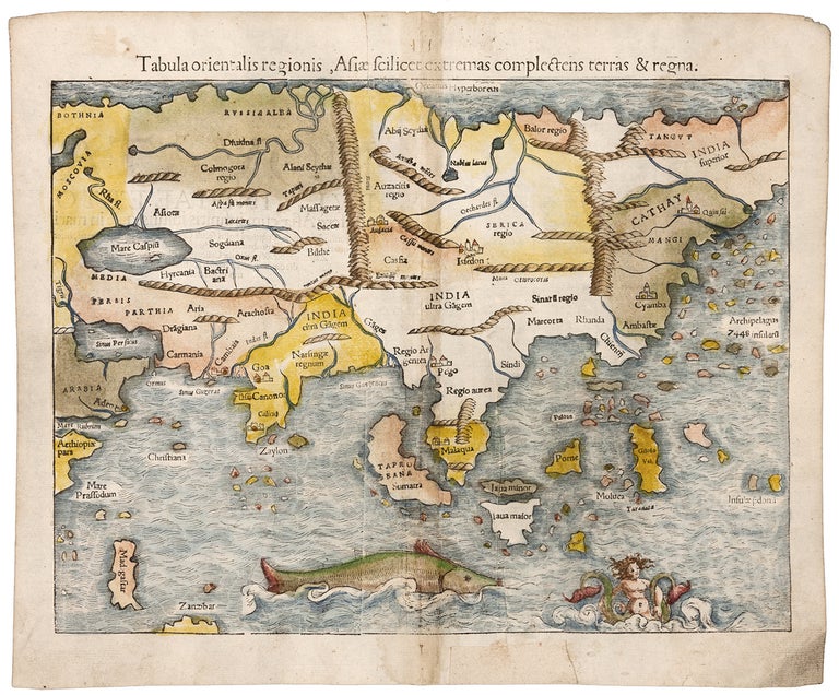
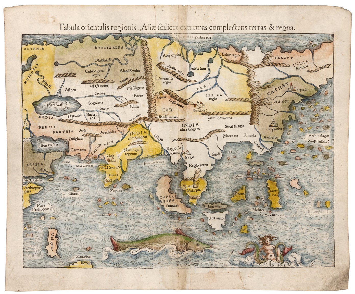
Tabula orientalis regionis, Asiae scilicet extremas complectens terras & regna.
10 ½ x 13 1/2 inches. Fine hand color; excellent condition. The earliest separate map specifically of Asia. Munster’s striking woodcut map significantly updated earlier European depictions of Asia that were based almost entirely on Claudius Ptolemy, the second century A. D. Alexandrian geographer. For example, the coast of China is here in more recognizable form, and although much too slender, and the Indian subcontinent is at least a single peninsula and not in the double-peninsular form of earlier maps. The relative size of Sri Lanka (“Zaylon”) has been corrected, but its early name, Taprobana, has migrated to Sumatra, which itself is mis-located to the west of Malaysia. The map retains mention of Marco Polo’s 7448 islands east of China seen on earlier maps. The woodcut is charmingly embellished with a mermaid and a large, whale-like creature.
Sold